Over 10 days, I walked 65 miles and 174,000 steps, at least according to the app on my phone. Hiking was the primary activity on this trip.
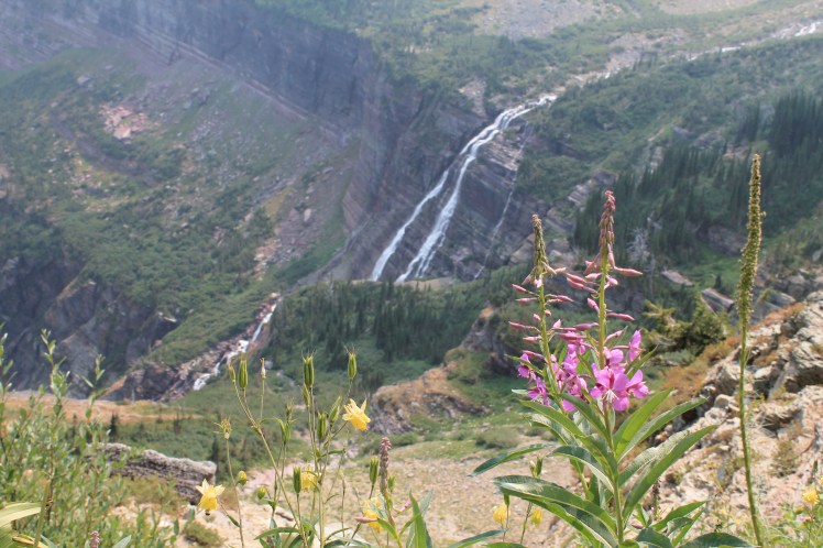
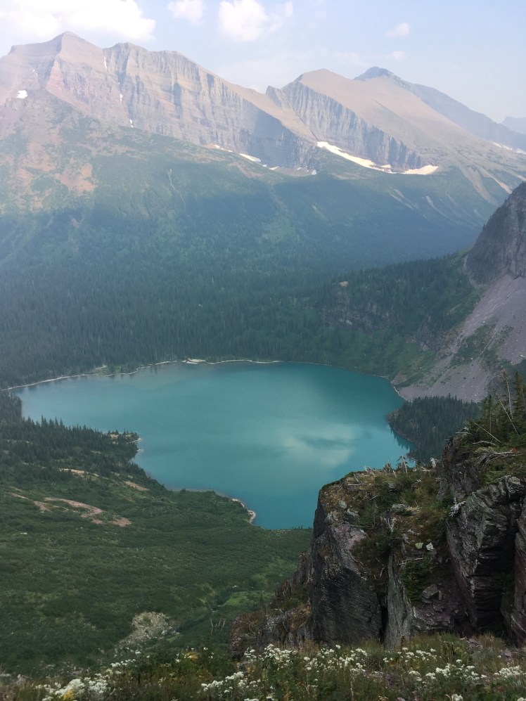
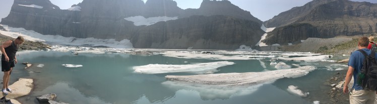
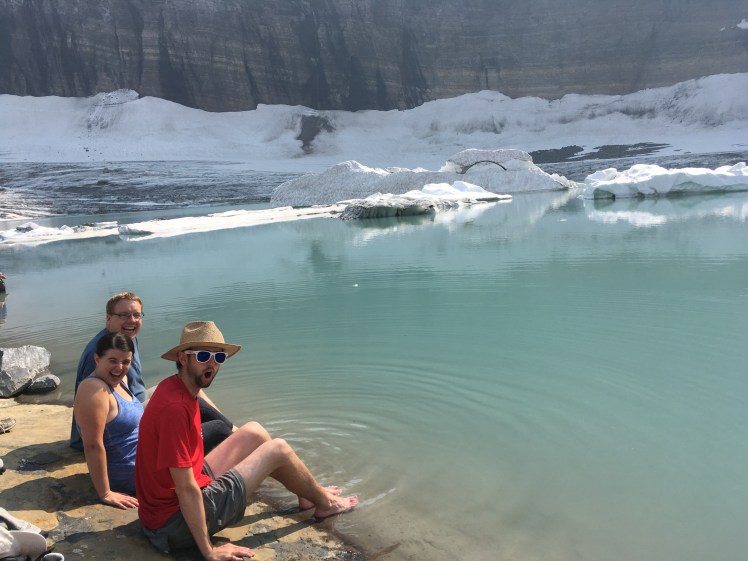
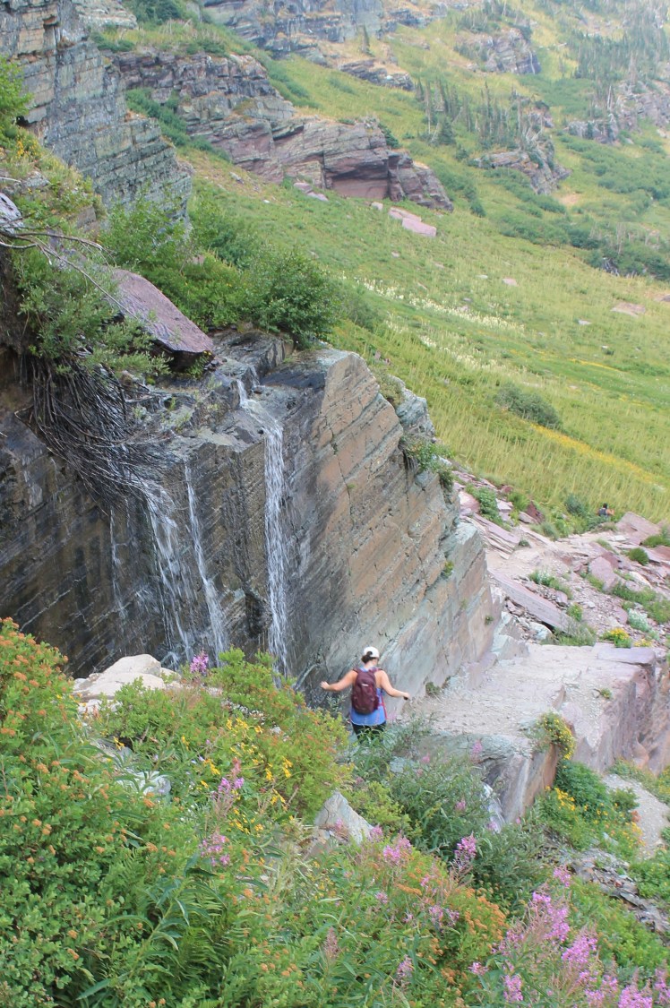
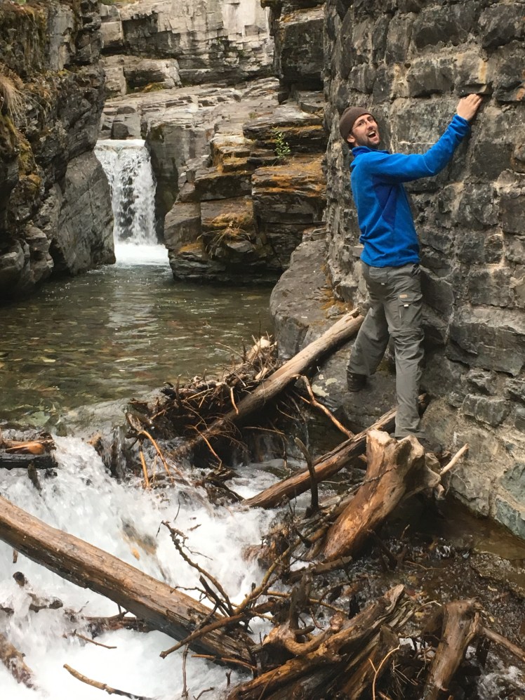
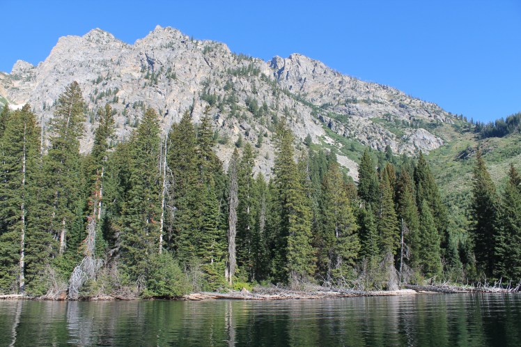
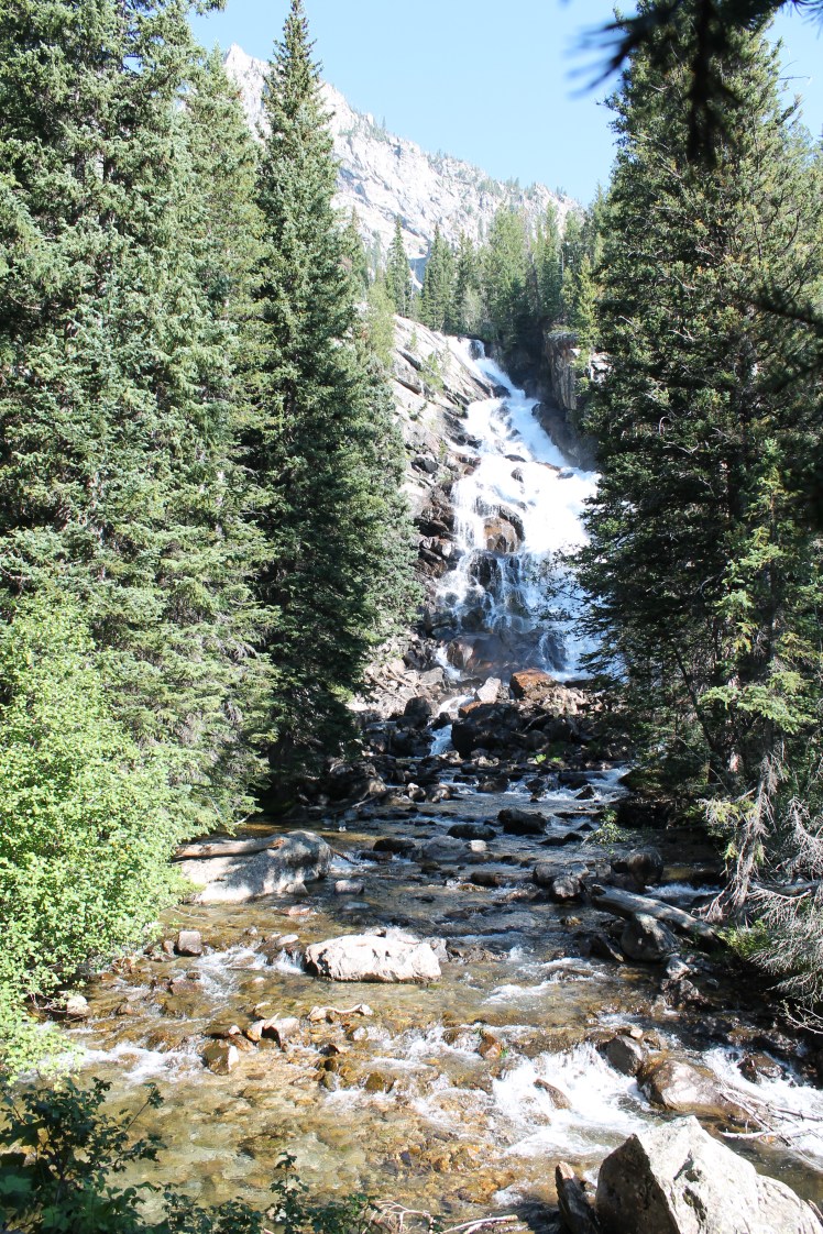
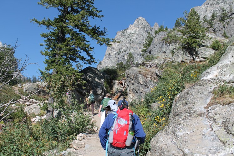
I started out strong on the first day with by far the longest hike of my life, covering about 13 miles to Grinnell Glacier in the “Many Glacier” area of the park. It was also probably the most rewarding. The trail starts by looping around two lakes and it pretty level, and you can cut time off the hike by taking two boats across, but we were not able to get the boats (the ranger told us there was a waitlist) so we walked. After the lakes it starts going uphill pretty consistently, with a total elevation gain of 1600 feet. I had to stop a lot on the way up because I was out of breath, which was intensified because of the high altitude which I am not used to. So it worked out that Thomas was stopping a lot to take pictures! We passed another lake from up high and its crystal ice blue color, which was stunning despite a haze from nearby fires. The path was pretty crowded throughout. We also passed many wildflowers, a waterfall where we decided upon questioning others to fill up our water, another waterfall you have to walk through, a bighorn sheep, and a moose down below us at one of the streams. After the last .4 miles of steep climbing we finally arrived at the glacier and its lake, which had chunks of ice in it and was surrounded by mountain. It felt very epic. We walked around the rocky bank and saw stromatolite fossils – which look just like circles on rocks but actually helped create the earth’s oxygen. We put our feet in the water a few times, which felt like the opposite of burning, it was so cold! We also found another waterfall and saw some people with inflatable 6-pound kayaks. The walk down was much faster. We saw a lightning strike and heard some thunder but it didn’t rain on us, but led us to pick up the pace. We picked up our new hitchhiker friend Molly on the trail, and by the end of the hike had become a big group of about 8 people. I was exhausted!

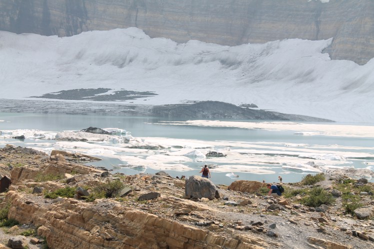
By the way, we learned that glaciers must be a certain size (25 acres or 100,000 square meters) and width and must be moving – like a river – to qualify as a glacier and not just ice or snow pack. Geologists estimate the glaciers in this park will be gone by 2030.
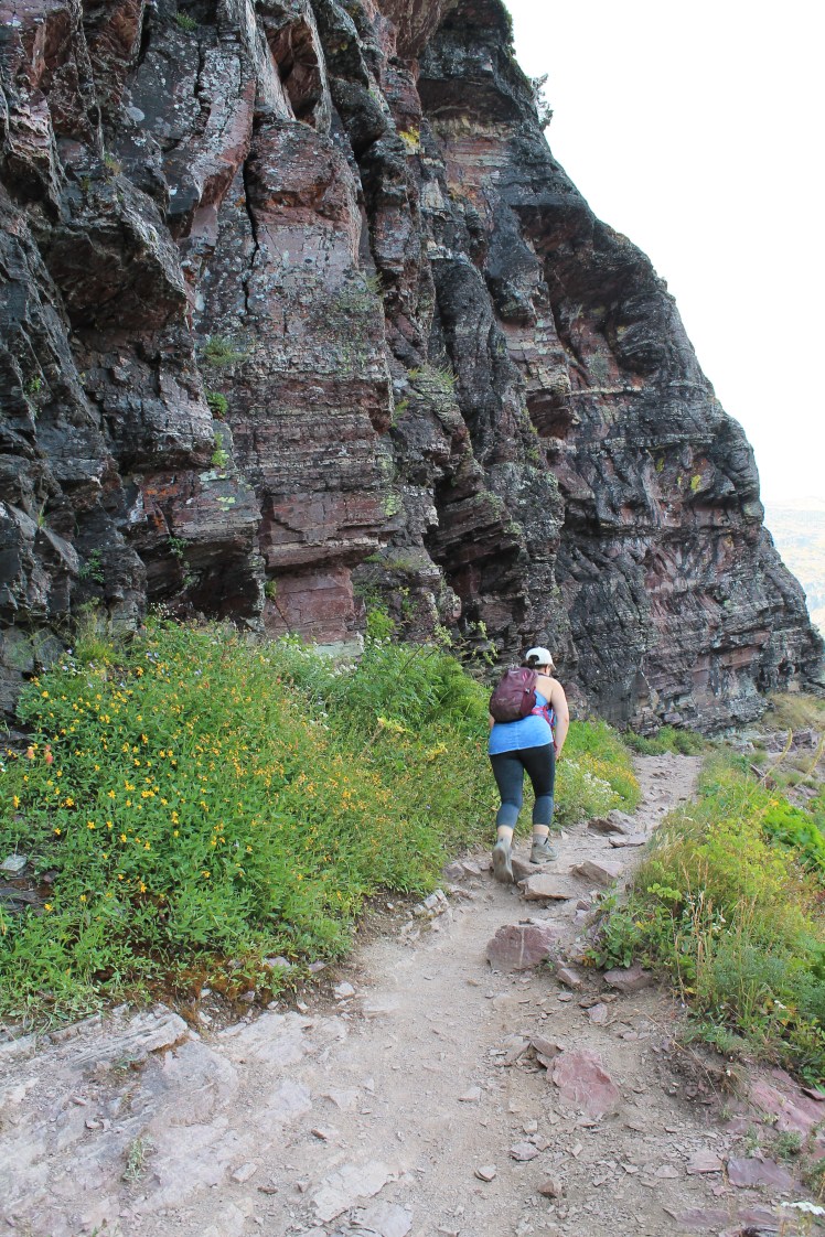
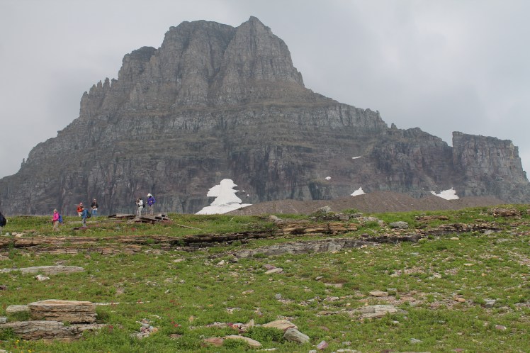
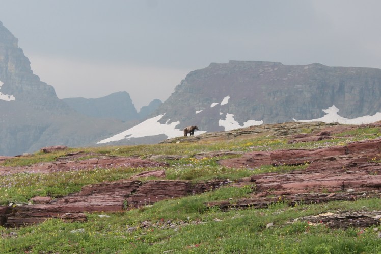
Our next Glacier hike was the Hidden Lake trail at Logan Pass, the area in the middle of the park that is the highest point (elevation over 6,500 feet and part of the Continental Divide) and the most crowded stop. We took the shuttle and started the hike in an on-off drizzle. It was slightly uphill but easy and half of it was on boardwalks. We only did about 3 miles roundtrip on this one but we could have done more. Fortunately we turned around at the lake overlook, because as we got back it started raining pretty bad and we had to take a break. Though this hike was short and extremely crowded, it was also pretty amazing because we saw a ton of wildlife (a bear!, bighorn sheep hanging out about 10-15 feet from the trail, mountain goats right on the trail, chipmunks, etc), 360 degree mountain views and being up in the mountains and in the clouds, waterfalls, and colorful wildflowers.

We decided to take the shuttle back to the car at the eastern end visitor center so we would have some rain cover, and we started another short hike on the Sun Point trail. It was a lakeside trail of less than a mile-in hike that passed through varied terrain including a burned out forest. We made it to Barring Falls, a fun and climbable waterfall, and then looped around to Sun Gorge which was also fun and climbable, before heading back out. Fortunately the rain had mostly stopped for this hike.
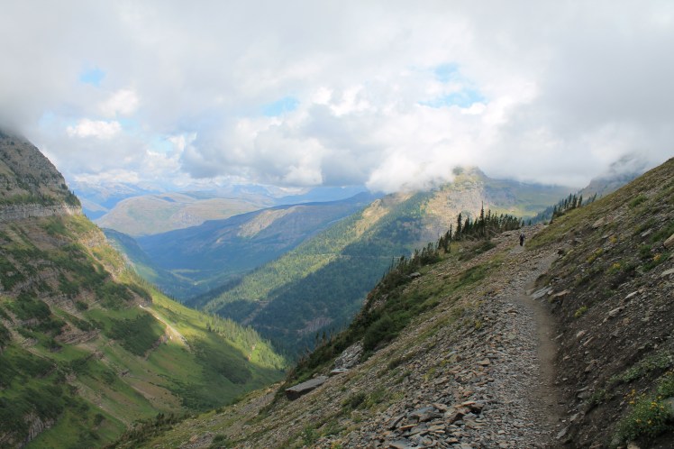
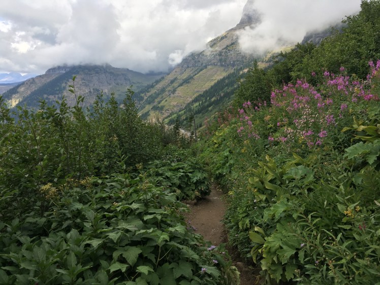
The final Glacier hike on our last day there was the Highline Trail at Logan Pass. It was nothing like the Highline in Manhattan, and dare I say much, much better. We only went in and back maybe two miles but got to experience all its wonders – a narrow cliff with a chain to hold for extra safety, sweeping mountain views, and sweet smelling wildflowers. It was truly wonderful, especially with the clear sunny post-rain weather that had cleared some of the wildfire haze.
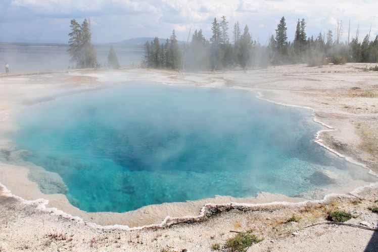
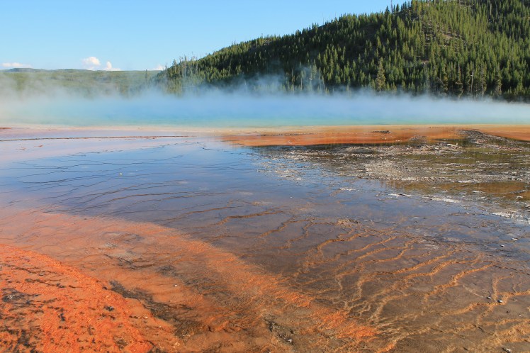
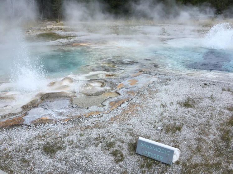
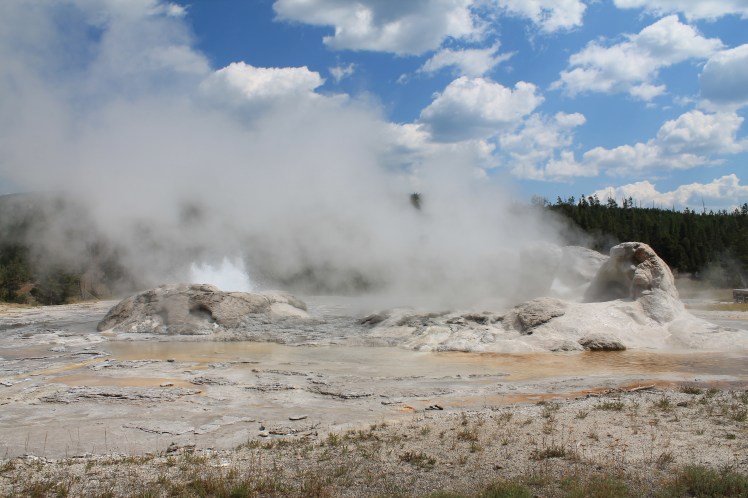
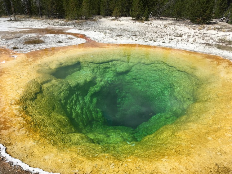
As I moved on to the solo part of the trip, I opted for shorter hikes. Yellowstone made this very easy, as a lot of the attractions are located right off the road with half mile to one mile loops on boardwalks in open areas. This made it possible to see Mammoth Hot Springs, Mud Volcano, Fountain Paintpots, the Firehole Lake Drive stops, West Thumb Geyser Basin, Midway Geyser Basin and Grand Prismatic Spring (one of the most popular stops in the park), and Upper Geyser Basin (a well worn 3-mile round trip near Old Faithful).
")
")
")
Each stop taught me about unique geological features, and they are all pretty hard to describe. It was all unique and unexpected. At times I felt overwhelmed by stimulus, but there was so much to do that I felt like I needed to pack in as many of these areas as I could. Yellowstone is huge, and driving through took a long time, so the short stops somehow seemed suited to its size.
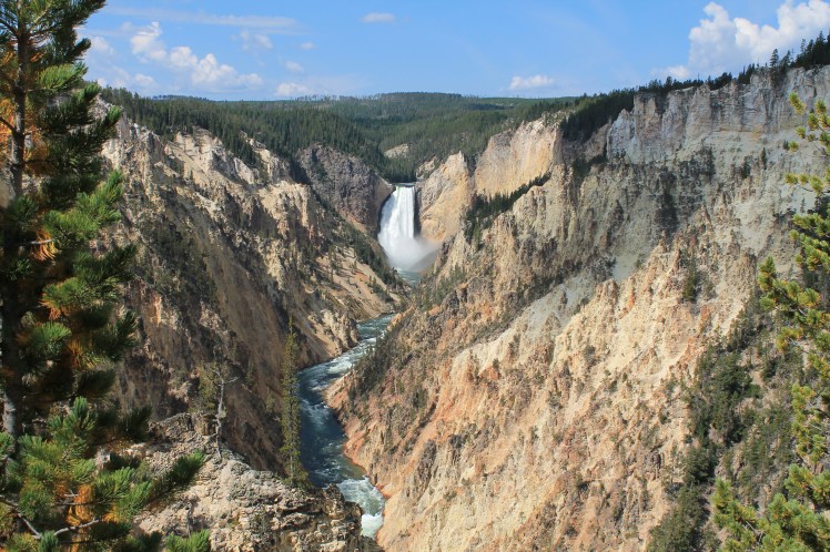
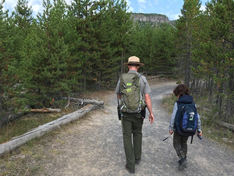
I enjoyed two ranger-led hikes in Yellowstone. My first morning I went to the Grand Canyon of the Yellowstone. I made a wrong turn on the way and ended up being about 10 minutes late, so I was rushing to try to catch up with the group. As I got to the edge of the parking lot I met Lauren – who I mentioned in an earlier post – and we raced in together. We stopped to take some pictures of the Lower Falls, which is a huge waterfall into the canyon river and is said to be the most photographed spot in Yellowstone – and it had the crowds to go with that reputation! We found the trailhead where the paved paths turned to dirt, and were able to catch up with the huge group of about 60 people. We learned a lot about wildlife in the park, like the reintroduction of wolves. The tour ended pretty soon and we decided to keep going to something a ranger had told Lauren about called Point Sublime. The whole trail we did was about 3 miles round trip and it followed the edge of the canyon, which was so beautiful with the Yellowstone River running through it. There were some steep parts but it was pretty easy.
My second morning ranger-led hike started at Biscuit Basin, another beautiful hot springs boardwalk area, and continued onto a trail that brought us up to Mystic Falls, a big and beautiful waterfall. It was a smaller group of about a dozen people this time, and we learned a lot about grizzly bears and forest fires. At the end of the hike I continued uphill through some switchbacks to an observation point of the area and completed a loop trail that made the hike a little longer and about 4 miles total. It was a very pleasant hike and I got to enjoy a lot of it alone, which was a nice change of pace from Yellowstone’s throngs of people.
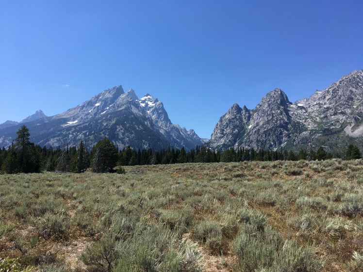
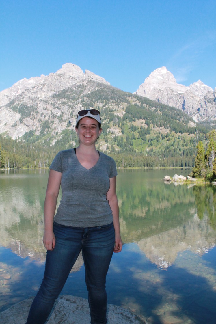
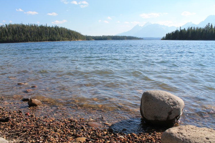
As I hit my last park in Grand Teton, I was starting to feel some foot pain so I tried to take it a little easier. My first evening I wandered on a flat, paved/gravely trail for less than half a mile in the northern park hub called Colter Bay, til I got to a spot where I could climb down a few boulders to the lakeshore for my first great views of the Teton range. It was quiet and peaceful and it was nice to just sit there for a while.
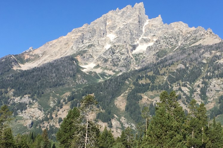
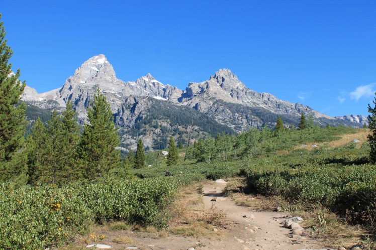
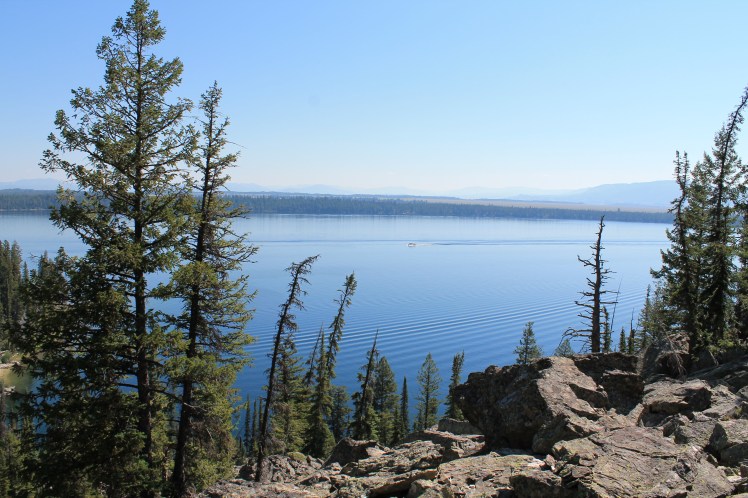
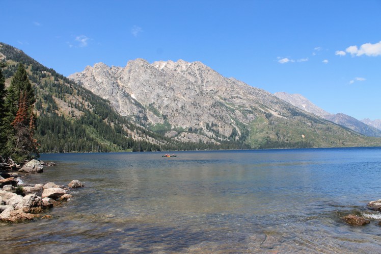
I did a popular hike the next morning with a ranger in the Jenny Lake area – which was much-hyped as extremely crowded with little parking due to construction. I got there early and was fine, and joined a ranger hike with about 25 people to Hidden Falls and Inspiration Point. The hike involved taking a boat that you have to pay for across Jenny Lake. It was awesome to feel like you were going into the Tetons and hiking through them. It was a very easy hike and we were going slowly so I barely noticed the uphill parts. We got to a great waterfall and continued on to a lookout spot. I decided to hike back along the lake instead of paying for the boat which was lovely, as it was a mix of lake views and forest. This was where I joined my 78-year old hiking buddy Ginny. We split up toward the end when we got to a boat launch area, where I could sit on some boulders and just stare at the crystal-clear lake and mountains for a while.
My final hike on my last day was a ranger-led program to Taggart Lake. It was a gorgeous hike with mountain views, and at the end we were treated to a perfectly still lake that reflected the mountain amazingly. It was an easy trail, and we did lots of stopping to discuss conservation and do some sensory-learning experiences like closing our eyes and listening for a few minutes and looking for certain shades of colors. It was a little weird at first but ended up being really cool at the end. Our guide Grace had us write down some reflections at the end that we could come back to in the future. At the end a hiker talked about threats to National Parks from the federal government. I later heard Grace saying thank you, and noting she wasn’t allowed to say things like that in her official capacity. I spoke to a mother and teenage daughter and Grace about conservation policies and local politics for a while at the lake. I backtracked and headed back on my own. The whole hike was about 4 miles.