This week I had a conversation with two people about the purpose of travel blogging, both with differing views. To one, it’s art that should be shared with the world for their enjoyment and inspiration. To the other, it’s a personal journal, meant to preserve memories and feelings lest they be forgotten. I found myself strongly agreeing with the second person, finding so much personal gratification from reflecting about my trips and the ability to look back, and taking solace in my introverted tendencies. But at the same time, I truly love when friends tell me they’ve read my blog or found their own inspiration from my writing. So I admit, it can be both. Now, as the world starts to open back up a little more, perhaps I should consider opening myself up a little more to the world. Don’t worry, I’m not ready to start Tik Toking or anything, but I will try to put this out there a little more.
So, around Labor Day I took a 10-day solo trip to Oregon. The trip continues a year of coming back to travel by visiting random domestic and outdoorsy locations, and I did choose this trip somewhat randomly. I knew I wanted to continue to get value out of my annual National Parks pass, and looking around on maps out west I focused my interest on Crater Lake National Park. So I flew to Portland, rented a car, and built a road trip adventure around it. It turned out to be quite the adventure, complete with natural disasters and some last minute changes of plans, testing my travel skills and resilience. Along the way I also saw a ton of incredible things, with every day bringing new experiences and sights that bordered on overstimulation at times.
The trip got off to a bumpy start with a 4-hour delay at JFK on Friday night, leaving me groggy and arriving in Portland at 5:30am New York time. At least they gave me a $100 JetBlue credit, and the part of the airport I was in wasn’t too crowded and masking was pretty good. As I deliriously took a Lyft to my hostel and made awkward small talk with my driver, I barely had time to panic about the idea of going back to sleeping in a shared hostel dorm room. I had booked the stays over the summer when covid felt a little better, and didn’t remember until it felt too close to change things. And saving money is always a very powerful motivator for me. So I checked into the trendy and modern hostel and crashed into a very comfy bed with just one other stranger in the room, and truly, I felt fine. One of my other hostel stays was not quite as covid-friendly, but I mean, I ultimately came home healthy so I consider that a success.
I managed to stick to my carefully-planned schedule and woke up at 7am local time. I got coffee in the hostel’s shop where I had an early morning conversation with the barista about the history of camelback bladders (let’s just say, vegetarians would be upset), while observing Oregon’s indoor mask mandate and getting used to the new convention of showing proof of vaccination to dine indoors. I then took a short cab ride to pick up my rental car, waiting for me at someone’s house thanks to Turo, a company that can best be described as Airbnb for cars. It was very easy to pick up the keys from the porch and just drive away. I chose a cute red hybrid Ford C-Max, which treated me so well on the trip even with its 130,000 miles. It had great pickup and gas mileage for all my driving.
I picked up a sandwich and then hit the road around 9 for my first big day trip out east through the Columbia River Gorge. I had planned this day very carefully, poring over travel magazines and online tips (including some travel blogs I stumbled upon!) to find the best stops along the scenic drive. It truly did not disappoint, featuring a windy, narrow historic road that parallels the interstate, with views of the Columbia River to the left, with Washington State on the other side, and a dense forest to the right. I stopped at the Women’s Forum Vista for the first viewpoint, then quickly on to the Crown building, the road’s tallest point and a cool historic building.
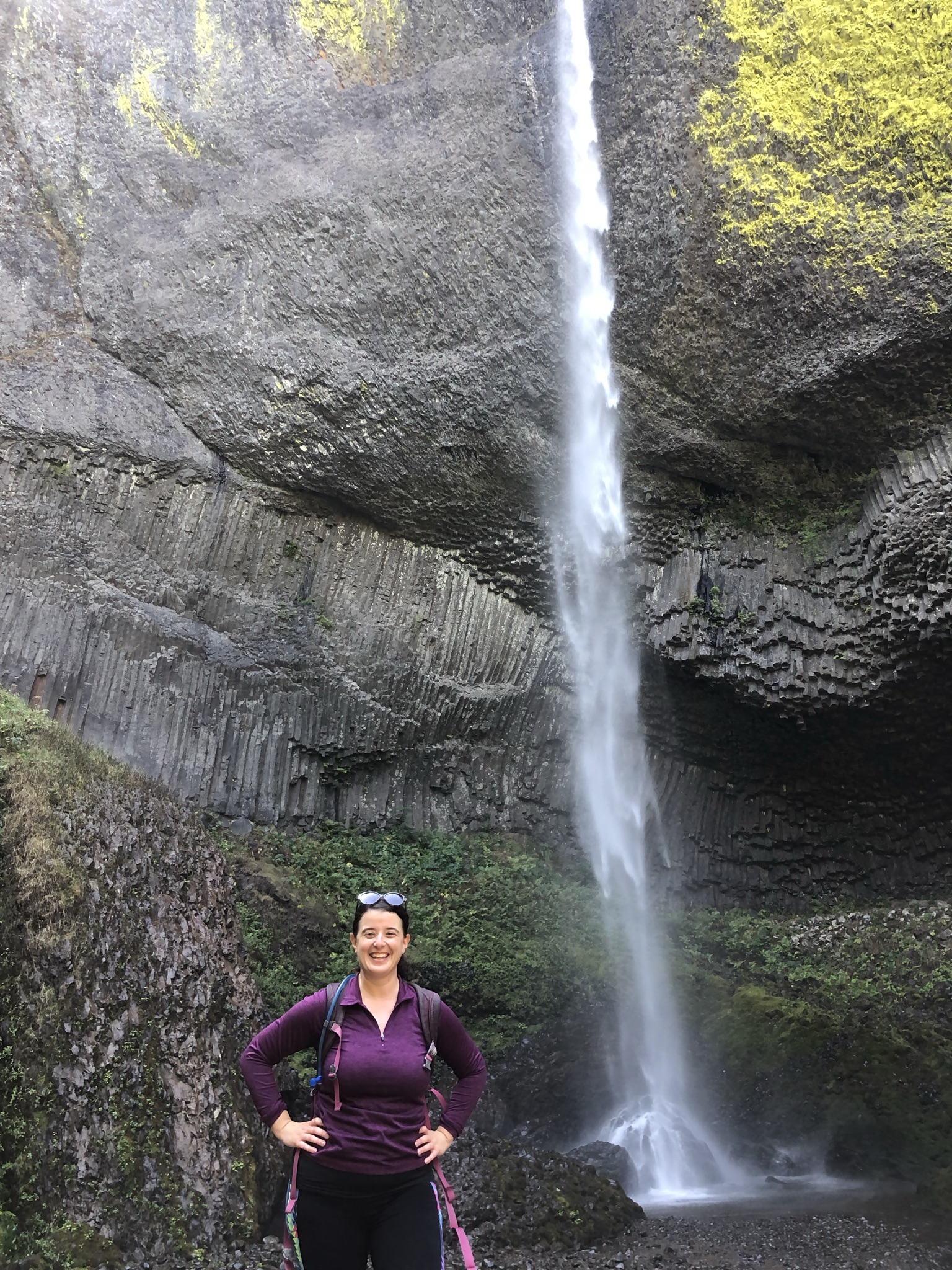
Next was the start of the chasing-waterfalls portion of the trip, which I thought about as a theme for the whole trip but ultimately I saw so much more. These skinny and tall waterfalls, all within a couple of miles of each other, were just stunning. I started with Latourell Falls and a 2.5 mile hike. While you could see the falls from the parking lot, the hike itself was pretty empty and a very interesting terrain, sort of like a jungle with wet ferns, and mossy pine trees. I got to use the AllTrails app, which I paid for so I could have the offline maps just in case, and I was very happy with it. I guess hiking alone is always a risk, but I know my skill and comfort levels and always make sure someone knows where I am that day.
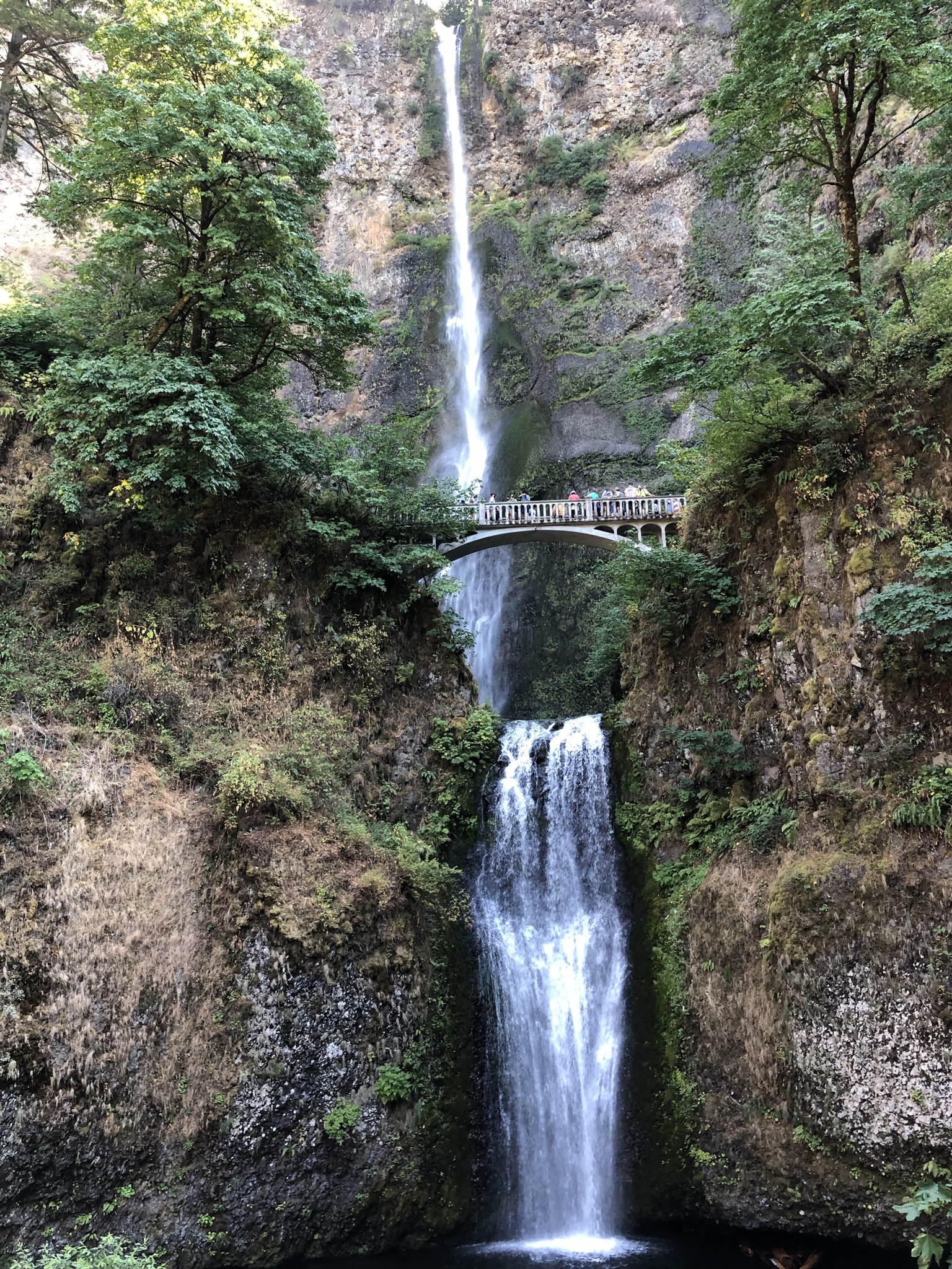
After Latourell I did a 2/3 mile hike down to Bridal Veil falls, where I ate lunch by a nice creek. Now afternoon, it was starting to get a little more crowded. This came into full view as I attempted to park at my next stop, Multnomah Falls, the tallest in the state and a very popular photo spot. I had purchased a $1 timed entry ticket in advance, but that didn’t help me find a parking spot. To get there, I had to drive several miles east down the historic road to reach the interstate entrance going the other direction. The parking lot was right in the middle of the interstate, and as I pulled to exit left, a man in a pick up truck had just put out traffic cones to block my entry. I locked eyes with him and he did not flinch, so I pulled back onto the highway. It took a while and a few tries to figure out how to loop around, and bad service meant google maps was not cooperating great, but about 20-30 minutes later I found myself on the other side of the interstate and entering to find a spot. You could see the falls from there, it was so big. Walking under the highway and entering the falls area, I could see why it was so popular. Masks were required outside here, as well as in the giftshop and café. Walking up to the falls and showing my ticket it continued to be swarmed with people, but the viewing areas were awe-inspiring. The path went up and over a bridge, and then continued up, turning into a hike. I went up a bit but decided to turn around and continue on with my day, with several more stops planned. I ate the rest of my lunch and got back on the road.
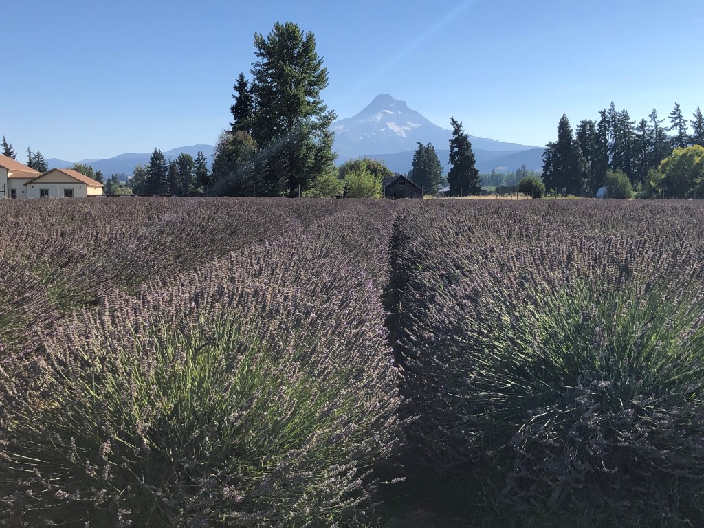
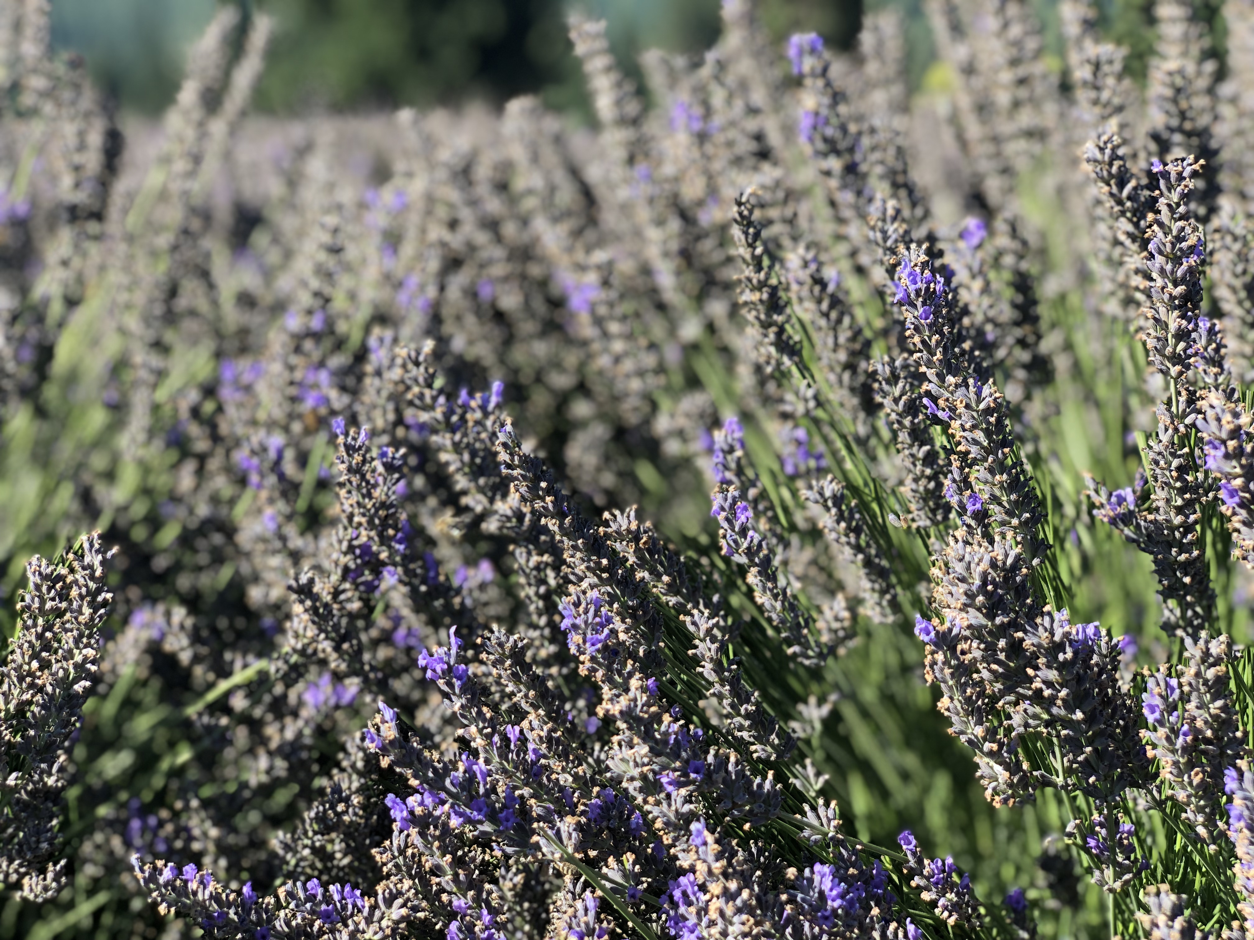
My next stop was a bridge called Bridge of the Gods in a little town. It was meh, but a pretty bridge and view. Maybe I missed something in the area. I continued to drive by lots of other giant waterfalls, some which I could see from the road. When I made it to the town of Hood River, about 60 miles east of Portland, I turned down south through what is adorably called the Fruit Loop, a marketing strategy to play on the area’s many farms, apple orchards, and other produce-themed attractions. Here I got my first views of Mt. Hood, a famous and huge mountain. I drove through some rural roads to my isolated destination, Lavender Valley. It was closing within an hour at 5 but that was more than enough time to revel in the fields with the intoxicating and relaxing smell of lavender. It smelled so so so good and was also a great photo spot with Mt. Hood in the background. I bought some stuff inside their shop and learned a bit about the products from the clerk. I was so happy after this.
I started to drive back the other way now, first making a stop at the Gorge White House, a sort of farmers market/winery/flowery/other things. I spent some time taking photos, enjoying the ambiance of couples and families drinking ciders and wine and picking flowers. I tried a little honey lavender beer tasting, which was weird but pretty nice, and bought a few apples. I still hadn’t done my grocery shopping and decided to save that project for my next stop, enjoying the takeout experience for now. Next up, stopping in the cute town of Hood River for some riverfront food truck pizza and salad which were ok. Sitting by the water was nice, watching a sport that is either kite surfing or wind surfing and listening to an outdoor concert with a pretty bad pop cover band. I put my feet in the water at the little beach and enjoyed the golden hour chill outdoor vibe.
As I drove back, I quickly noticed I was driving into the setting sun on a cloudless day, which was tough but manageable. Back in Portland, I made a stop at Salt & Straw Ice Cream where I enjoyed a theme flavor from that day, honey lavender. It was a trendy spot with a long line, and I talked to some guys who were on their way back from a cruise in Alaska. They said it was rainy. Back at the hostel, I found street parking but realized there was some trouble with the car’s lights not going out, but the car owner on Turo helped me figure it out. I took a great shower, packed up for tomorrow’s next adventure, and went to bed exhausted but happy.
I’ve written a lot about day 1 so far. Do you get a sense of what I mean by “overstimulated” now?
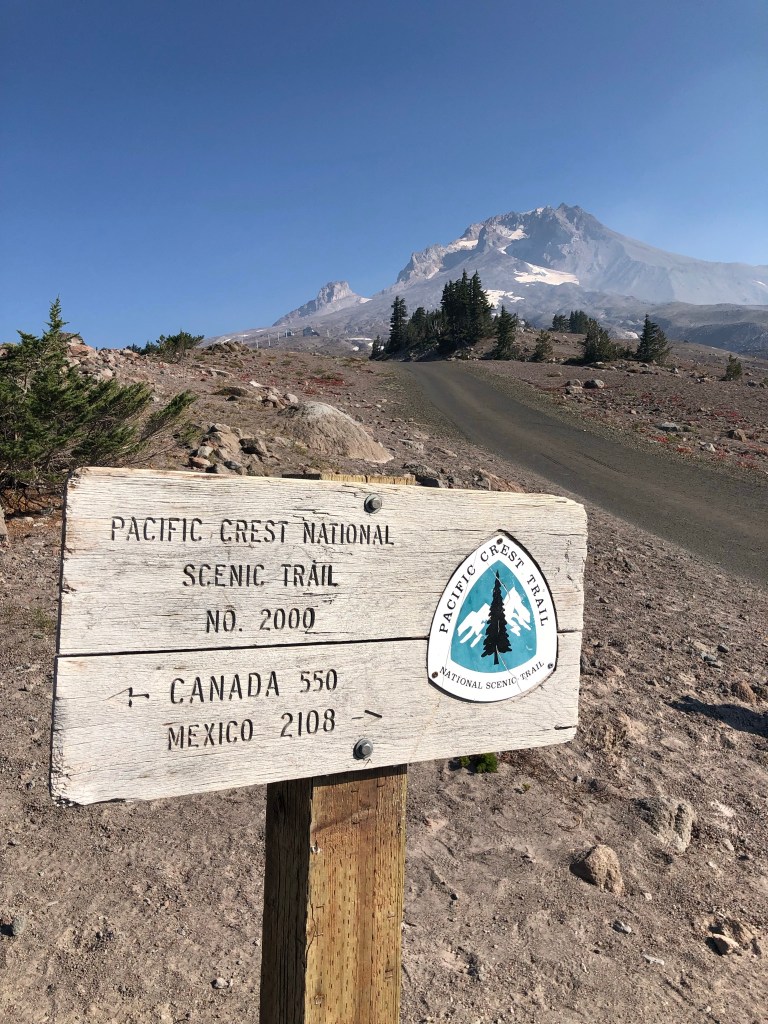
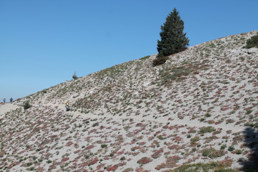
Next up, on Sunday I explored the Mt. Hood area and made my way to my next destination, Bend, about 3 hours away if you drive straight from Portland. I used an audio GPS driving tour from a phone app that gave me some history of the Mt. Hood area as I drove a quiet tree-lined road that morning, enjoying the mountain view. About an hour and a half later I drove partway up the mountain and arrived at the Timberline Lodge, a hub for outdoor activities like mountain biking and skiing, and also where they filmed The Shining. One of the ski lifts was still running but I opted to skip it, instead going for an out-and-back hike for about 5 miles around the mountain. The trail was part of the famous Pacific Crest Trail, and it was really cool seeing the signs pointing north to Canada and south to Mexico. The trail had easy parts and some more moderate, with some cool rocky elevation dips, and lots of great views of the peak and valleys below. It was fun seeing the backpackers and thinking about the book Wild. On the way back it became very crowded so I’m glad I got an early start.
One of the big highlights of this hike was my first experience with the western wildfire smoke. It wasn’t too bad here, but I definitely smelled it a little. The air looked sunny and clear, and a little hazy far out in one direction. I wore a mask for part of the time outside to help, though no one else was doing this. Little did I know it would get much worse.
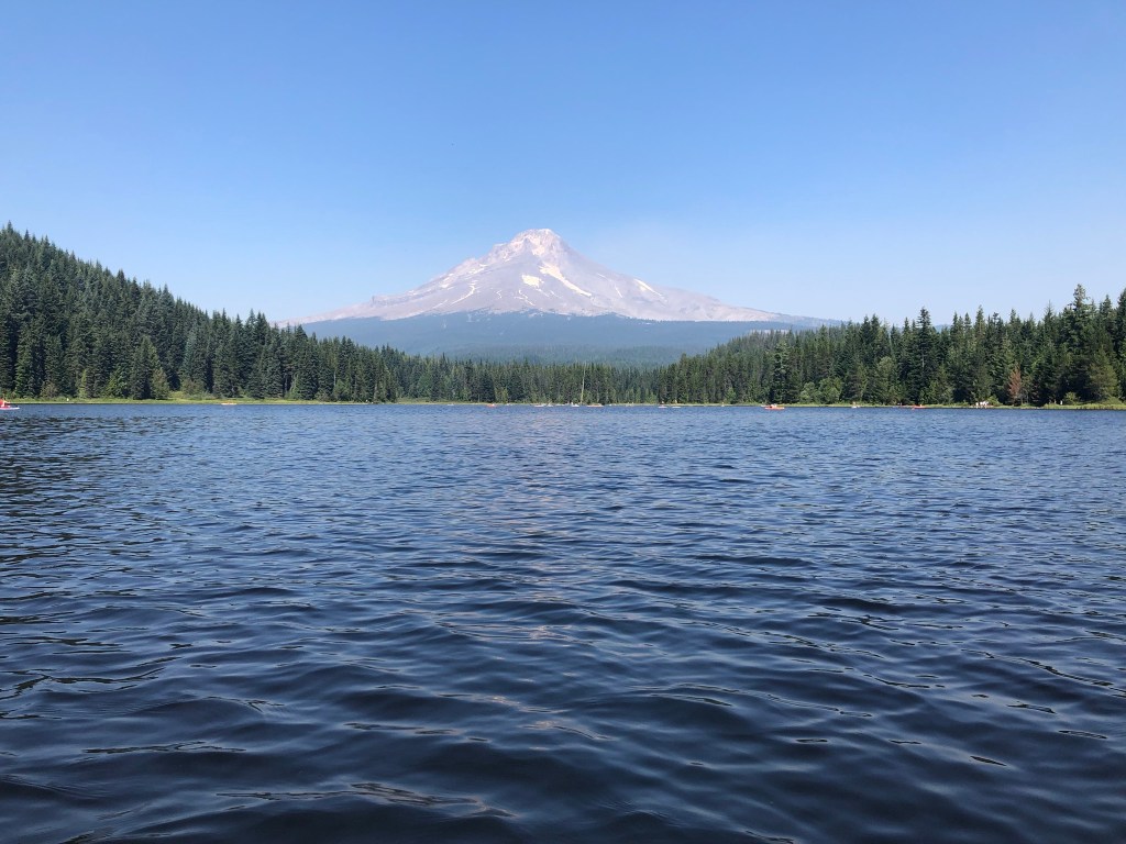
After picking up a gross sandwich at the lodge I took a short drive onward to Trillium Lake. I paid $10 to park and walked to the very-crowded lake. And it was gorgeous, a deep blue lake surrounded by forest with Mt. Hood right in the background. I had hoped to rent a kayak but they were all out, so I rented a paddleboard. The rental guy was grumpy but watched my stuff, since I couldn’t wear my backpack on the board. I’m comfortable with a kayak and I’ve tried paddleboarding a few times, sometimes successfully, but here I quickly found I couldn’t balance to stand, wobbling on the flimsy board and in the wind. So I just sat and kneeled, taking some comfort in seeing other people doing the same, and making fun of myself to the friendly passersby. Despite the crowds it was so nice, peaceful. I walked around the lake a little bit before heading out once again.
I drove straight on to Bend for the next two hours. I got to drive really fast, experiencing changing landscapes that went from forest to mountains to plains that reminded me of what I thought the Oregon Trail would have been like. Arriving in Bend I instantly felt that it was a chill and outdoorsy city, paired with a high number of crusty kids, if that helps describe the vibe. After checking into my hostel I finally got some groceries in town, taking their recommendation and checking out the chain Grocery Outlet, which I thought was pretty meh, and I ended up finding a Trader Joe’s on the way out of town.
Here I stayed in a “real” hostel, a crowded space filled with cheap, young, and social travelers. Upon arrival the desk person gives everyone a tour of the space and a coupon for a free beer at the truck outside in the backyard area, which paired great with the Mexican food truck. The masking inside was not good, but I felt alright. There were two older women (in their 80s) staying in my room. I overheard the hostel staff saying that one of them was homeless and the other woman had paid for her room, even though it’s usually against the rules. I did not love that, mostly because the woman spent most of her time in the room listening to weird and loud videos on her tablet about god and the benefits of weed, even after she fell asleep and I had to turn it off for her. Despite that weird experience, I had some really fun nights in the outdoor hostel space. I made some friends during trivia night where we all won free beers, and enjoyed the next live music night. New friends included a very young married German couple, a guy from Nevada, two girls from CA/WA in the process of moving, and an energetic nomad who had just gotten his covid booster shot while traveling. At one point they told me they thought I was just out of college and it truly made my month if not my year.
The next day commenced the unscheduled and unexpected part of the trip. While I knew I was traveling to a wildfire area and that I might need to rearrange some plans at the last minute, I really was not prepared for what it would actually be like, and for how dramatically I ended up changing my plans at the last minute. I learned a lot about air quality/AQI in preparing for this trip, knowing the scale goes from 0 to 500 and includes levels of good, moderate, unhealthy for sensitive groups, unhealthy, very unhealthy, and hazardous; with corresponding levels of health warnings and recommendations. Further, wildfire tracking is very strong, and it’s pretty easy to see how close they are to where you want to go, which way the smoke is blowing, and if any roads or public lands are closed.
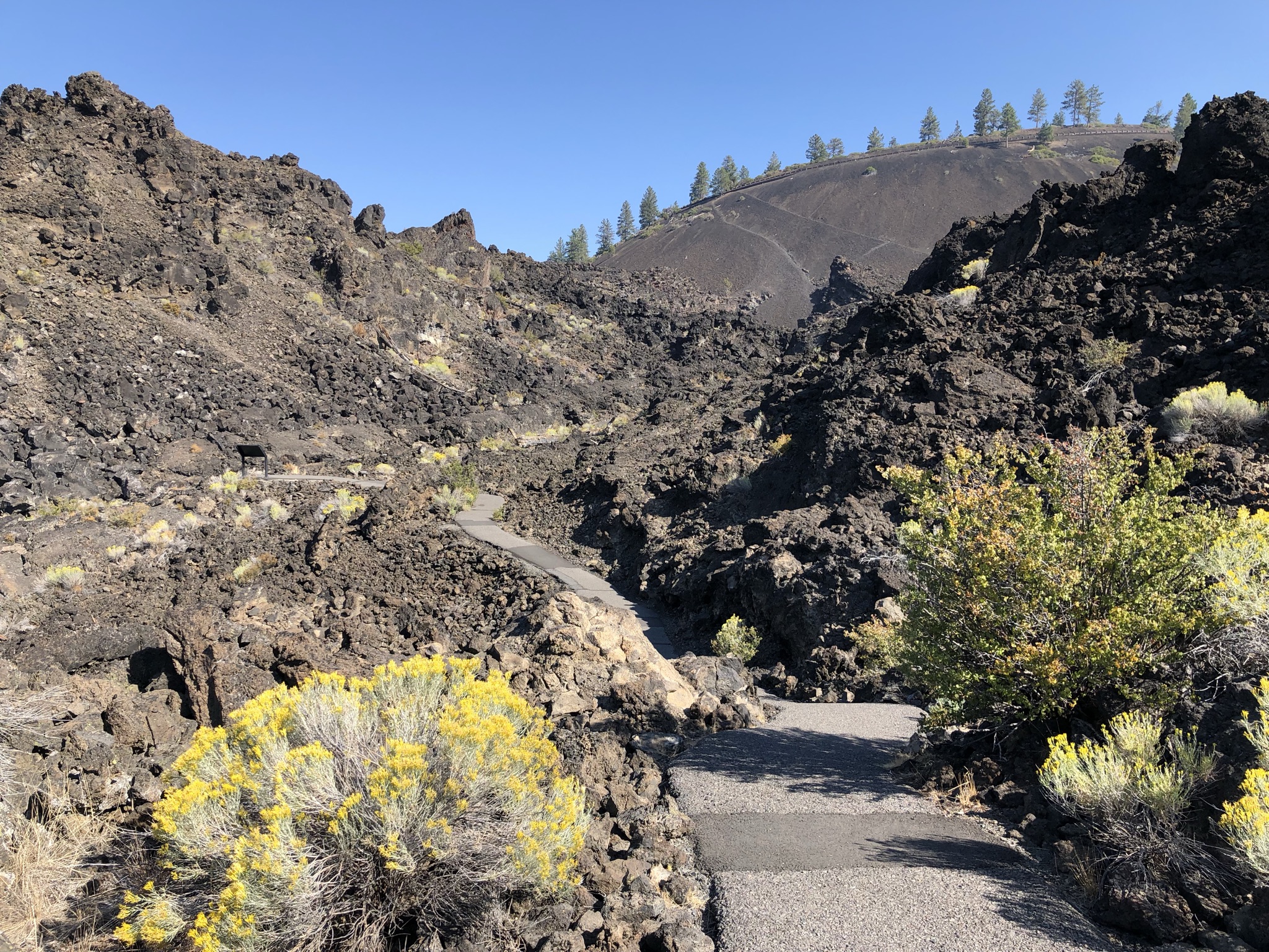
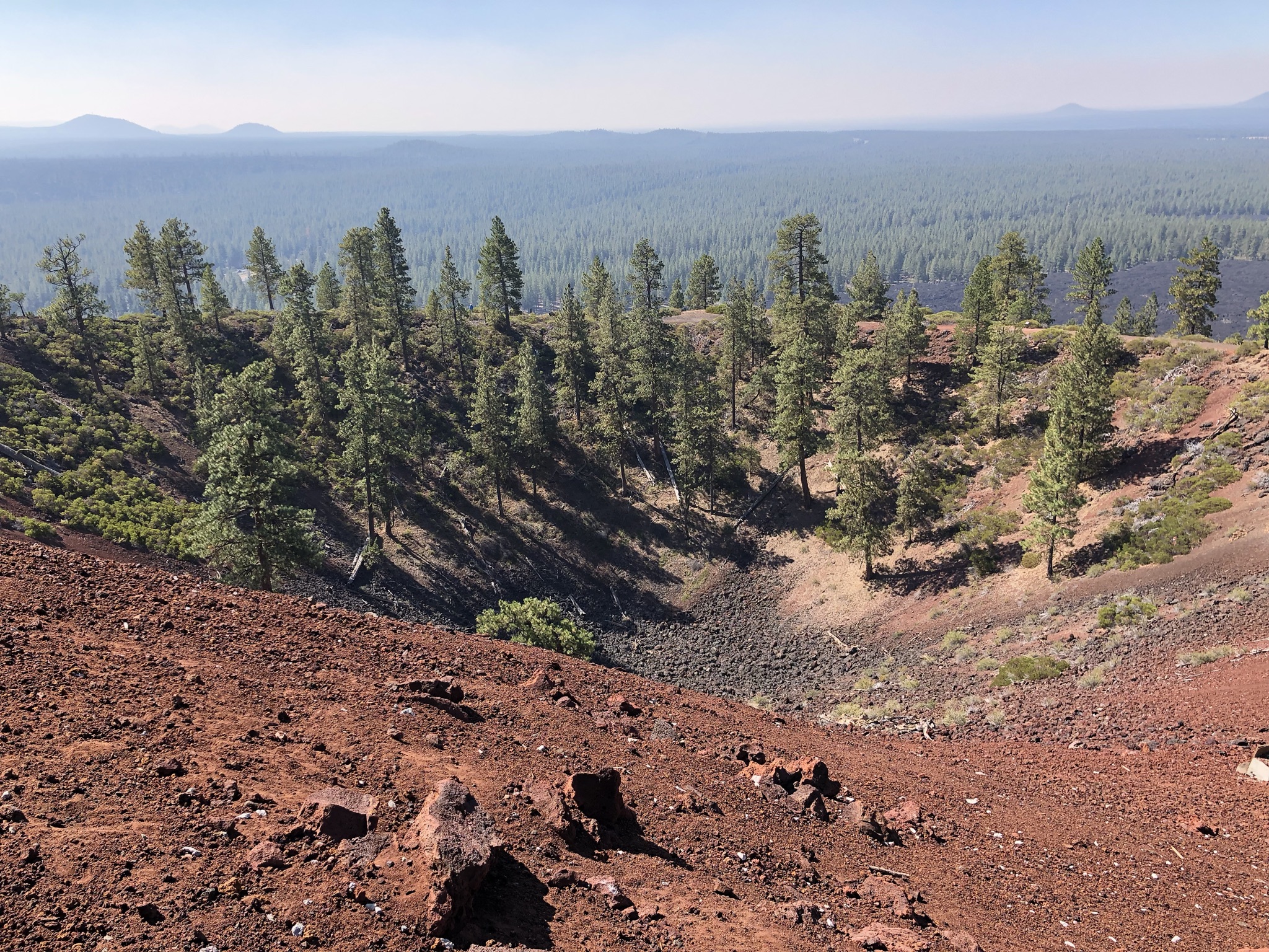
After arriving in Bend on a clear evening, I woke up early and ready for a day trip I was looking forward to (Tamolitch Falls, hot springs, and more nature!). With glasses on the floor below my top bunk I blurrily peeked out the window shade by my bed, and thought it looked a little extra blurry, but like a morning haze that would probably soon clear up. I climbed down and commenced my weeks-long daily ritual of checking air quality on my phone, and was shocked to see it high up in the “very unhealthy” category. Since the fires were out in the direction of the day trip I wanted to do, I saw that it would be just as bad out there. I decided to change my plans, taking a slow and calm morning to figure things out, chatting with some folks at the hostel over breakfast while I researched. It was a tricky predicament: due to covid I really wanted to prioritize outdoor activities on this trip – plus Bend is very outdoorsy – but it would be tough to be outside for too long due to the smoke. Good thing I’m a planner, because I had a lot of backup activity ideas for the area. I settled on driving to the Newberry Volcanic National Monument, just a 15 minute drive away and thus giving me the option to come back easily if I needed to. It ended up being really cool! I used my National Parks pass to get in for free, parked in the not-crowded lot, and got some tips from the park ranger on what to do. I ended up doing a one-mile paved hike that showcased the landscape, a sea of craggy lava rocks under a cinder cone from a past volcanic eruption. It was very cool! I mostly stayed masked to help with the smoky smell, though I grappled with how clear the air looked up close despite the smell. After my little hike I took a shuttle bus up the cinder cone (like a mountain/hill), winding around a road several times to reach the top. There I walked around the ¼ mile circular and steeply-sloped view of the caldera, which inside was growing trees – truly a unique landscape with almost no people around! I ended the experience eating my packed lunch by some picnic tables, fighting off some very aggressive chipmunks.
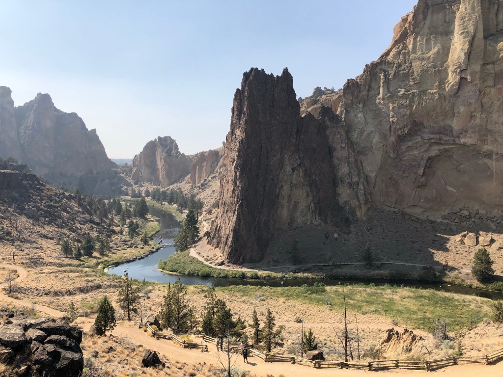
After a nap back at the hostel, I drove 35 minutes north to Smith Rock State Park, a highlight I was excited to see the more I read about it. While I really wanted to check out some of the difficult hikes, it was way too smoky for me now. I found myself wearing a mask even in car, because the smoke smell was coming in with AC. It was hot out now in the high desert, after a cooler morning, but not unbearable. I ended up parking near some incredible viewpoints and just walking back and forth a little, looking down at the brave, mask-less hikers and up at the awesome rocky formations. I really wanted to hike down, but I knew that what goes down must come up, and I was struggling enough walking around flat and getting out of breath. I’ll keep this one on my list to get back to one day! On my drive back I had the difficult job of finding gas, cutting it a little close. As I drove I decided I was grumpy about the smoke and wanted to leave early. So I cut my Bend stay a day short, got a much-appreciated refund from the hostel (who does that?? So nice!), and moved up my 3 night stay outside of Crater Lake to start the next day.
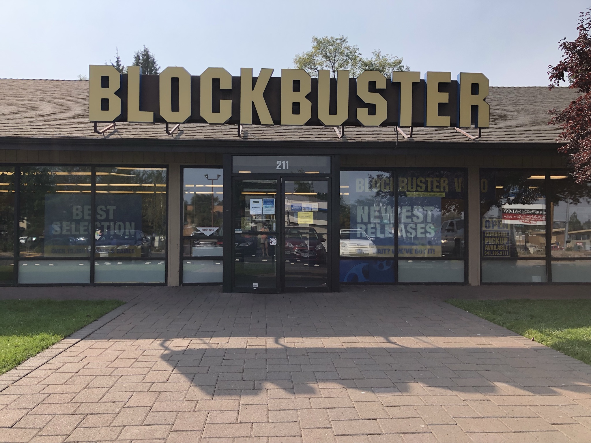
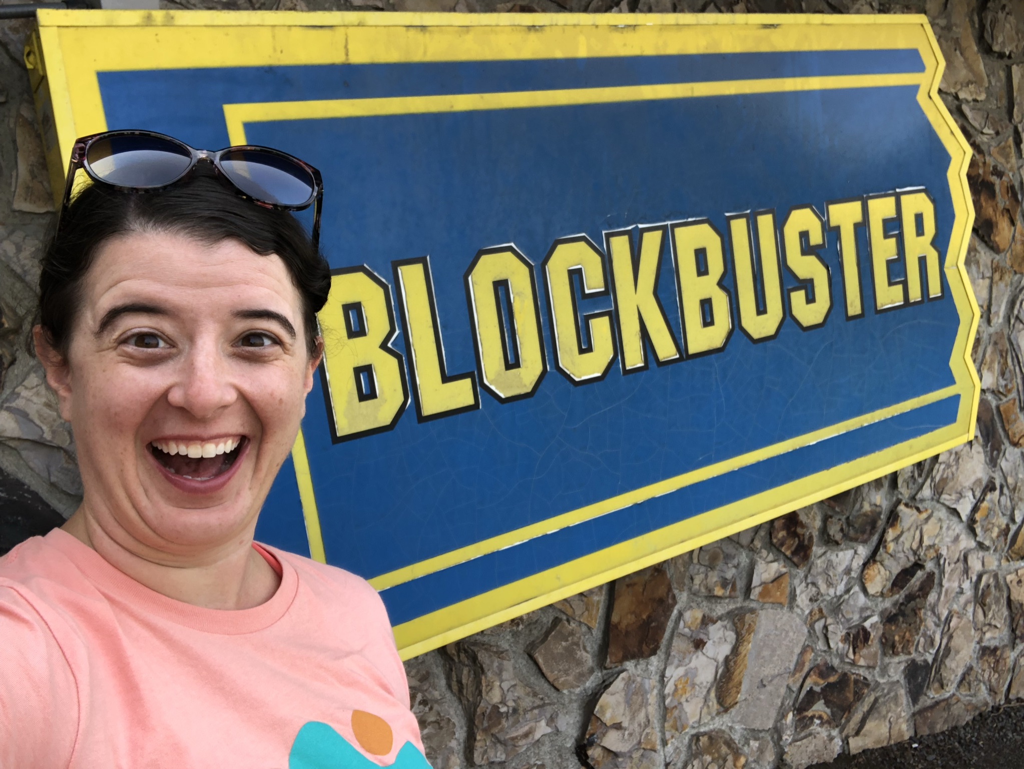
I felt good about my decision; I was eager to leave Bend. But not before a trip to The Last Blockbuster, an actual, functioning Blockbuster Video store that is the subject of a Netflix documentary. (For John Oliver fans – the Alaska store closed and sent the Russell Crow underwear to the Bend store.) It was so incredibly nostalgic and I spent a good half hour there, enjoying the DVD rentals, candy, and even the familiar smell. They definitely make a killing off selling some merchandise. Apparently people do still rent videos there. I hope they survive!

I spent the evening walking around the cute downtown Bend near a river, checking out some of the brewery culture. I ate back at the hostel’s Mexican food truck again, enjoying a fun open mic night with good music and social hostelers.
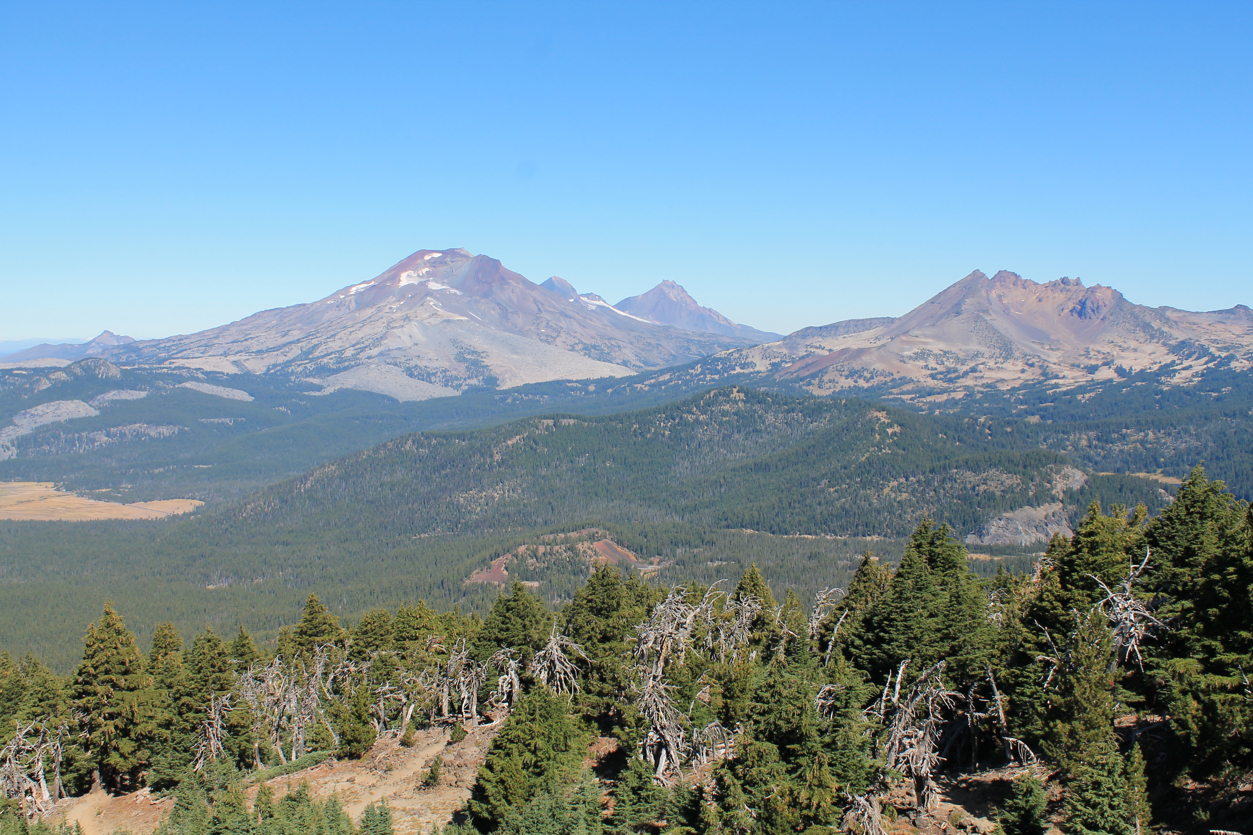
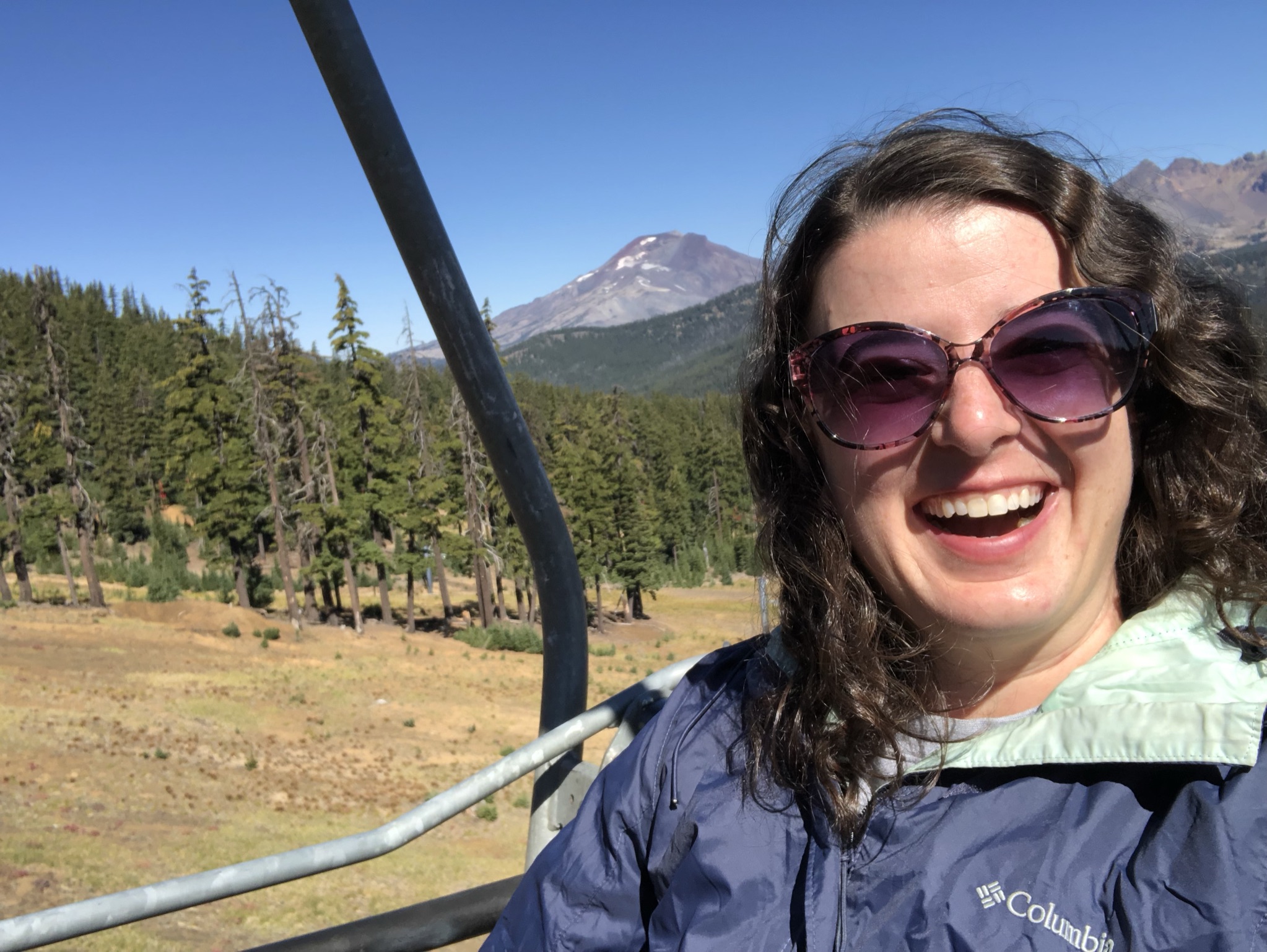
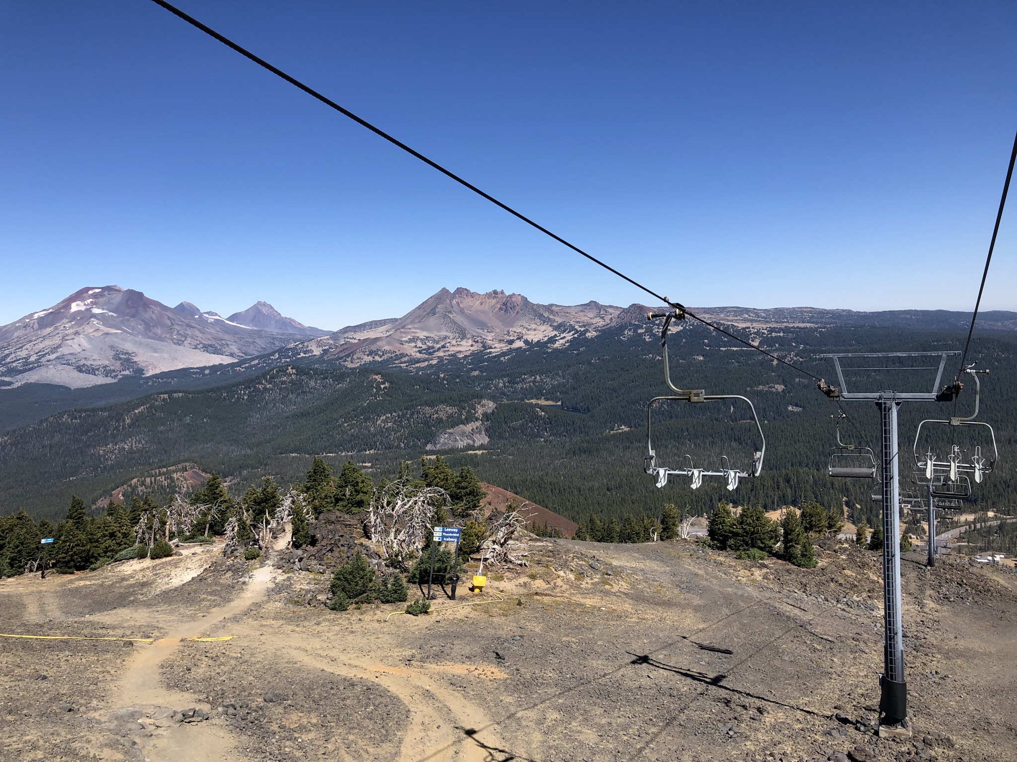
The next morning was clear. I guess I could have spent another day in Bend, I thought to myself, but I was fine moving on. I spent a slow morning getting on the road and picking up groceries and gas, then commenced the slow road trip to Crater Lake via the Cascades Lakes Scenic Byway, a gorgeous and nearly empty road at times that was lined with pine trees and mountain views of Mt. Bachelor and the Three Sisters. Taking a recommendation from a coworker, about an hour into my trip I made a stop at the Mt. Bachelor ski resort. Putting on my winter hat and layers I went to explore the not-crowded resort and figure out what to do. I opted to take the ski lift up and down for $24, deciding to skip the zipline experience. I had such fun going up the snowy mountain and seeing some amazing clear views in all directions. At the top I saw a few mountain bikers and zip liners and checked out the weirdly-located lodge and restaurant. I took a little hiking trail for a bit and enjoyed the awesome views and imposing landscape around me, filled with more lava rocks and patches of snow. I felt very happy out on the cold clear mountain!
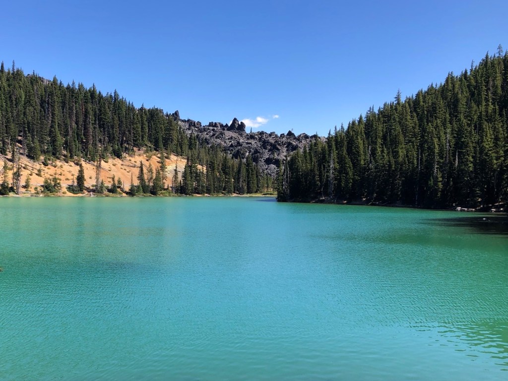
I continued on to the nearby Devils Lake, another coworker recommendation. The lake was small and visible from the road, but what really stood out was its stunning and crystal clear turquoise color. I loved it, and decided to take the little hour+ out and back trail around one side of the lake. Aside from near the parking lot and across by the road I didn’t see a single other person, so I really got to enjoy the nature, solitude, and lake views.
I stopped at another lake a little bit down the road, Elk Lake, which seemed a little more touristy, so I just made it a quick snack stop and kept it moving. I had about two hours of driving to make a decision about my next stop. I was thinking about seeing some waterfalls closer to Crater Lake, driving straight to my lodging, or driving a little longer through Crater Lake on the way to my lodging. As I reached the end of the Scenic Byway, I was really disappointed to see it start to get smoky again. There was more and more smoke as I drove, and I once again pulled out the mask for the car. Soon the sky started looking white around me instead of blue. I decided to scrap the waterfalls and take the scenic drive.
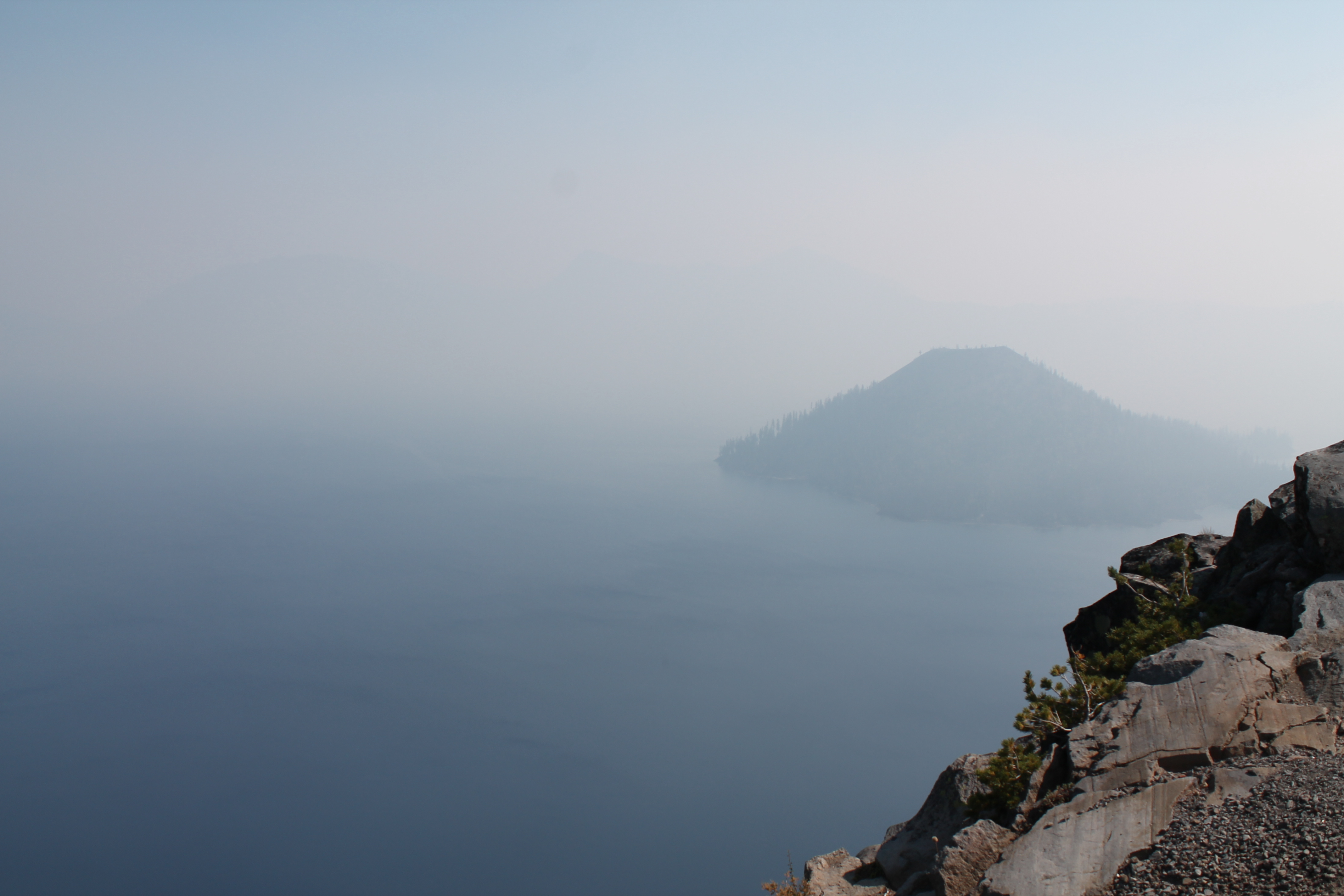
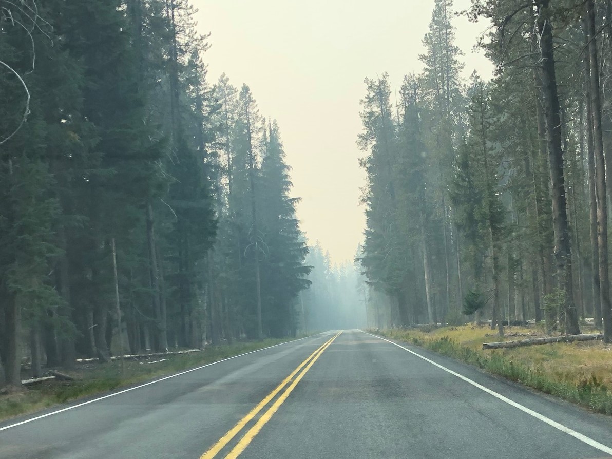
As I drove through the north entrance gate, which was un-manned, I started getting excited to see the landmark lake that had inspired the trip. I pulled the car over to stretch and use a bathroom, and really got hit by the smoke. It was bad. So I adapted to a come-what-may attitude and kept on driving until I hit the first pull-over along the 33-mile road circling the lake. And well, I sort of saw it. There was clearly something there, but it was completely shrouded in thick smoke and impossible to see anything clearly. The shores were a little more visible with the contrasting cliffsides down to the water, but it was just bad. I talked to an older couple who I overheard saying “well, that trip was a wash.” Turns out they lived near Lake Tahoe, and had driven out here to revisit Crater Lake, on their way somewhere else, as they were evacuating the area due to even worse wildfires. (At this point, I felt like how could it possibly get worse than this?? But I guess it does.)
So, womp womp. But fortunately I am a planner, knew there could be bad smoke, and planned 3 nights in the area just in case and in hopes it would clear at least one day, as it tends to do. Crater Lake lodging is really sparse and far away if you can’t get a booking in the lodge within the Park (like most National Parks, these are expensive and sell out very early). I found a lodge/cabins place about a half hour drive west of the southern park entrance in what I thought might be a small town called Union Creek. It was the closest and cheapest thing I could find, with a private lodge room for $100 a night with a shared bathroom. It turned out to be completely rural and remote – like off the grid. There was a little restaurant window with picnic tables and an ice cream shop across the street, and that was Union Creek. The next development was 11 miles further down the road. There was no cell phone reception and wifi was in and out – better until late evening when it seemed to stop working. This was pretty awesome and so rare nowadays. To get there from the Park was a bit harrowing in the smoke, though. It was fine, I guess, in that I could see, but the smell continued and I got a sense of foreboding driving on an empty and smoky road, with thoughts of “should I really be driving here? Am I driving into a fire??” The lack of cell phone service was another eerie element in getting there. Google maps worked a little and I had written down the directions just in case.
I checked into the lodge and found it nice and rustic. I was happy to hear that the smoke had often been clearing up in the morning and then getting worse in the afternoon. My comfortable private room on the second floor had a sink and mini fridge with two private toilets and showers down the hall. The only real problem was that the downstairs door to the stairs was propped open with a do-not-close sign, which resulted in letting the smoky smell into the hallway and bathrooms. I took care to keep my door and window closed, and with a fan and my lavender spray from Mt. Hood it was fine. I had dinner at Beckie’s Restaurant across the street, some chicken fingers and fries, and enjoyed food and some grocery store wine in my room while managing to watch some Netflix. I realized I was exhausted after a very long and somewhat trying day. As tired as I was, overnight I became a little paranoid that I smelled the smoke a little, so I put a towel under the door. I don’t know if I really smelled it or not, but my nerves made me a little too nervous to sleep great while I was there. Still, I stayed hopeful for clear skies the next day and prepared to wake up early and see, remaining flexible to know that if it was bad I could just chill in the room with books and such.
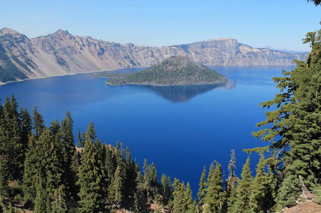
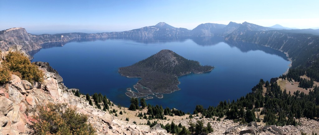
I woke up before sunrise, unable to tell the smoke conditions by looking out the window. But a phone check gave me some tremendous news – the AQI was moderate to good. I packed up and got a move on in the freezing (literally) morning weather, with just a faint smoke smell lingering in the air. By the time I arrived at Crater Lake it was clear and gorgeous, not to mention empty. I saw some smoke in the distance but it never rolled over to the lake. It warmed up nicely later in the day, and while the crowds grew it never felt crowded at all. I drove the full lake loop throughout the day and fit in a few great hikes and lots of viewpoints. It was the perfect day I was craving there.
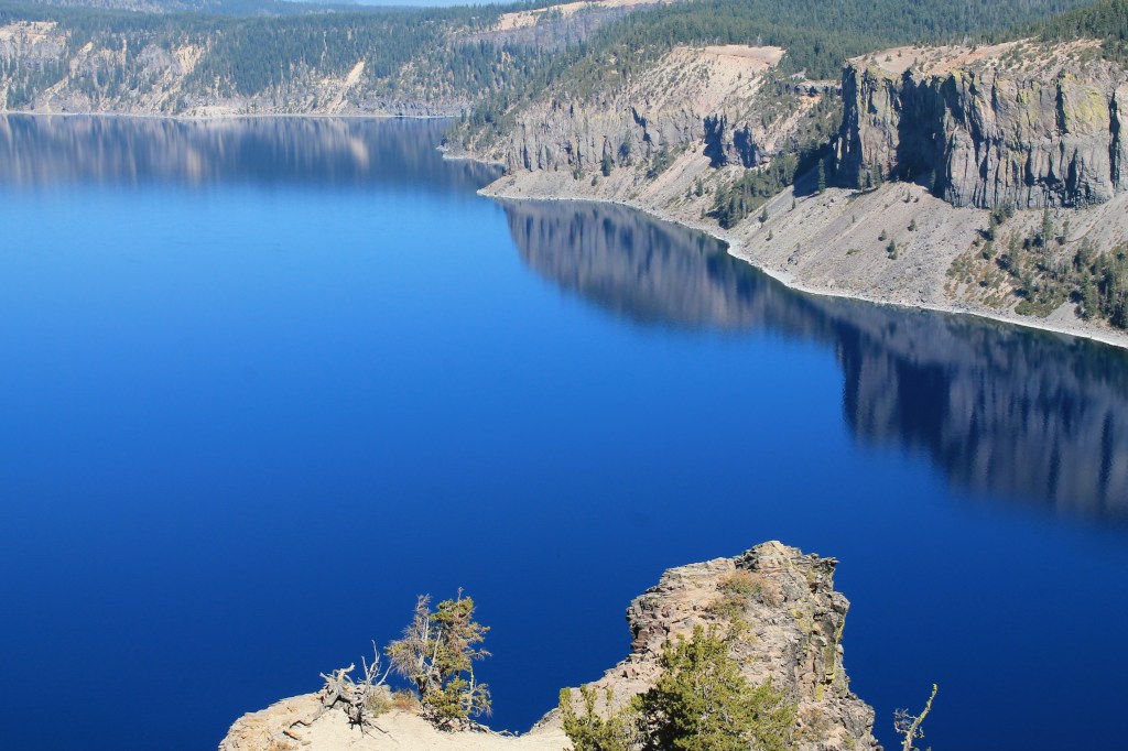
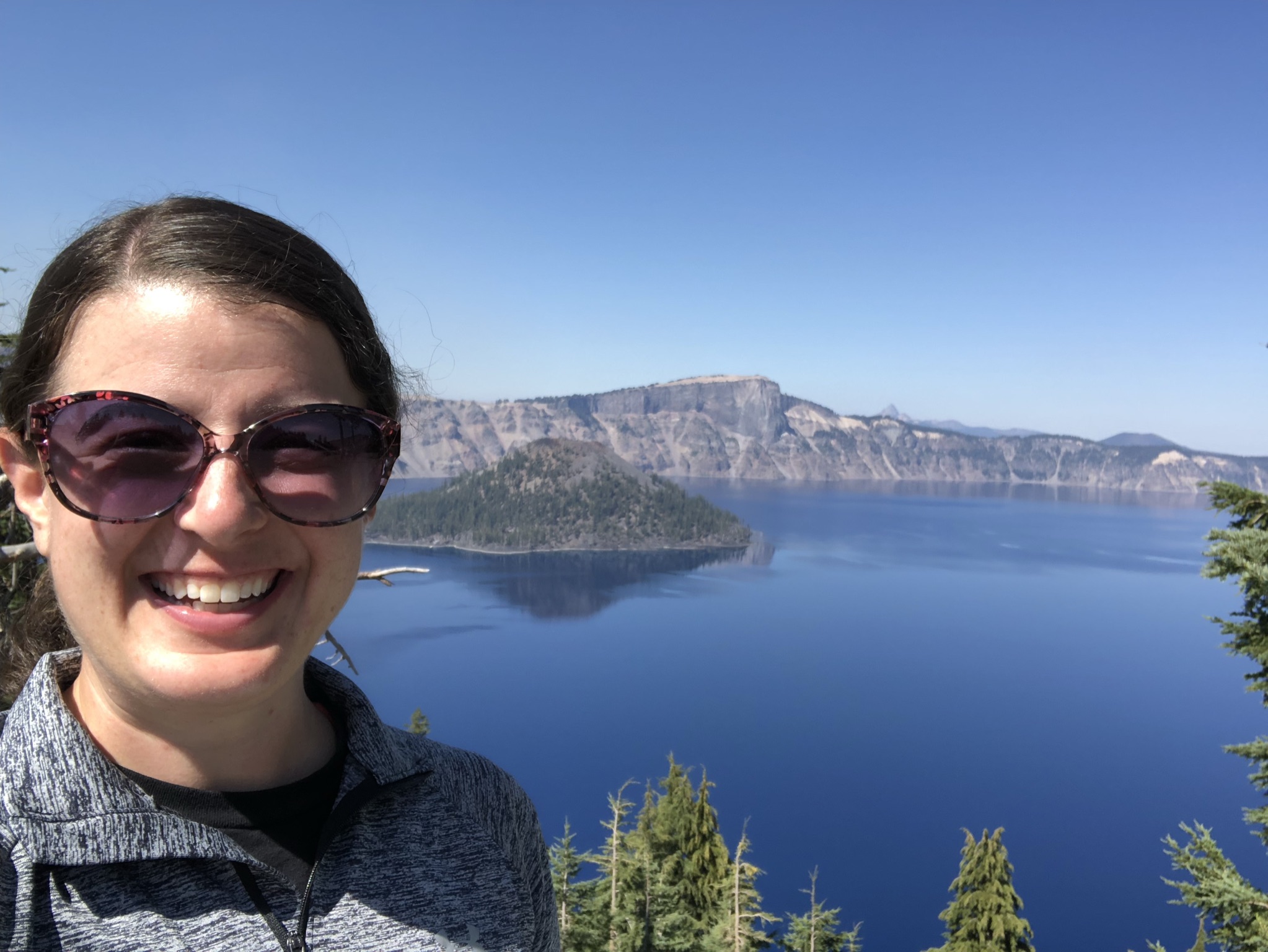
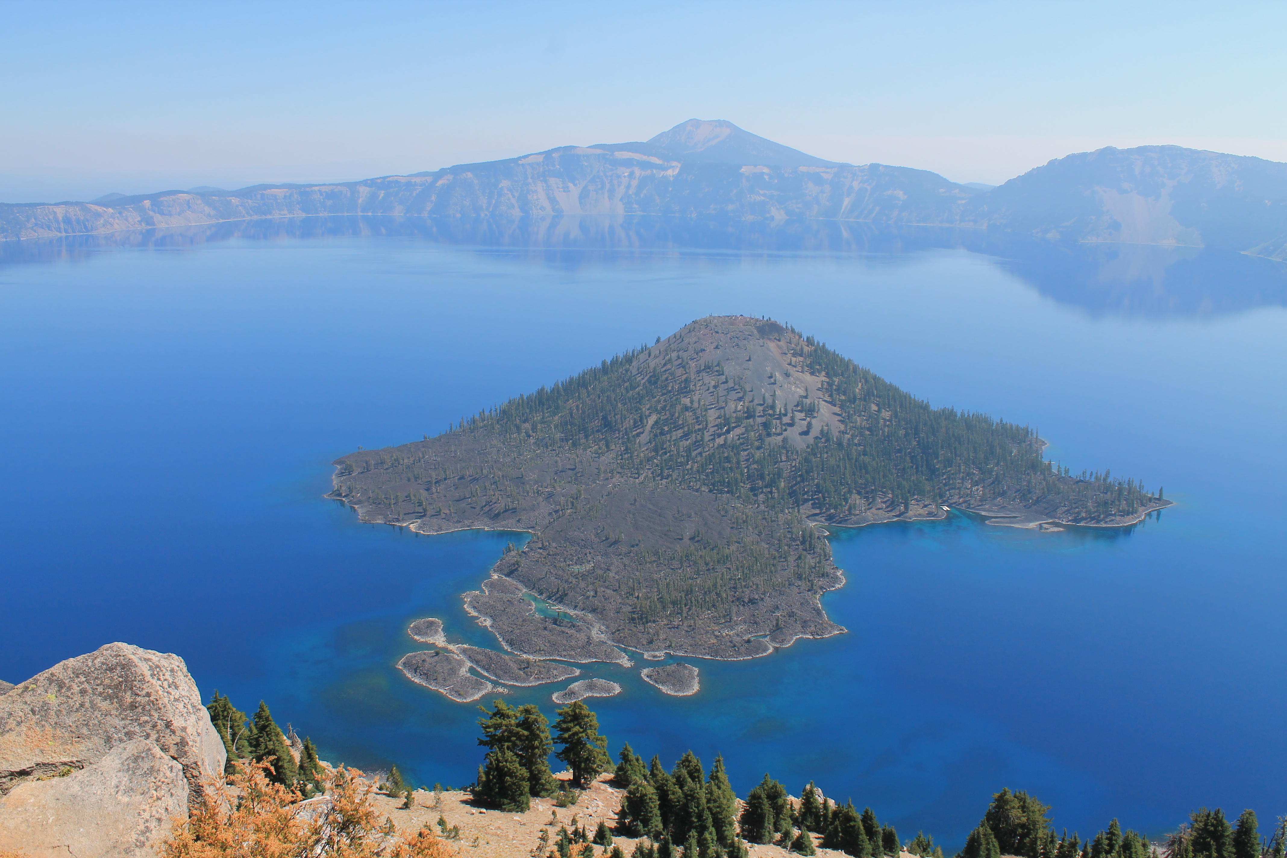
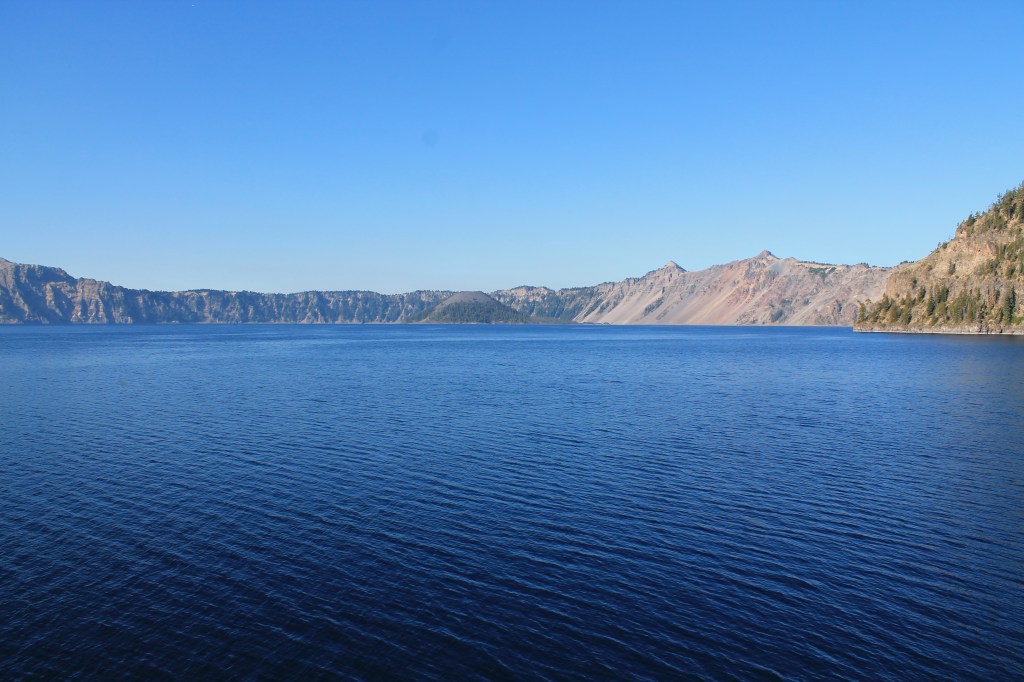
As the sun rose the giant deep lake showed off its dramatic colors, just getting better and better with each stop I made. Crater Lake is the deepest lake in the U.S. at 1,943 feet deep, which gives it a unique deep blue color. It is completely fed by rain and snowfall which also makes it crystal clear. I learned a little more about its history, but mostly just took joy in being in such beautiful nature.
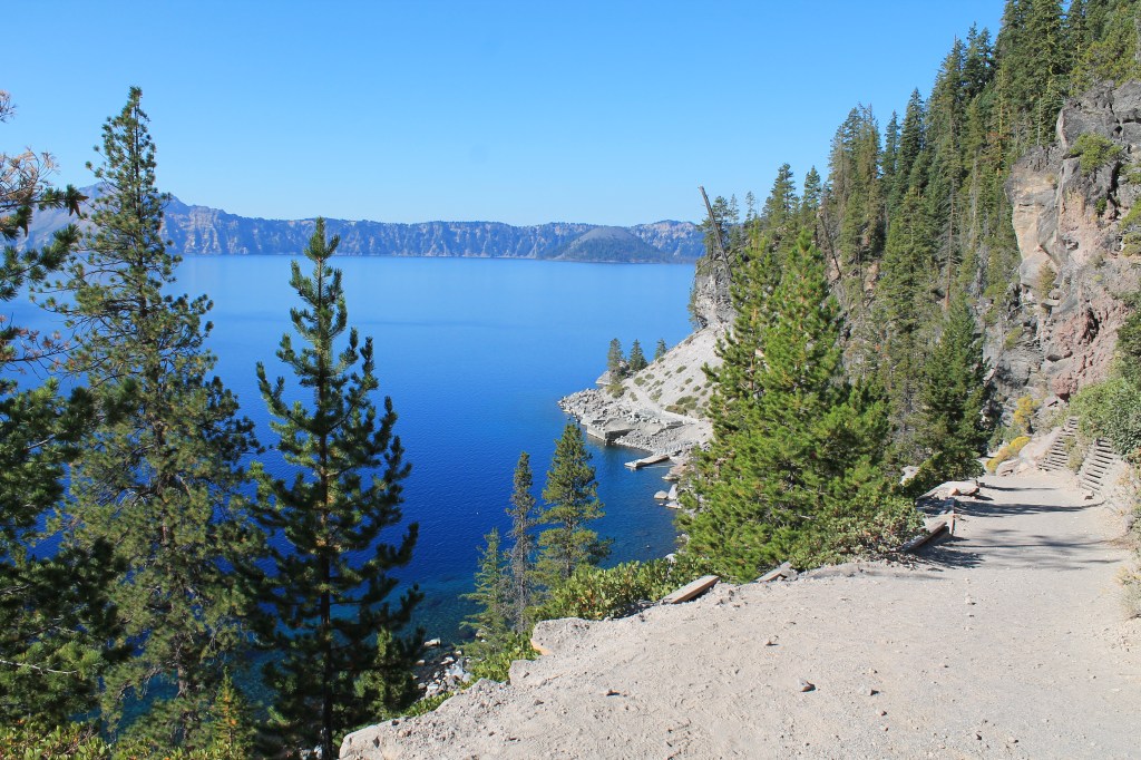
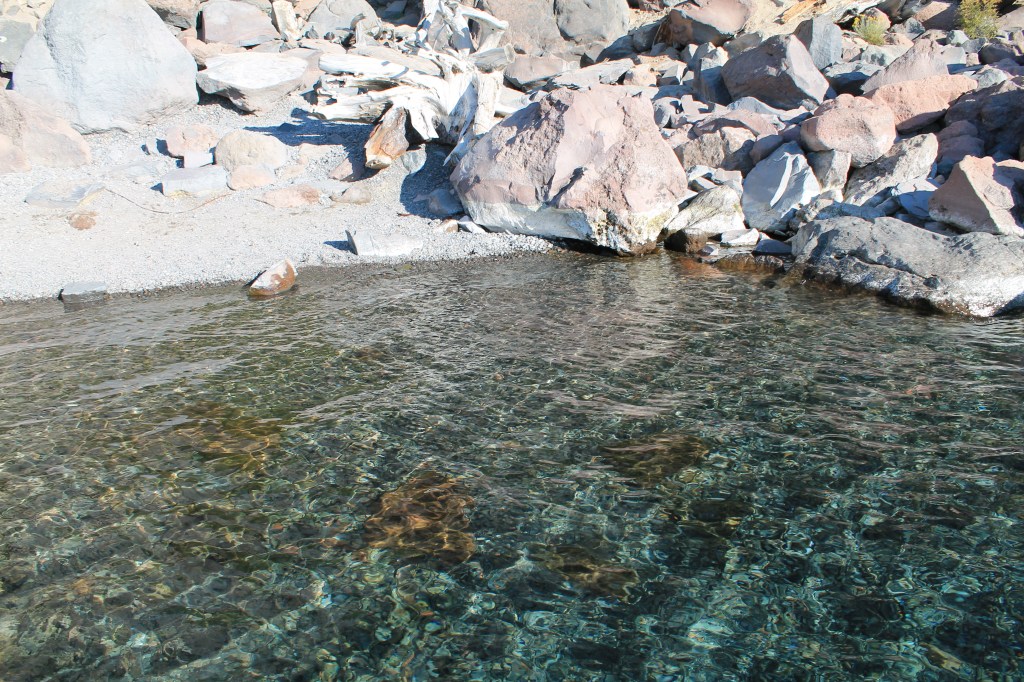
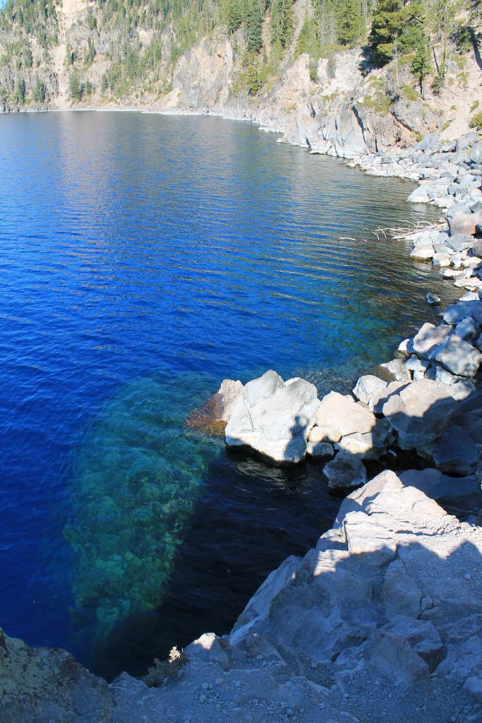
I decided to start the day with Cleetwood Cove, a strenuous-graded 2.2-mile round trip trail that is the only downhill hike that gives you water access to put your feet in or risk a freezing cold dip or high cliff jump. Pre-covid there were also boat tours that launched from there. It was still about 40 degrees out when I arrived so I opted to leave the swim suit behind this time. With just one car in the parking lot ahead of me I had a joyous downhill walk. I lingered at the bottom, talking to two women who were impressed by my solo travel and later an Indian man traveling the U.S. alone. I put my feet in the icy, crystal clear lake and enjoyed some awesome solitude. What goes down must come up, and this hike has multiple warnings about how difficult the uphill can be. For me it was not hard, just a flat sandy trail that went uphill with a lot of switchbacks. I had to stop and rest a good amount but I probably wouldn’t have called it STRENUOUS DANGER CAUTION the way the Park did. I even passed the Indian man on my way back up.
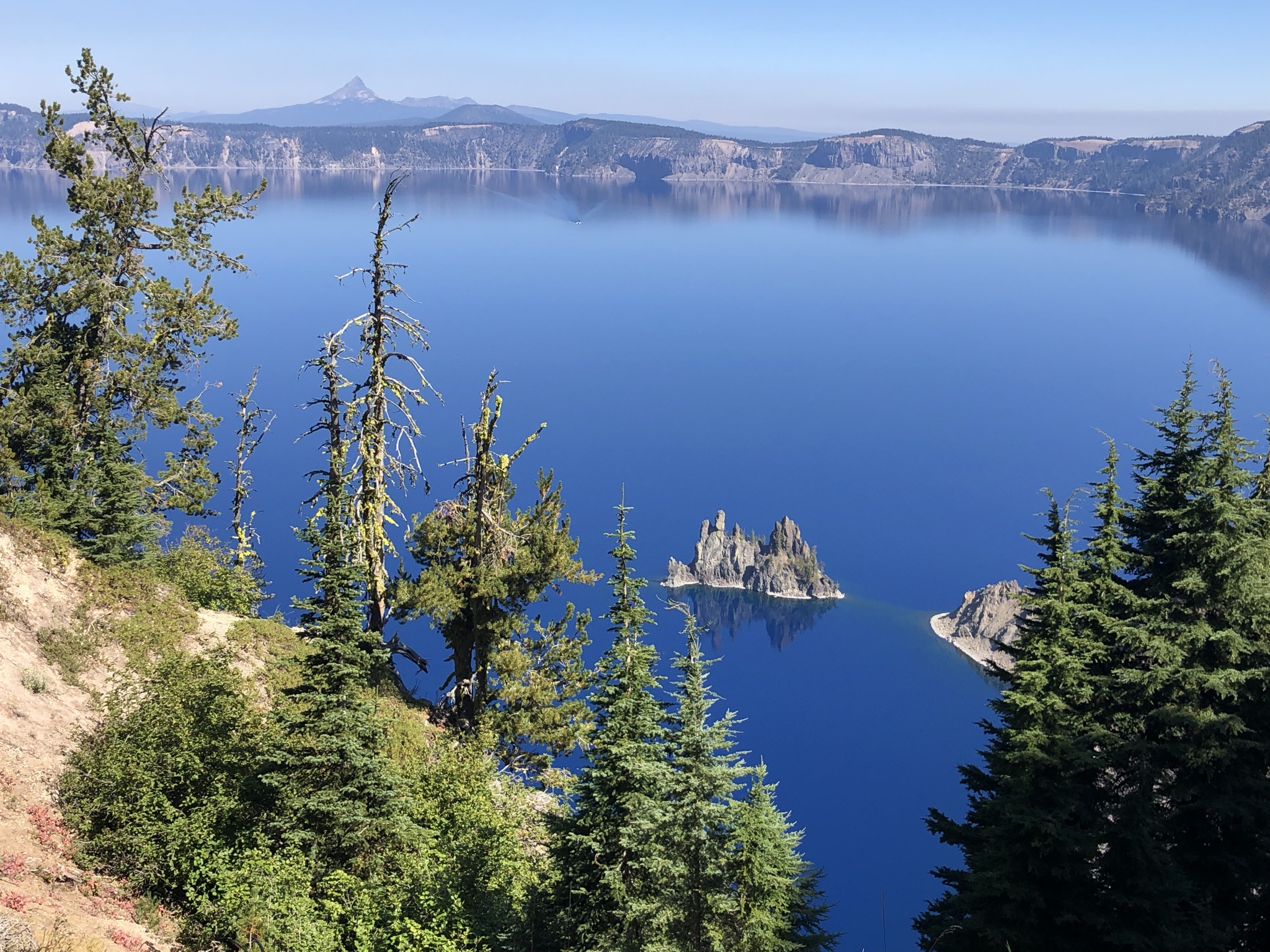
My next hike was a little 20 minute paved loop called Sun Notch, which led to a view of a rocky formation in the lake they call the phantom ship. I took this one fast, zipping by some older folks and small children. Finally, I did one of several of the Park’s uphill climbs at Watchman Peak, a moderate 1.6-mile round trip climb up to an amazing lake viewpoint by a fire watch tower (which I think was in active use). The hike was similar to the morning one in difficulty, with fewer trees and more comfortable weather now in the 60s. At the peak I ate lunch while I waited for a big family to stop hogging the best photo spot, and then was alone until another solo hiker parked down with a cooler filled with a cold beer. I could see the smoke in the distance more clearly now, but it still wasn’t hitting us.
I made my way to a crowded area with several buildings, a gift shop and café, etc, and spent some time sitting around staring at the lake and chatting with a ranger about fires and his recent trip to Alaska. I was really happy with my day and felt great. It occurred to me that I had done everything I really wanted to do at Crater Lake, and I was pretty eager to go somewhere without smoke risk all the time. So there, in the mid-afternoon, I made the decision to leave the next morning.
I used the cell phone reception in the park to make some calls and bookings, putting my flexible traveler skills to the test. I told the lodge I’d be checking out early (I wasn’t refunded this time, sadly). Tomorrow was Thursday, which gave me 2 more days to play with than originally planned. But of course, I had a backup plan. The original plan was to leave Crater Lake on Saturday, drive the 4-5 hours back up to Portland, and do a short day trip from Portland to the northern Oregon coast on Sunday before my red eye flight home that night. The new plan allowed me to see more of the coast and spend time in some cities. So I booked Thursday night at a hostel in Florence, a small city on the central coast (just about $50 for a private room), called my coworker in Salem, Oregon and made plans to stay there Friday night, and kept my reservation back in the Portland hostel for Sunday night. Oh yeah, it’s getting chaotic. Get ready for some more over-stimulation.
As I got gas on my way out of Crater Lake and drove back to the lodge, the air was immediately covered in smoke once again. I got a chicken sandwich from Beckie’s again (which weirdly had a crowd there, with people coming for their famous homemade pies apparently). Some people said they had just left come from Crater Lake on a day trip and that it was very smoky there. I must have just missed the smoke rolling back in. I got a good night’s sleep and left early the next morning.
Oh but wait, I’m not in the clear yet.
The drive out of the smoky area entailed driving west and straight through what looked on the map like a north-south line of fires. It was intimidating, but since the wind generally blows toward the east it was necessary to drive through to get into the clear. I checked online maps as best I could, and the roads were open. So I once again got an early and cold start, with the air just a little smoky. I made a quick stop right across the street to take a peek at the Union Creek/Rogue River Gorge – the “town’s” namesake, and continued on the empty, tree-lined roads, with the air alternating between fully clear and moderately smoky for the next hour.
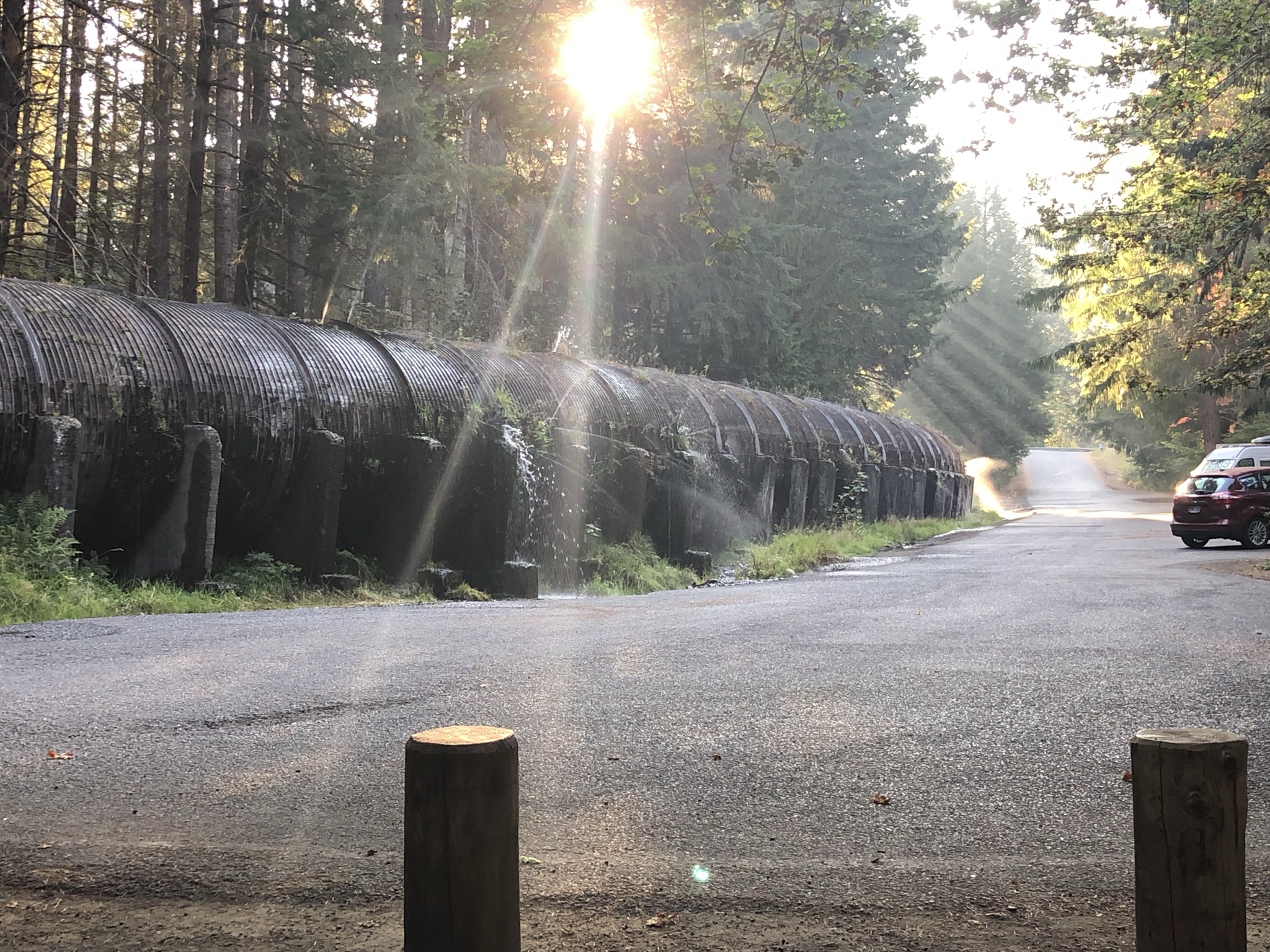
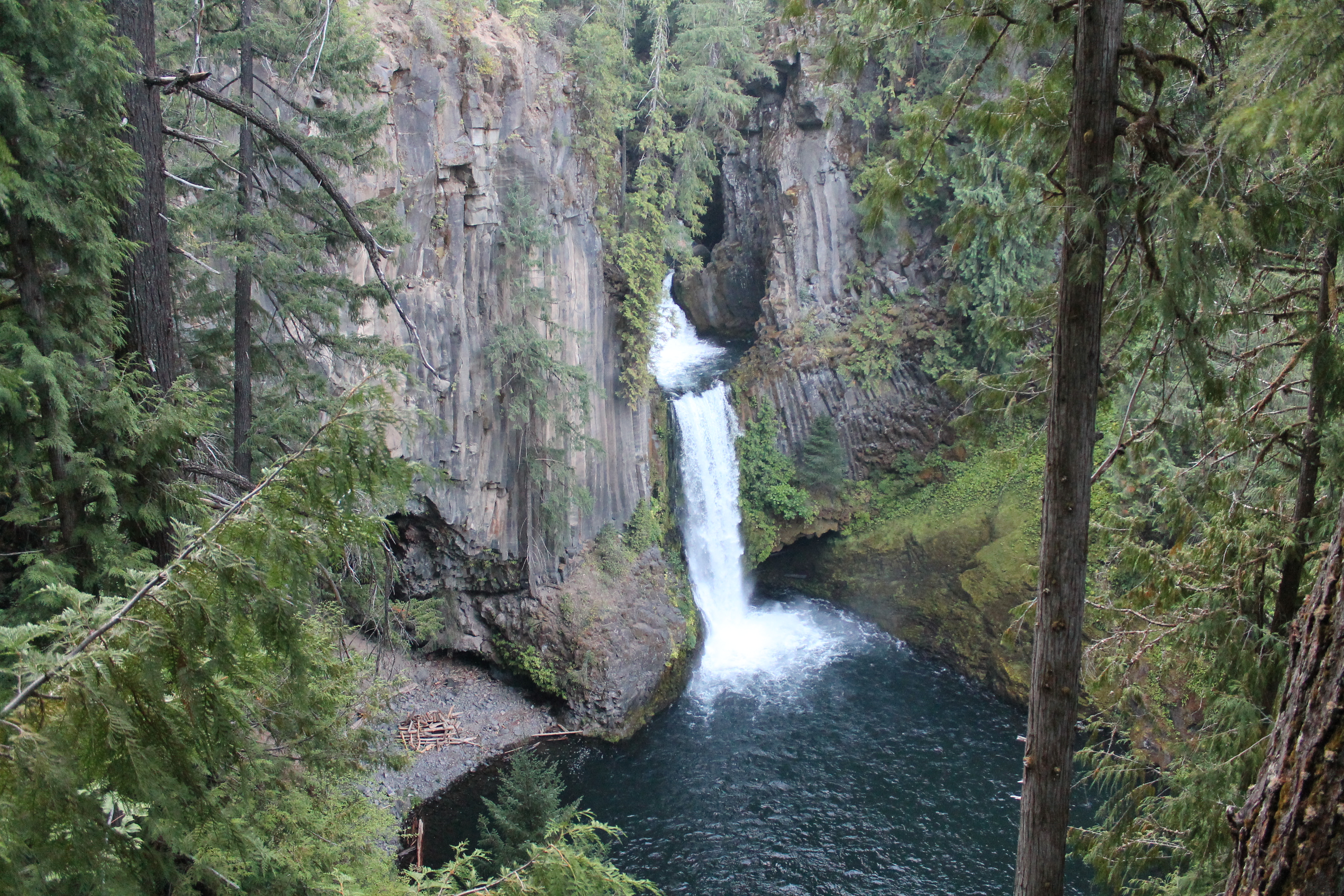
With clear skies, I decided to make a stop for a short hike to Toketee Falls, another popular waterfall hike of just about a mile out and back. The parking lot – empty except for a van that I think people were sleeping in – featured a giant tube leaking water in several spots. As I got ready to hike I saw one other car and solo hiker come in; I ended up seeing him going out on my way in. It was a lovely, lush trail that I had to myself that ended in an elevated viewing platform of the falls. I had read online about people who climbed to the bottom, and so I noticed next to a hole in the fence a rope was secured to help people descend the near-vertical rocks. It was way too intense for me, especially being there alone, so I took a pass. I was glad I was able to squeeze in one of my planned hikes in the smoky region.
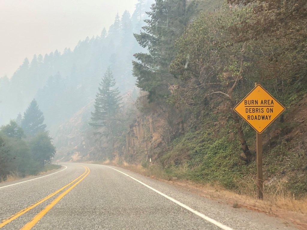
I knew the next hour-plus was going to be the most smoky and intense part of the drive. And it was pretty bad; like everything I had seen already but worse, and more ominous. There was some solace in seeing a few other cars on the road, and I could still see the road ahead of me, but it was still pretty scary, uncertain, and very sad. I passed a few work crews clearing burnt trees, and as the air began to clear I drove by a huge tent city set up for emergency fire crews. It was certainly an experience.
It wasn’t an immediate relief, but as I reached the Interstate and some development I felt like I was back to a little bit of normal. I shook off some nerves with some coffee from a McDonalds, and passed the interstate for the final hour and a half drive to the coast. The other side of the highway seemed to immediately clear up, and all of a sudden it was a gorgeous sunny day on a lovely winding road. At one point I even drove by some elk! I turned up the coastal highway and thus began my last-minute-planned series of stops along the coast.
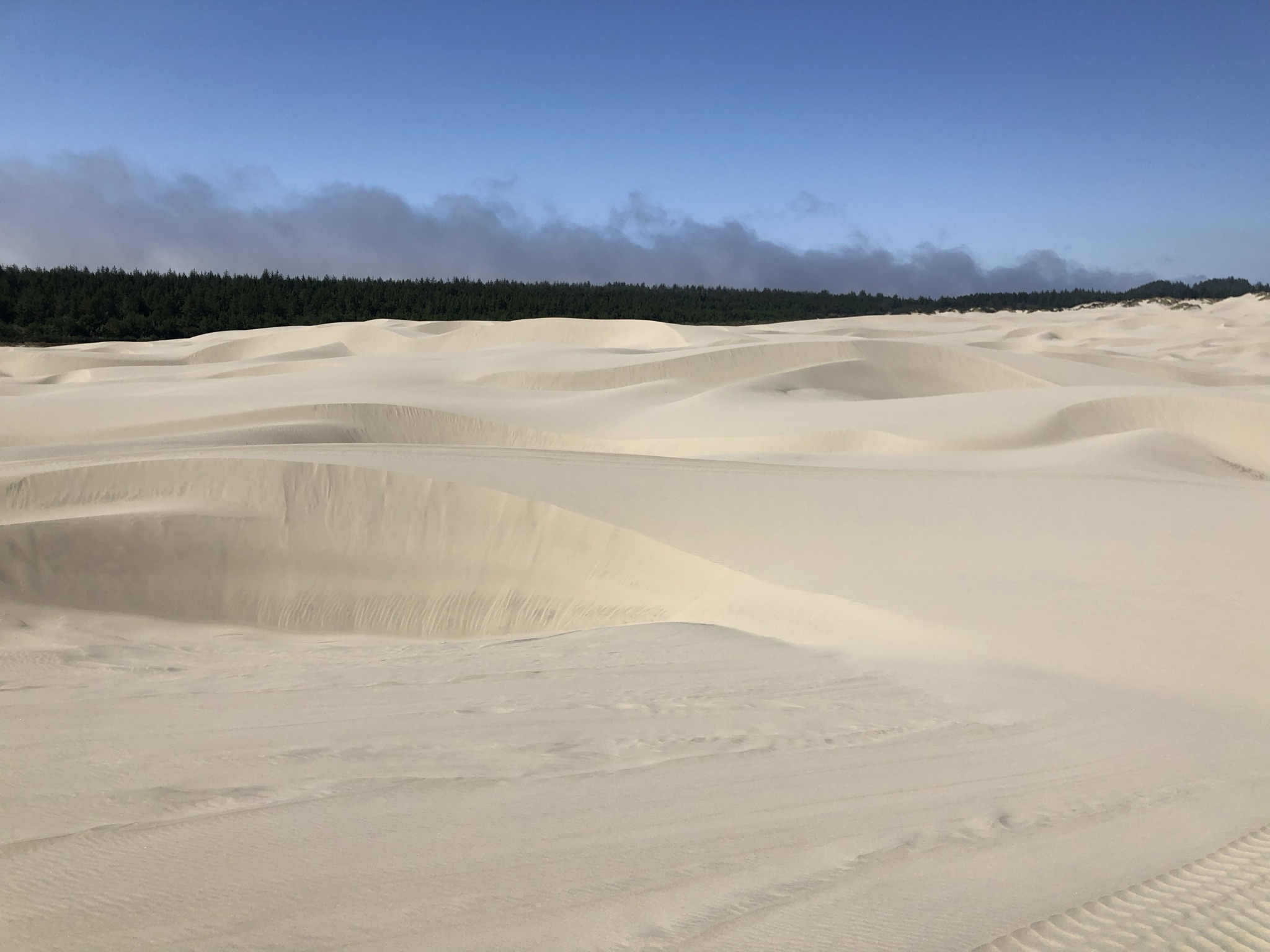
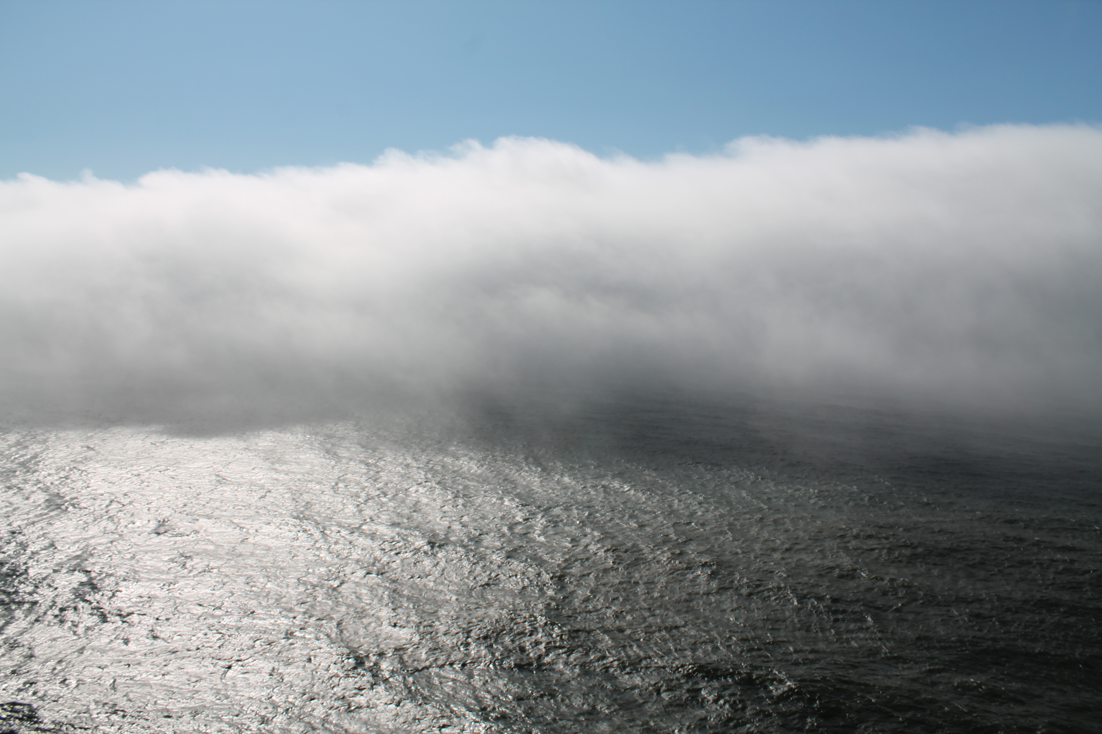
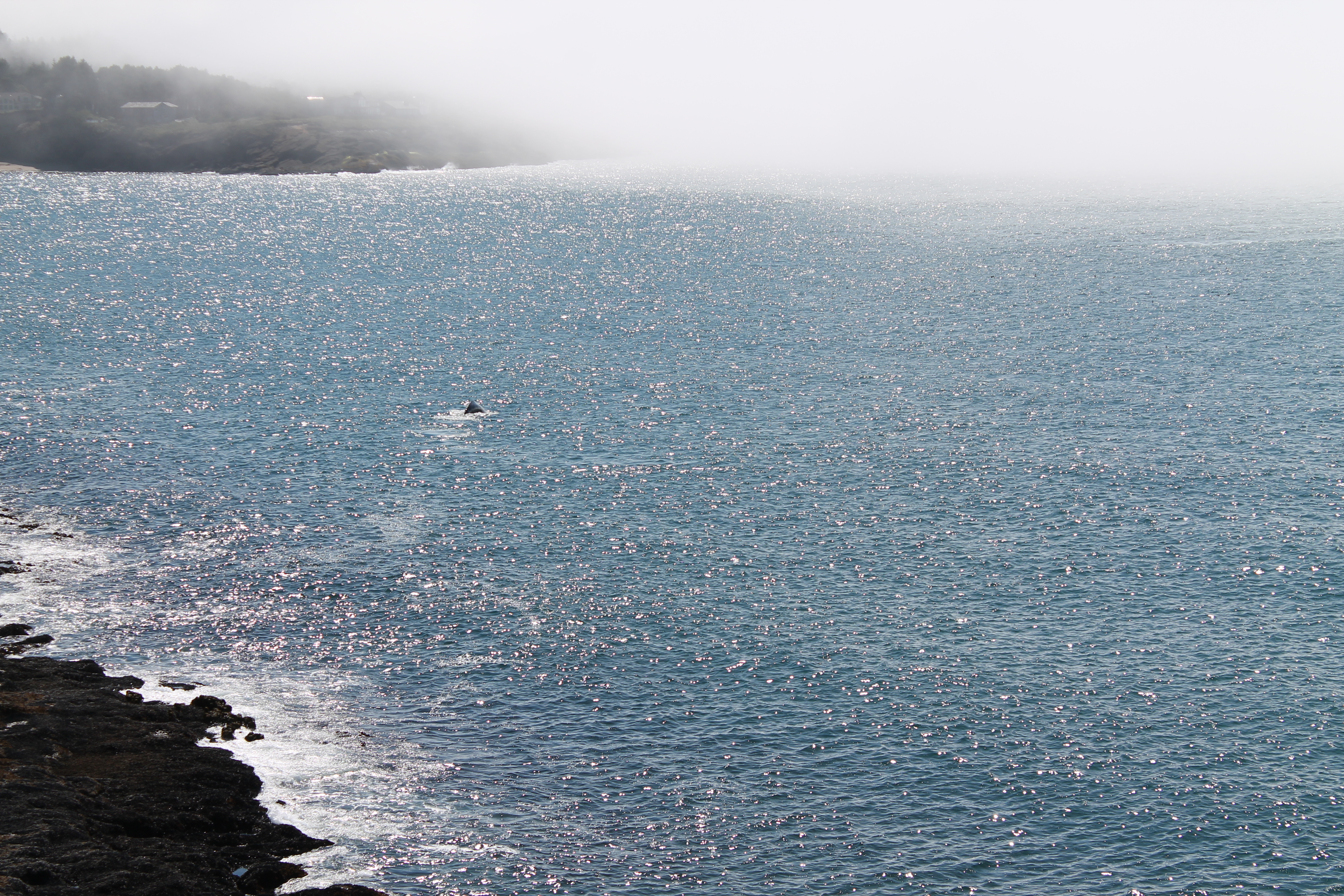
First up, the Oregon Dunes National Recreation Area. Did you know that Oregon features one of the world’s largest expansions of temperate coastal sand dunes? Until I stopped and saw them, neither did I. My first breath of fresh, cool salty sea air after days of smoky stress felt magical. I explored the dunes a little and watched some kids taking some death-defying leaps down a sand hill. I opted not to hike downhill to the water through the sand. The ocean view below looked eerily similar to having a line of smoke in the air, but as I learned later it was just fog, a very common coastal occurrence here.
A few minutes away I entered Florence, a central point on the coast and a cute little town. I checked out the hostel; more of a guest house with a few rooms. From the empty parking lot I entered the code on the door and found my room key next to a lamp. The room wasn’t quite ready so I enjoyed the empty property for a nice lunch break in the kitchen.
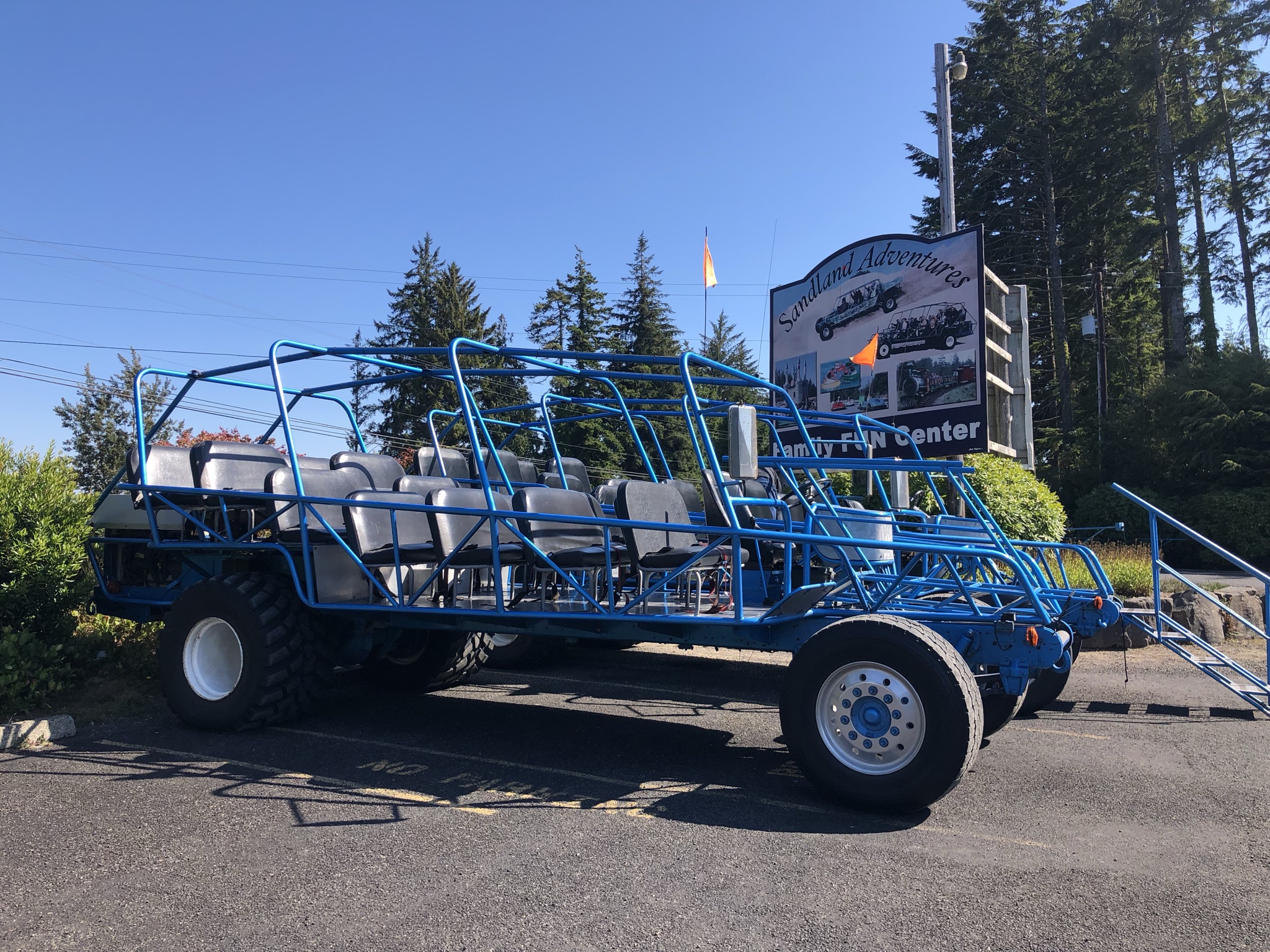
Next up, back to the Oregon Dunes, where I had just booked a last minute tour on a giant dune buggy! It was so cool!! It was an adventure driving all over the dunes with a group of people, while also learning about the dunes. Other people were riding dirt bikes and ATVs and being even more adventurous, but I thought our couple of hills and fast dips and turns was great adrenaline without feeling too dangerous. It was really unique and memorable, and I marveled in how the spontaneous side of travel sometimes brings the most fun.
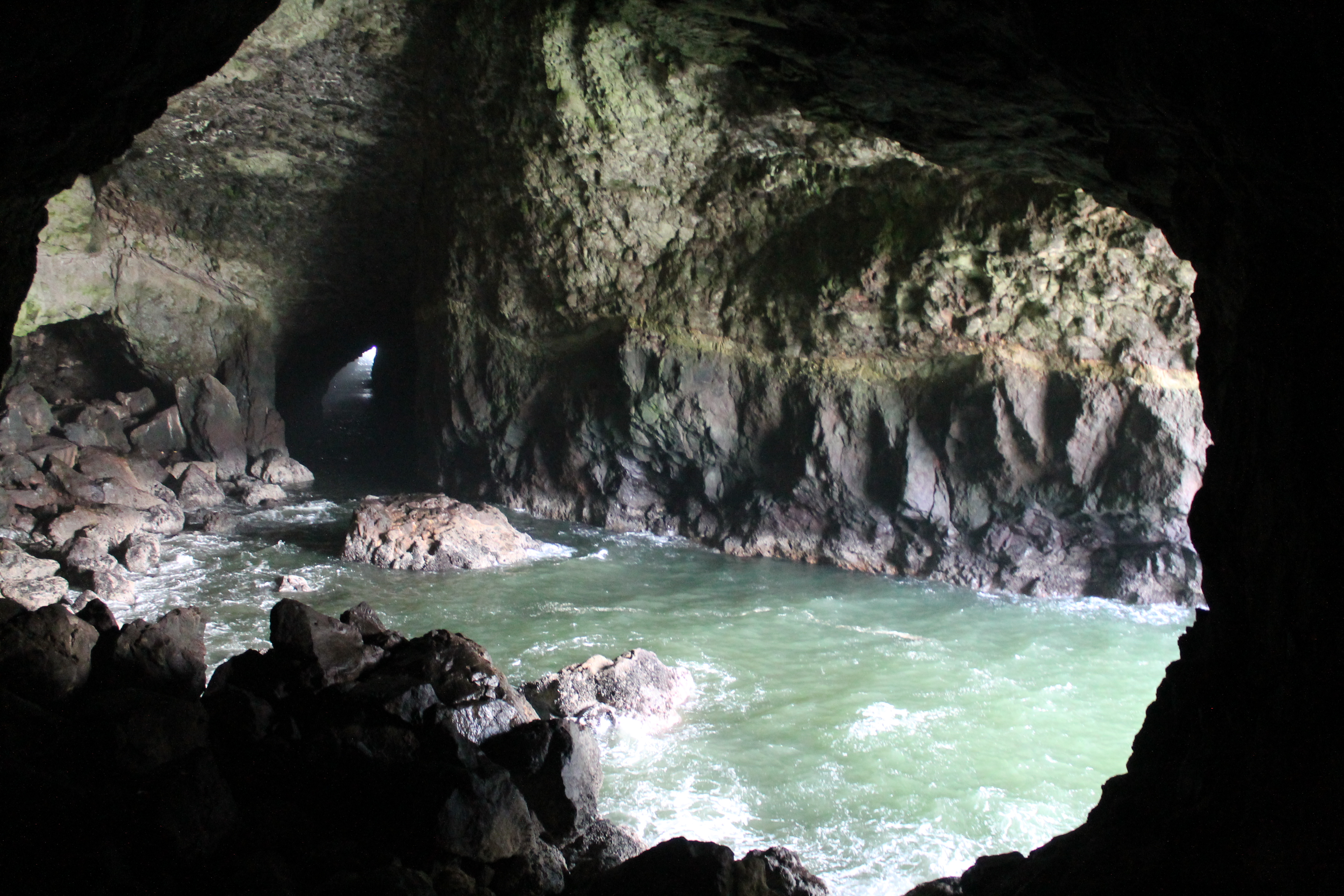
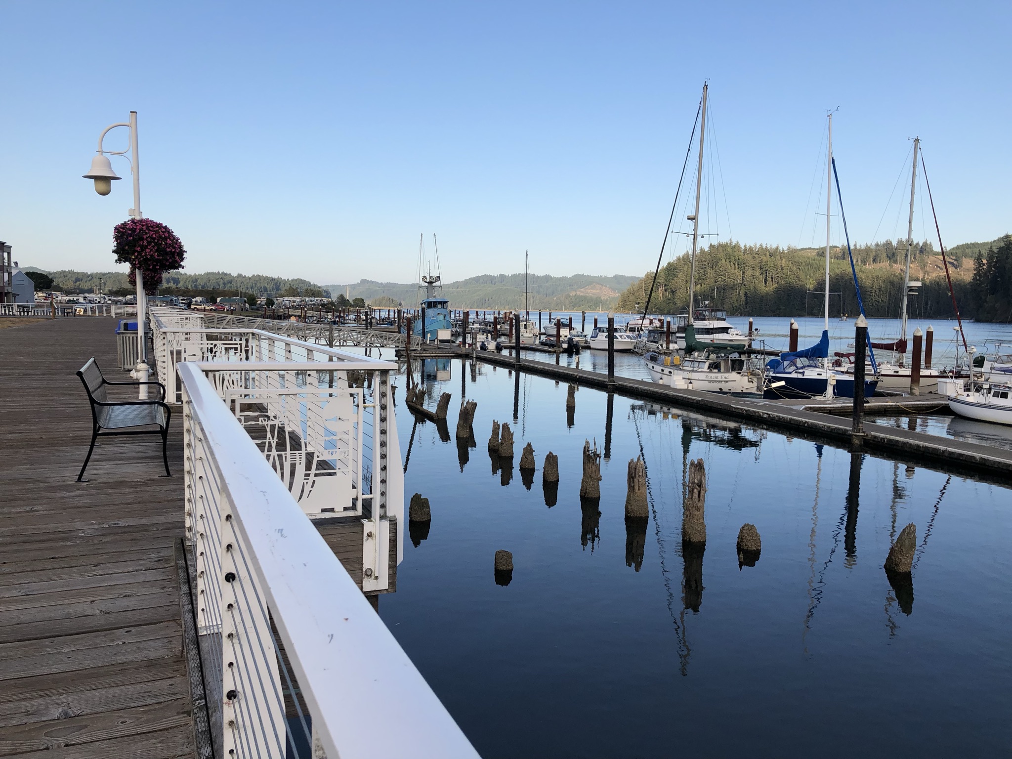
For my next stop, I drove about 20 minutes north of Florence to another big tourist attraction in the area, the Sea Lion Caves. After paying you ride an elevator down to sea level, enter a little cave, and get a viewing spot of the largest sea cave in the world, where the sea lions like to hang out. Sadly, they were away for the season, but I decided to go down anyway and it was still pretty cool to see. I also ended up seeing some wild sea lions later, although from a little far away. The area also gave me my first great views of the rocky and wild Oregon Coast, including a far-away view of the famous Haceta Head Lighthouse (at least, once the fog blew away). I headed back into town, formally checked into my room, and partook in my favorite guilty pleasure meal by picking up some Pizza Hut to eat in my room. After dinner I drove into the town and walked around the cute shops and harbor a little bit, though most stores were closed for the evening by then. I marveled at the interesting fog which stopped abruptly in a line, and then realized I was exhausted after a long day so headed back for a good night’s sleep.
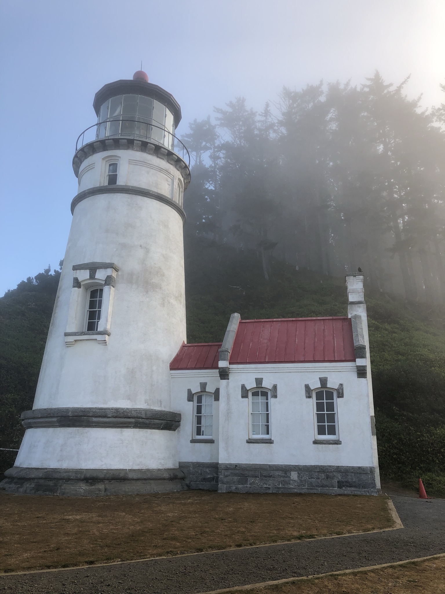
I left early the next day to start an ambitious day of driving up the coast and then looping inland to meet up with Katie in Salem. I planned this coastal part of the trip almost entirely through tourism magazines, which the Oregon tourism bureau had mailed to me for free and I had brought along. As I left the hostel parking lot I noticed 3 other cars there, and I waved to some people I saw. A few minutes into my drive, it immediately became very foggy. Unlike driving through smoke, I was struggling to see the road in front of me, and it got a little scary. I decided to turn around and head back. After sitting in the car for 15 minutes and mulling my next move, I figured I’d just have to buck up and keep moving. It was a little better for a bit, but then got worse again. I just drove slow and got through it. I made it to my first stop, Haceta Head Lighthouse, where in the parking lot it was still very foggy but in an interesting and cool kind of way, now that I was no longer driving. I noticed a foggy beach at eye level here. Since it was early it wasn’t crowded, and I just saw two people walking down, one dog walker near the beach, and a parks cleaner in the parking lot bathroom who told me to enjoy the road trip and take it slow (she wasn’t the first person who told me that since arriving on the coast – a weird old man watering the plants at the hostel told me the same thing yesterday). So in the isolation I walked the half mile hike uphill to the lighthouse, which apparently is a famous photo stop. The fog was really cool to hike in, and despite the bracingly cold weather I had a great time. Some hike highlights included wild blackberries, loud birds, an inability to see the ocean below from the lighthouse, and awesome sunlight through the trees and fog.
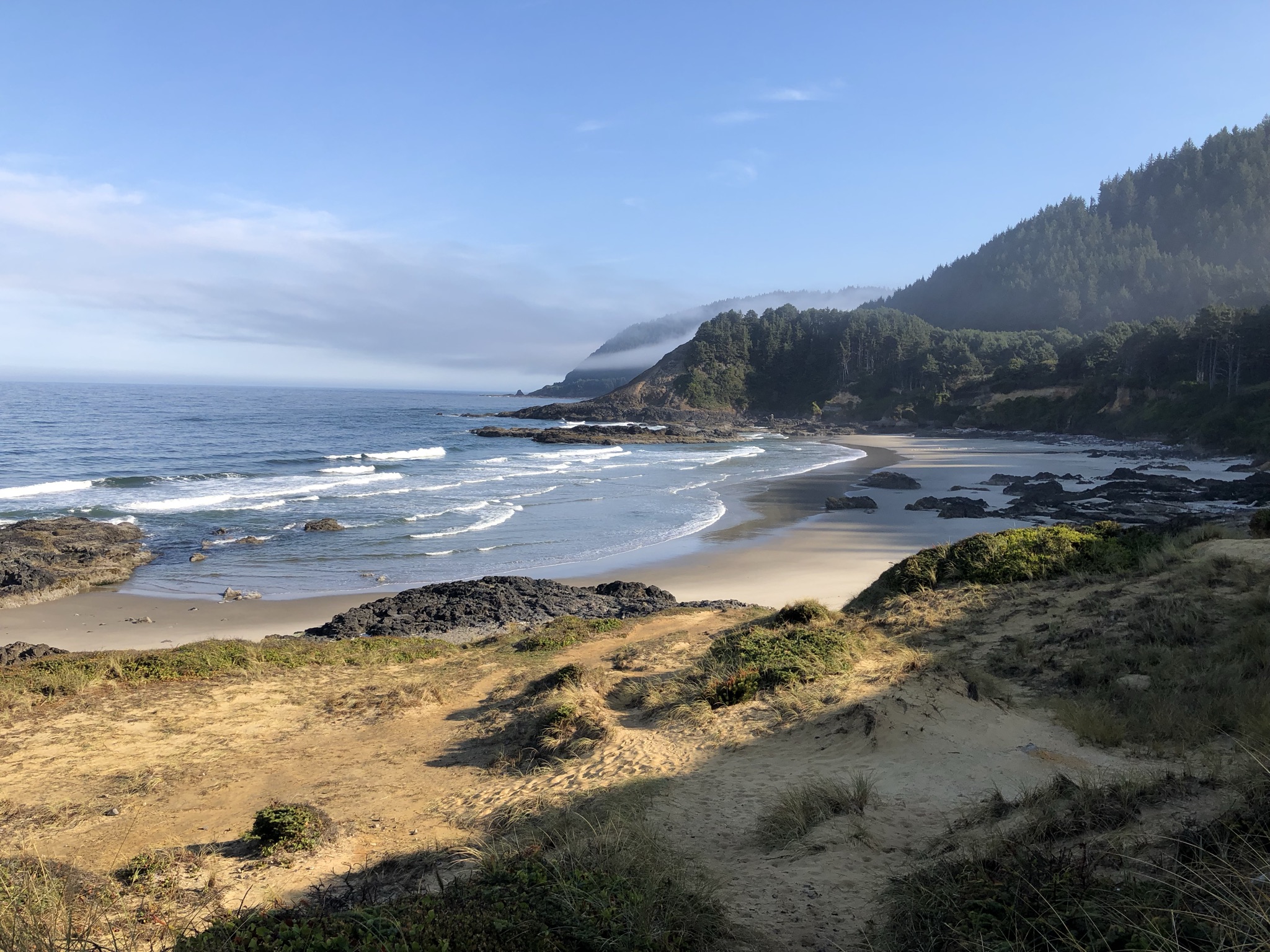
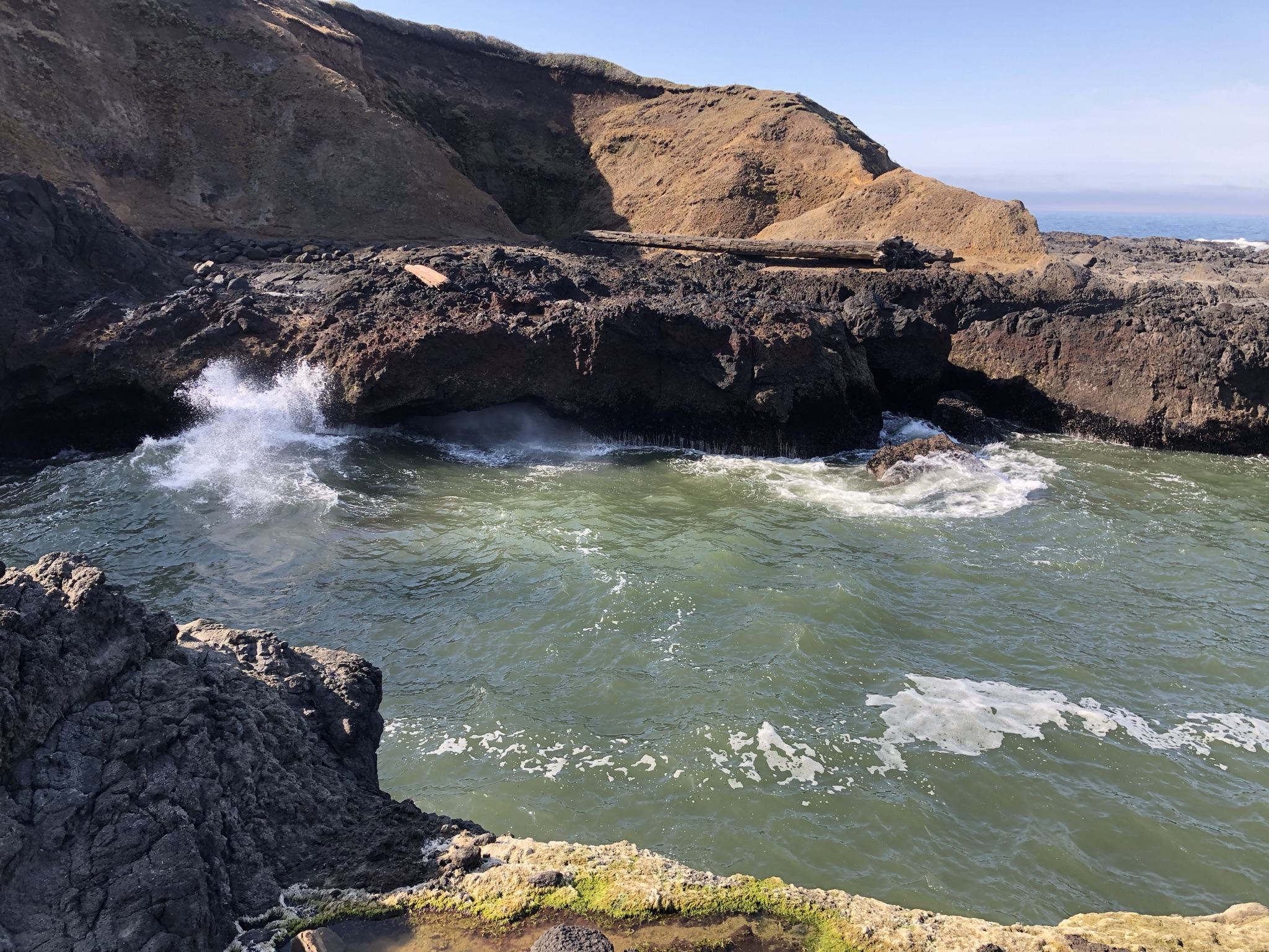
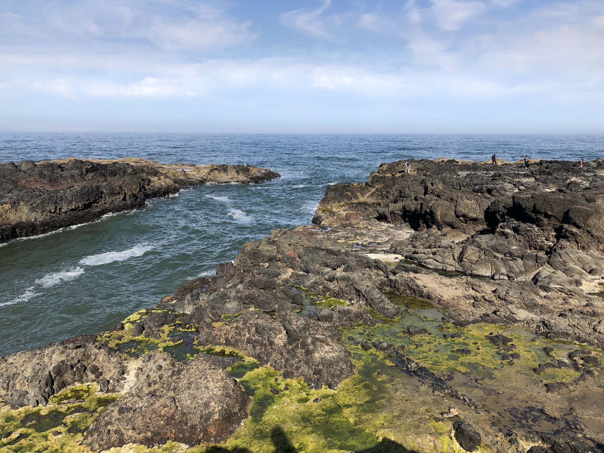
As I drove on I found myself climbing uphill and going above the fog for a bit, then back down into it, and then seeing it clear. It continued to be in and out for the rest of the day but was mostly clear. It was wild! My next quick stop was a viewpoint the parks cleaner recommended called Strawberry Hill, where in total solitude I climbed down some rocks and onto the beach, enjoying the amazing views. My next driving stop was also pretty close by at Cape Perpetua. Here, like some of my stops today, I was able to use my National Parks annual pass to cover parking, while other stops were state land and I had to pay a little bit to park, like at Haceta Head. Cape Perpetua was a little bigger spot with a gift shop and staff around, with paved sidewalks available for hikes near the ocean. I zoomed through some of these hilly walks and got to play around on some tidepools. These connected to a formation called Thor’s Well, sort of a U-shaped, cave-like inlet of water that made awesome splashes and roaring noises. I almost got wet a few times standing precariously above on the wet rocks but stayed dry and didn’t slip in! It still wasn’t too crowded but I was starting to see other people around. My next stop just a minute down the road was called Devil’s Churn, where I did a half mile loop trail that was also paved and accessible from my last hike area. With clear skies I was really enjoying myself now!

I drove on, next stopping in one of the many cute coastal towns called Yachats to go to Bread and Roses Bakery, where I tried an Oregon treat of marionberry in a pastry. I saw some of the locals as I drove around, giving me some slight Rockaway Beach Queens vibes. Just up the road was the Smelt Sands area, where I ate my treat and people watched, seeing lots of people out looking for things on the beach. I opted to skip the 1.5 mile round trip “historic” walk along the beach, but it was a pretty area.
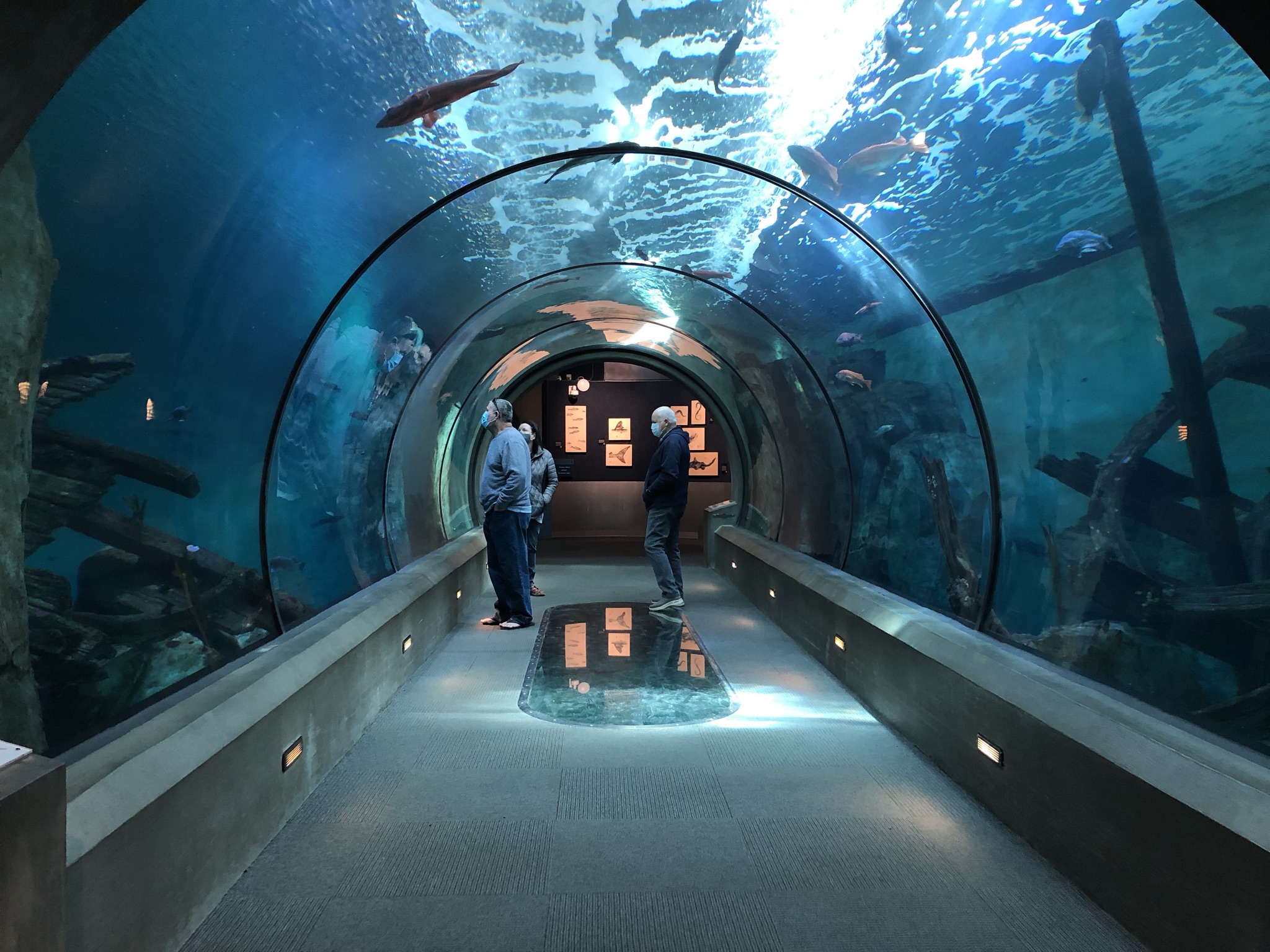
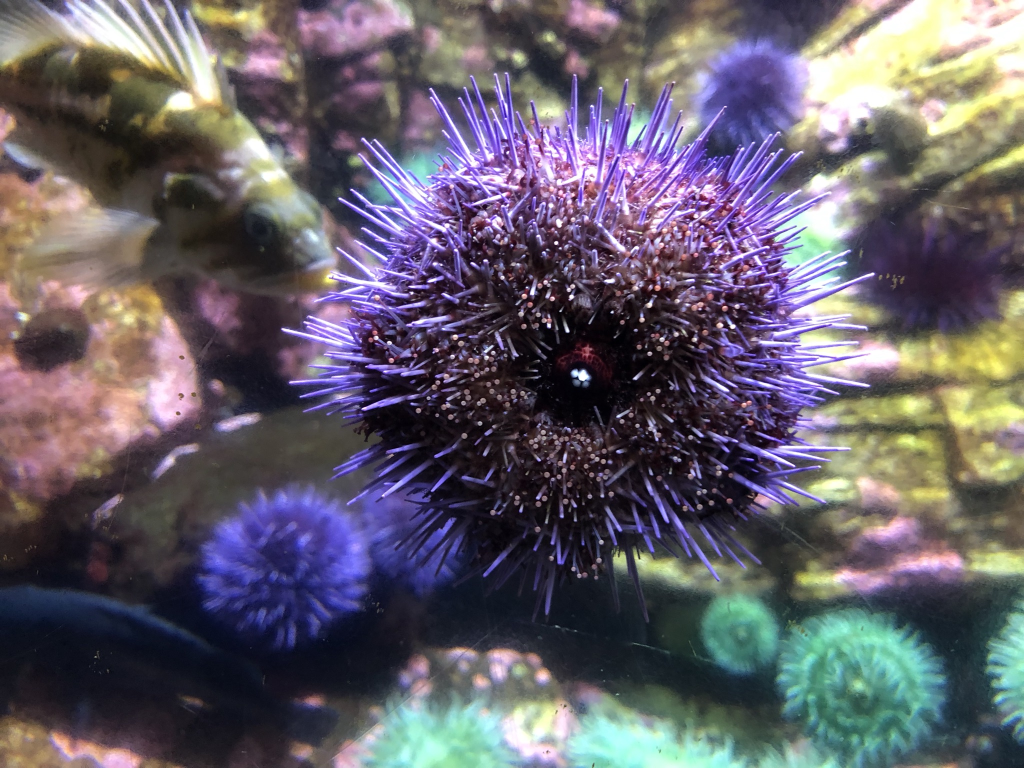
I was doing pretty well on time, so I decided that my next stop would be the Oregon Coast Aquarium. It was crowded and touristy, but a fun and small aquarium where I got to see sea lions up close, plus otters, a giant octopus, and lots of other colorful stuff.
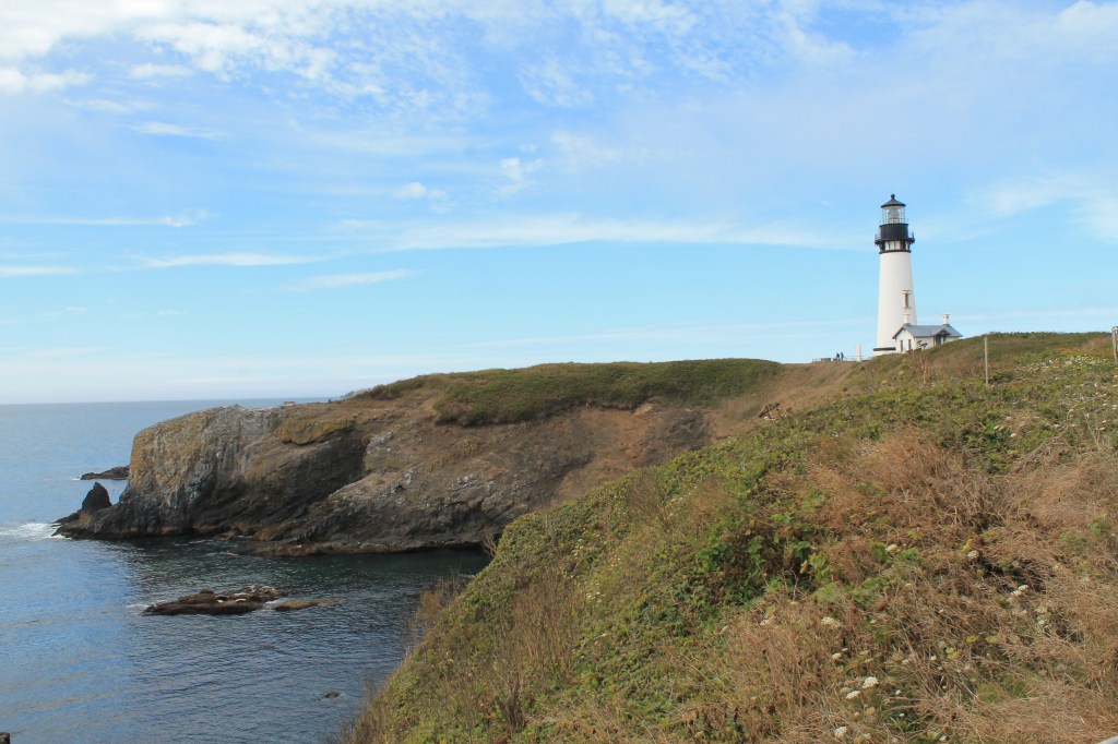
Onward, I drove through the town of Newport, and then stopped at Yaquina Head Lighthouse, which was federal land called an “Outstanding Natural Area.” This one was famous for being the tallest lighthouse in Oregon, and also a very popular spot for photos. It didn’t involve hiking so it was a more touristy experience than the morning lighthouse, but also really beautiful. Looking down and out to the water I also got to see sea lions lounging on some big rocks!
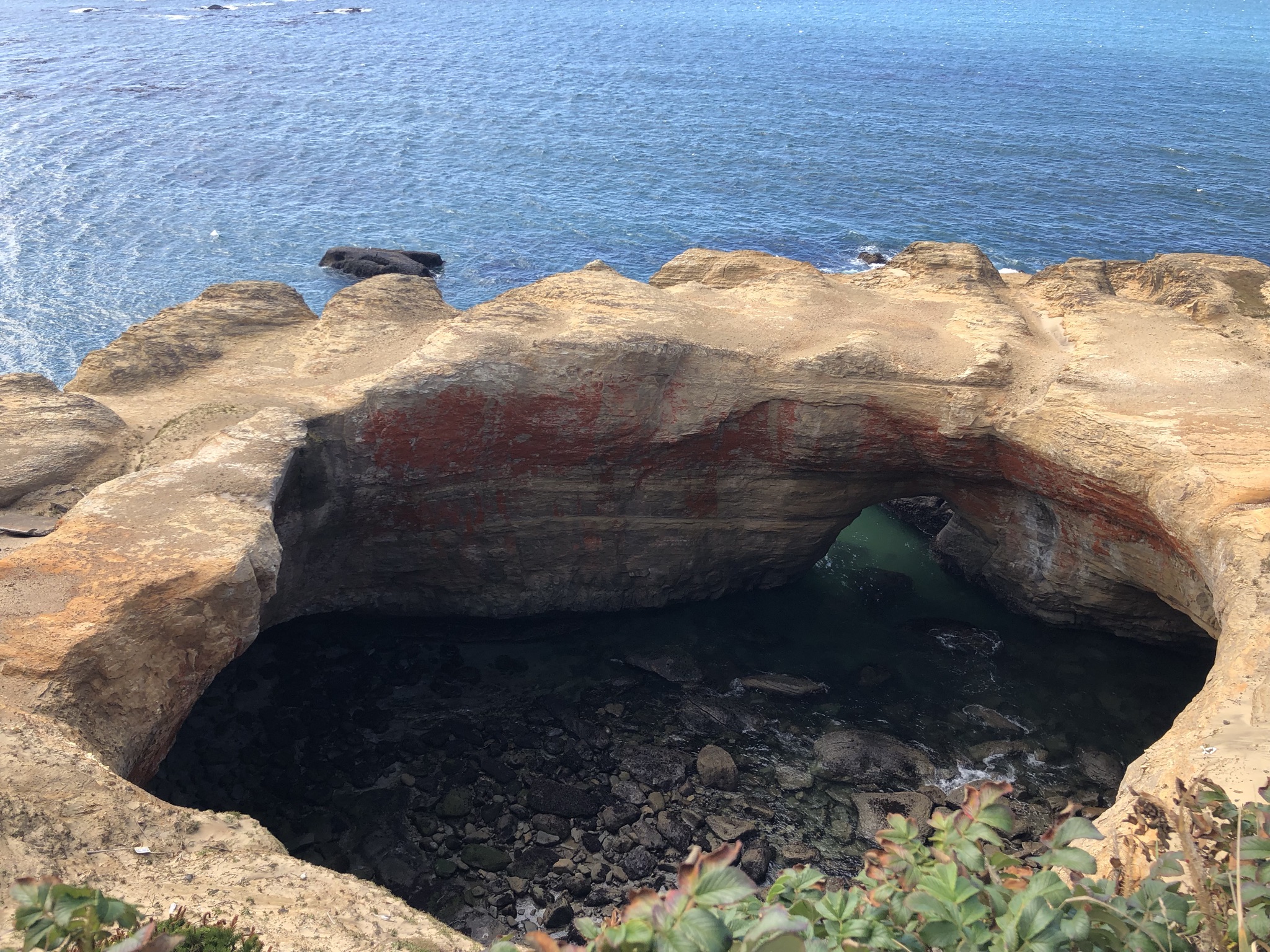
Next up, I drove on to Devil’s Punchbowl, a crater-like formation in the water that made for a cool, quick, and crowded photo spot. Onward to Depoe Bay, where everyone and their mother was standing on the town’s sidewalk looking toward the sunny ocean and watching for whales. Thanks to all the pointing I saw one! Next up was Boiler Bay Scenic spot, but that one happened to be too foggy so I just drove on. By now, I was getting tired, my back was hurting, and I was for sure overstimulated. It was only midafternoon and look at all the things I saw and did today! But I was so close to finishing my planned itinerary, so I pushed on for one more stop. Right outside Lincoln City I swung inland a bit to go to Alder House, where I watched a glass blower give a little demonstration in his workshop. It was beautiful. I asked him about the Netflix reality show about glass blowing and he poo-poo’d it, saying glass blowing was not a medium for creative personal expression or drama.
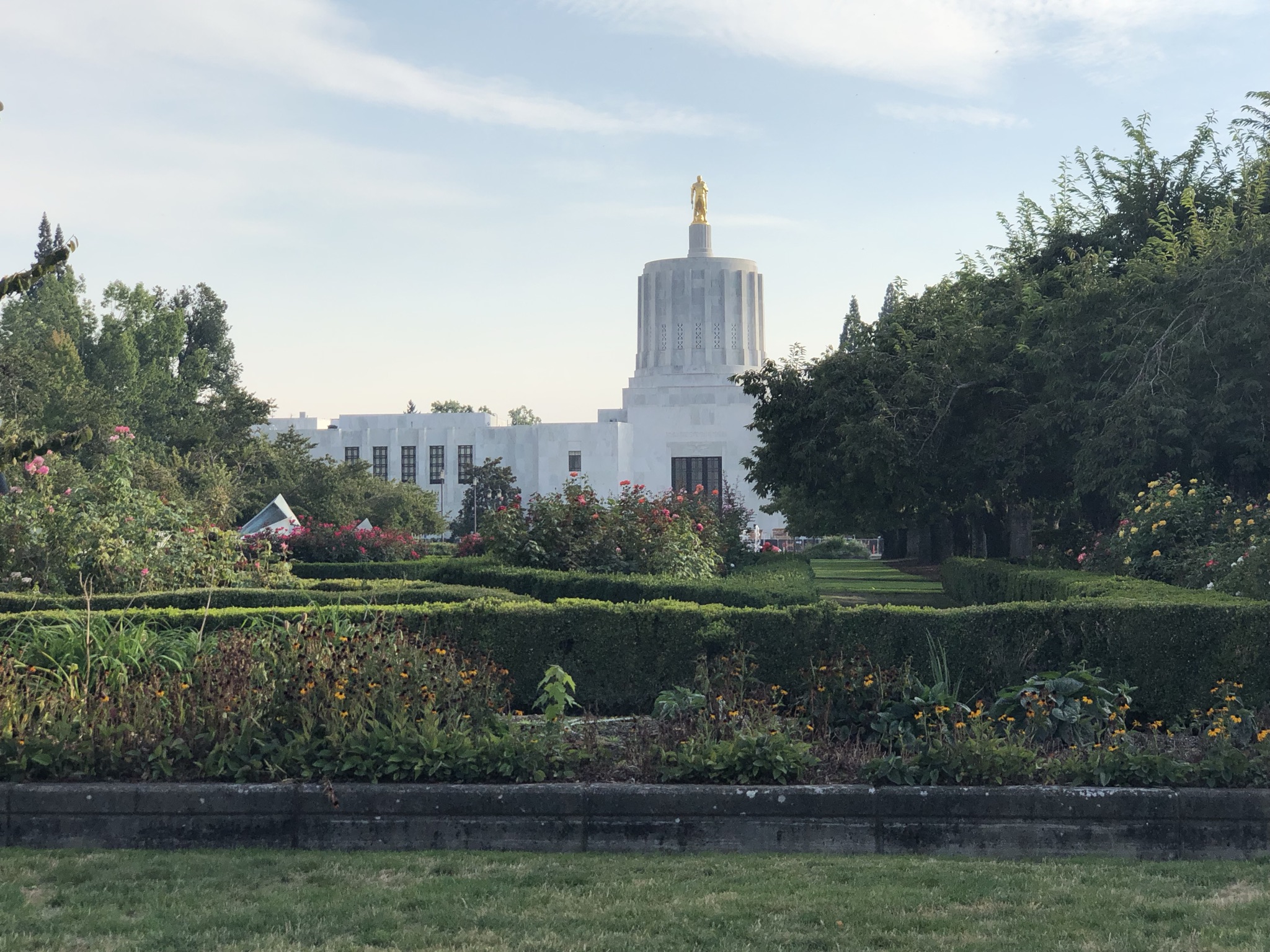
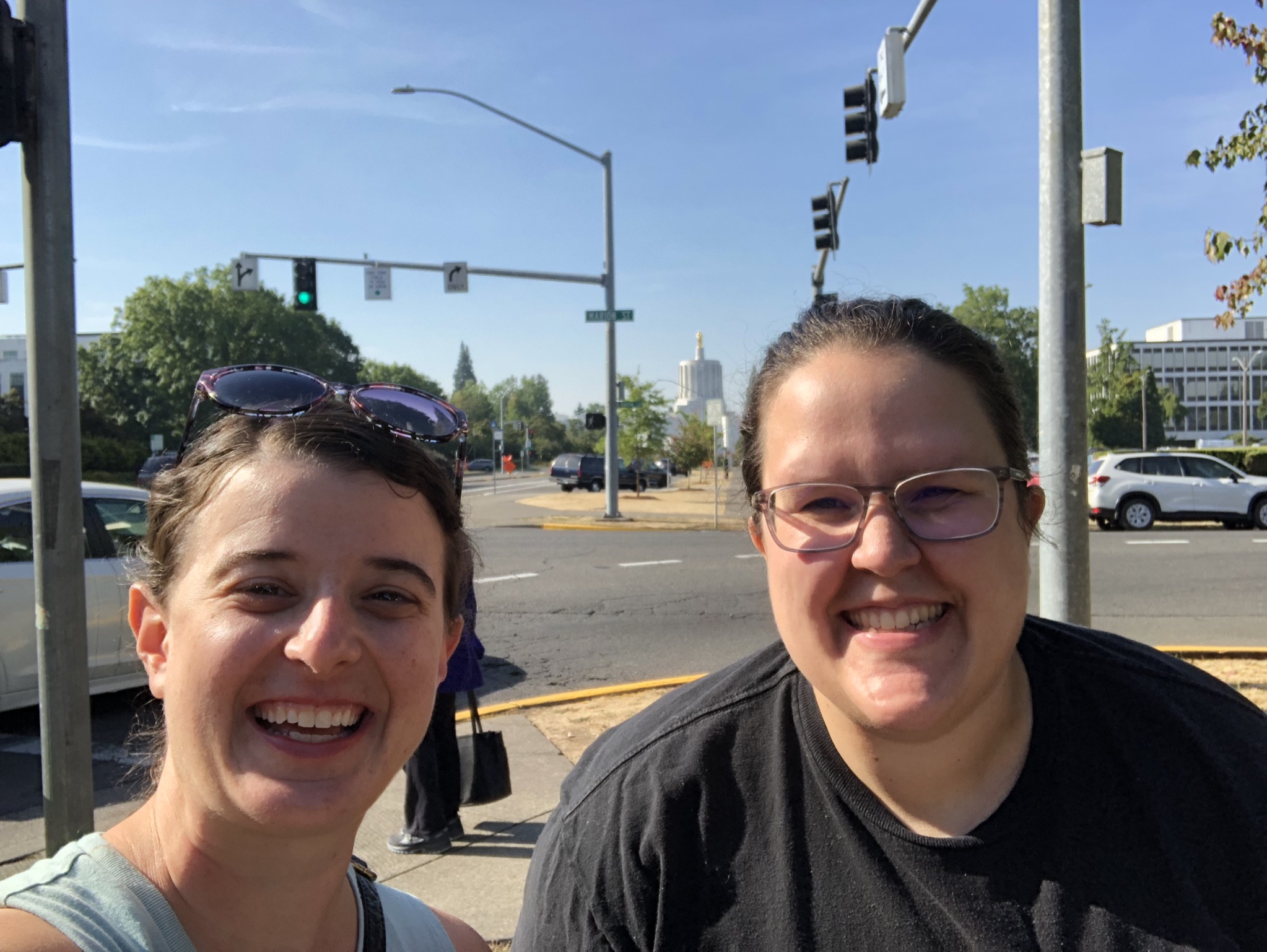
I finally called it a day and did the hour 15 minute drive inland to Salem, arriving in the late afternoon. Katie worked with me in New York and moved back to her hometown of Salem during the pandemic, but kept her job in NYC remotely. She bought a house and got two big dogs, Atlas and Otis, who were jumping around a lot and enjoying the big backyard (a perennial reminder of what type of life is possible outside of NYC). As a lifelong non-dog person this was a lot for me, especially adding the third foster dog for that day, Sawyer. Especially the next morning when I woke up early and decided to go out to organize the car, and while I was out there Katie woke up and let the dogs out back and they wouldn’t let me back in the back door so I had to go out front and ring the doorbell… But it was a fun experience! And always really nice to meet friends and have some personal hospitality during a solo trip. We chatted and caught up a lot, and I gifted her my remaining perishable food. Then we walked downtown via the Oregon State Capitol grounds, a non-domed building with a gold man on top (another one checked off my list). We got some dinner in a chill restaurant (mac and cheese!) and then explored a park with a nice sunset and a not-great high school Christian band performing. The next morning we walked to a huge farmers market with Atlas, where I experienced dog culture where everyone comes up to play with your dog and asks you its breed and tries to give it treats. It was a lovely quick stay in Salem!
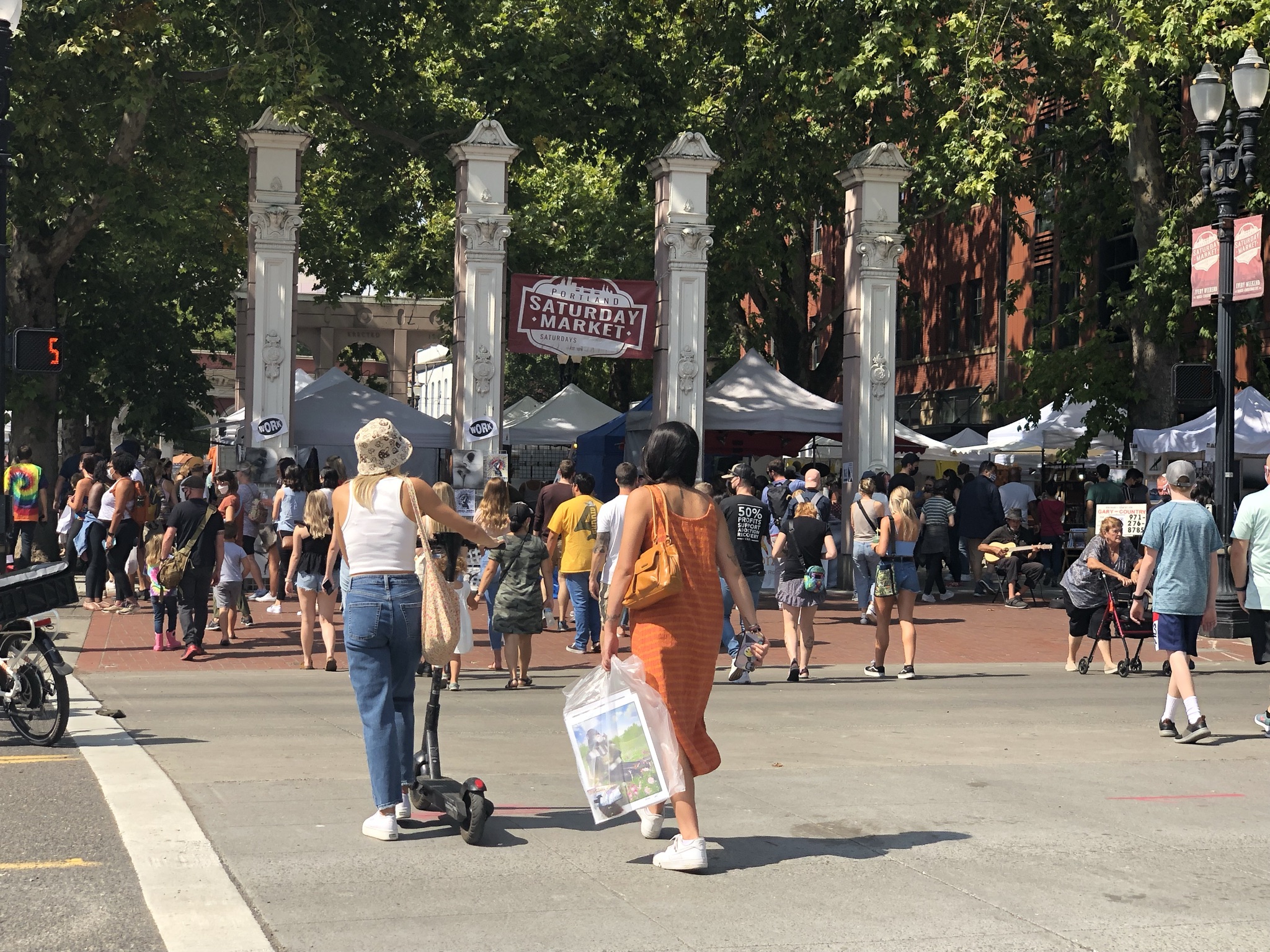
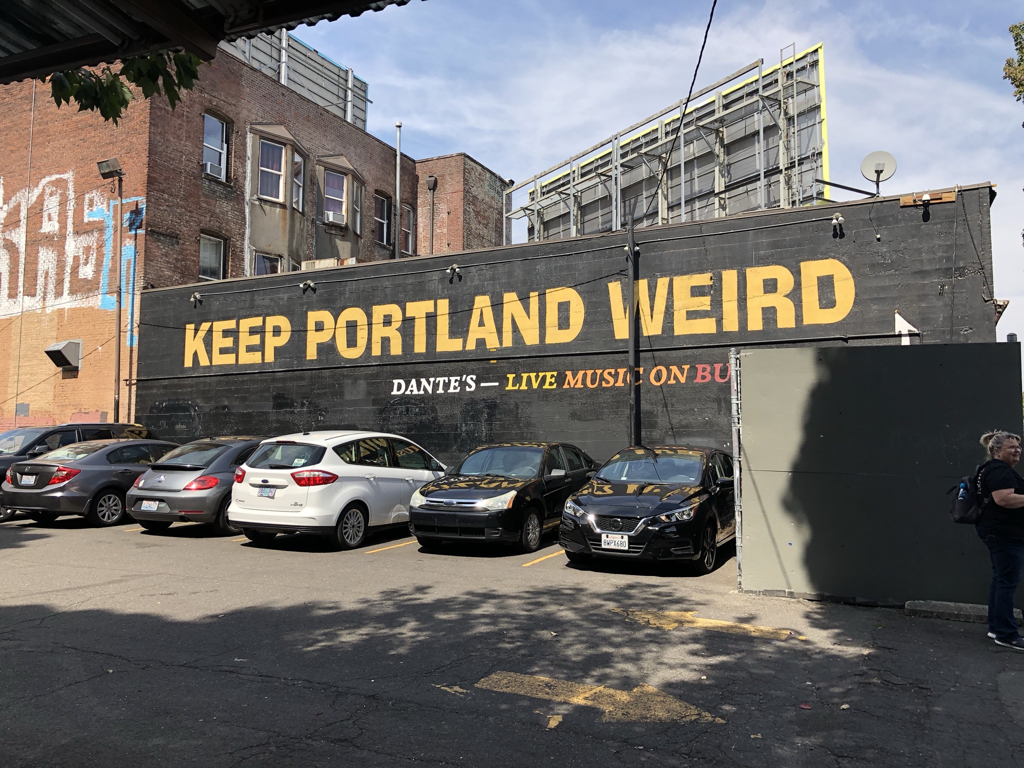
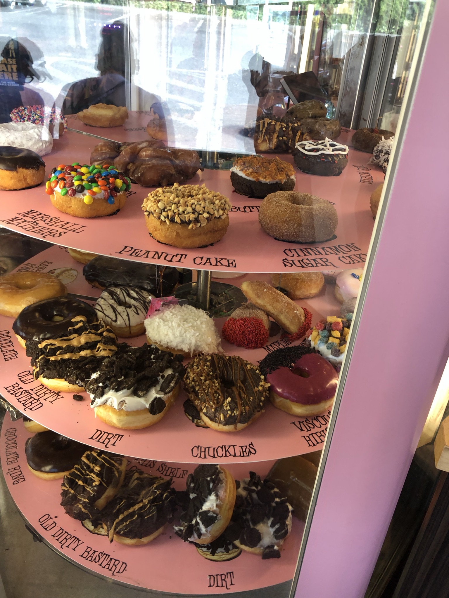
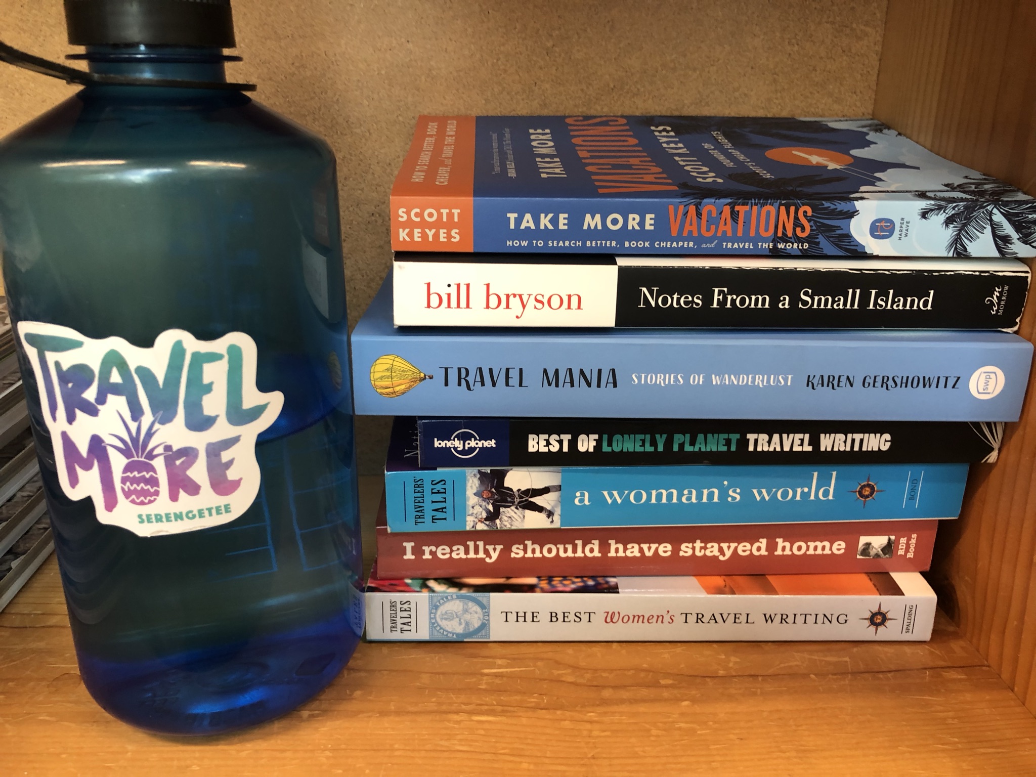
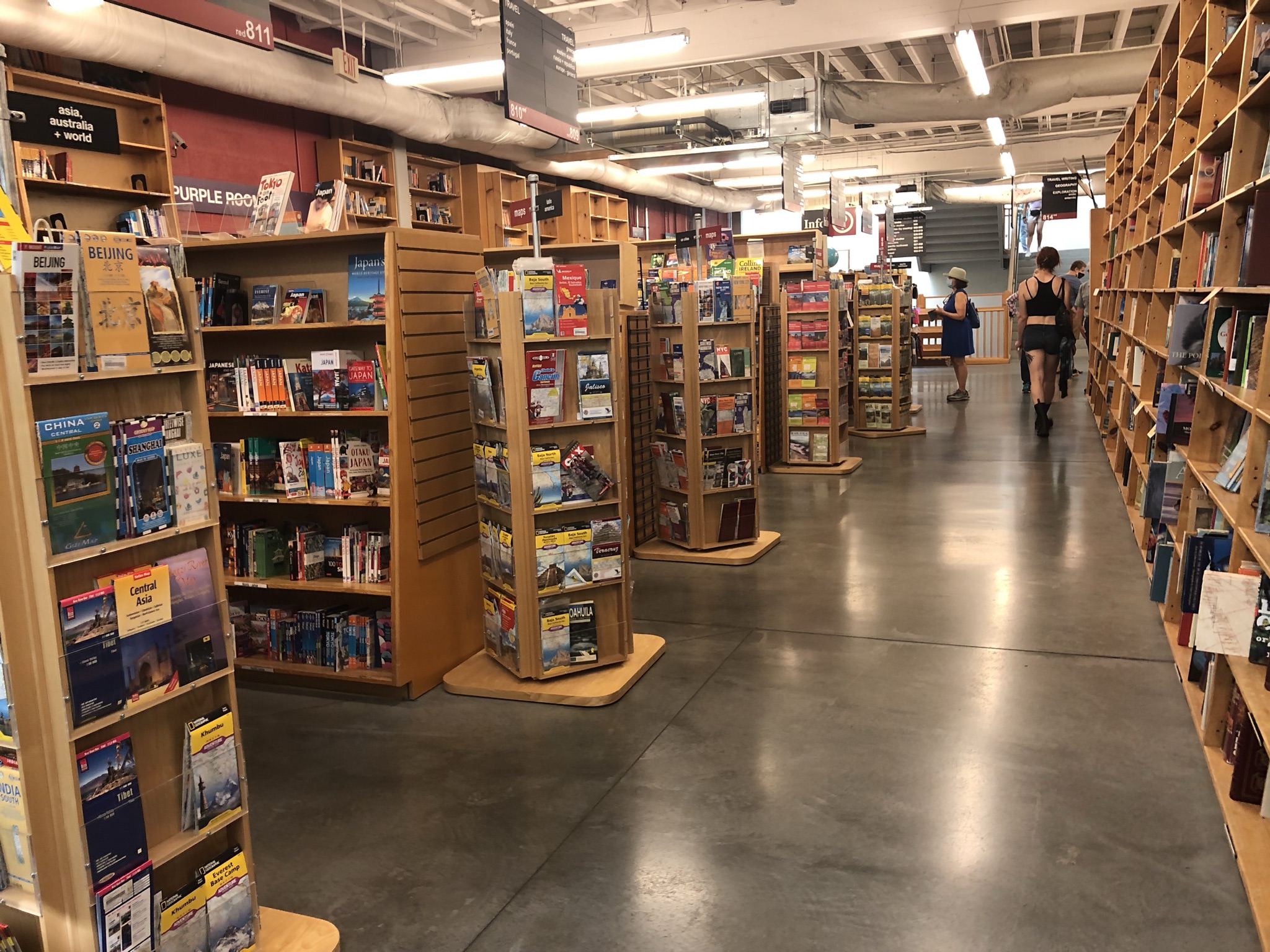
In the late morning I drove on just about an hour to Portland, and was excited to finally have an unstructured city day to enjoy after all the overstimulation. Perhaps that sentence might sound strange – I found myself sensing calm and order in the city compared to feeling wild and overwhelmed in nature. At least on this trip, and since I had been to Portland once before. So I parked by the hostel (the same one I stayed in at the beginning of the stay) and walked about 25 minutes over a bridge to the main downtown area. I took some time catching up by phone with my friend Thomas, a long-time friend and past travel buddy who had been on a similar Oregon trip a few weeks earlier. The outdoor Saturday Market near the waterfront was really cool and crowded, but I couldn’t really fit anything in my suitcase so I opted not to buy anything. I swear I didn’t overpack – the hiking shoes took up a lot of space! I bought an empanada for a snack and people watched for a bit. Next I walked past the famous VooDoo Doughnuts, where there was a prohibitively long line. Onward a few blocks to Powell’s Books, the largest independent bookstore in the world. I quickly found the travel section, which was its own huge room. I was thrilled and sat there reading and browsing for a while, eventually buying two books despite not having any space for them. I walked around a bit more, looking for food trucks and finding a really yummy falafel gyro. One of the most noticeable things about this city was the huge number of homeless people and a persistent smell that went along with it. Portland allows people to set up tents all over the city, and it seemed like folks were just flooding there. As I was walking I thought I sensed a little smoke in the air, but I couldn’t really smell it. I headed back to the car via bike share, which I got to use nearly for free with my NYC bike share membership. It was my first time trying an ebike, and taking it over the bridge was really fun and fast! Right near the car I noticed another branch of VooDoo Doughnuts right there, with no line. So I got a Grape Ape flavor and ate it in the car, since my next task was bringing in my suitcase and checking into the hostel. It was early evening and I spent the rest of the night bumming around the dorm room by myself, repacking, enjoying an amazing sunset view, and listening to travel-themed podcasts (I’m on a bit of a Rick Steves kick right now).
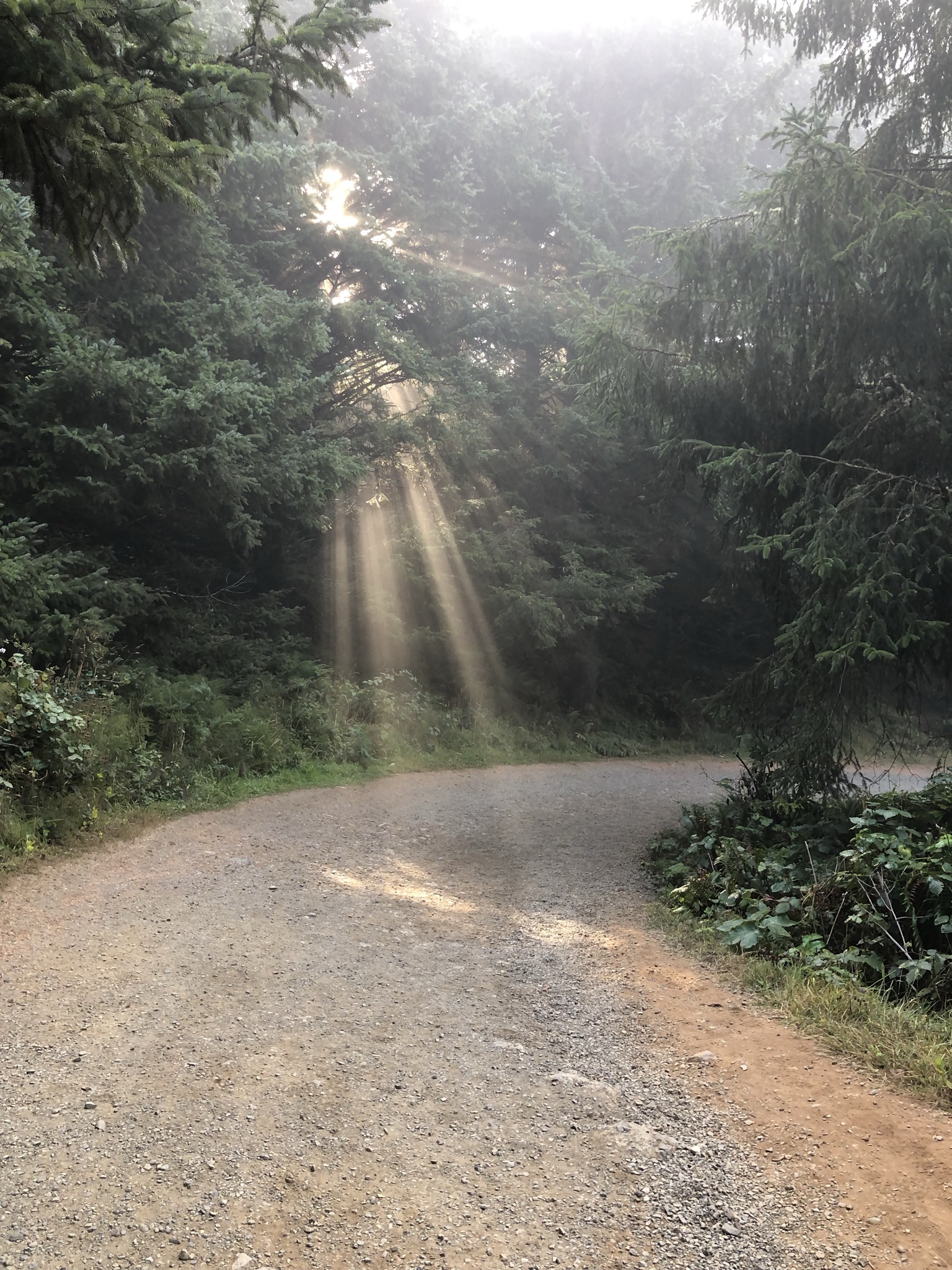
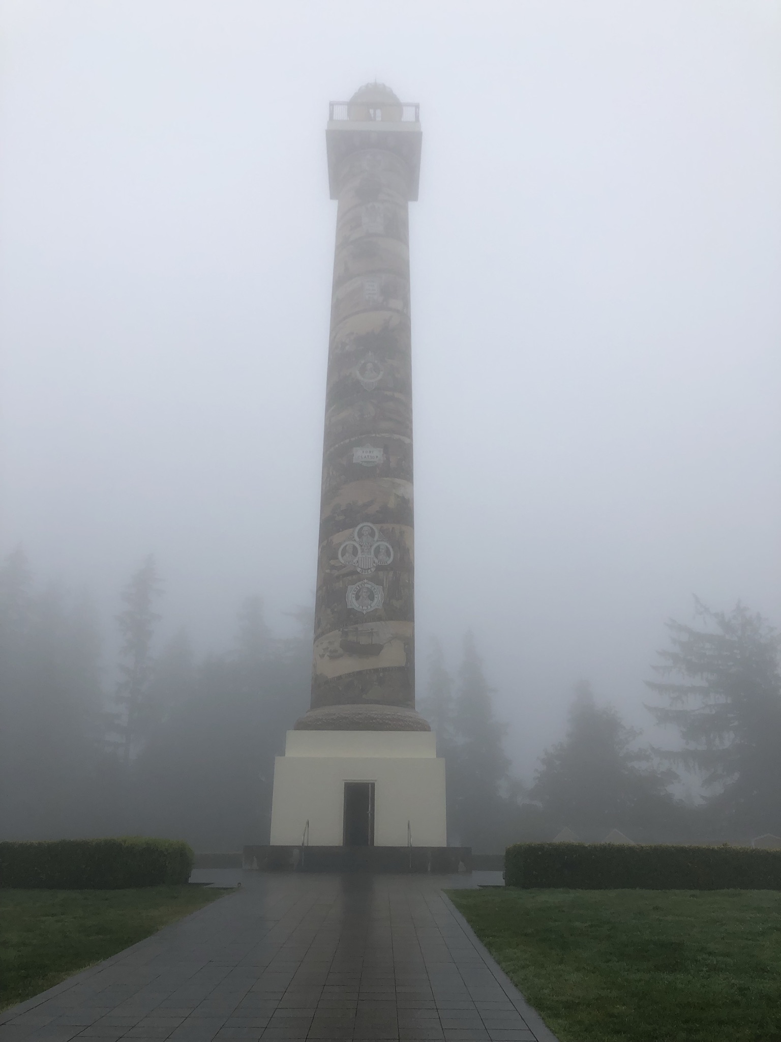
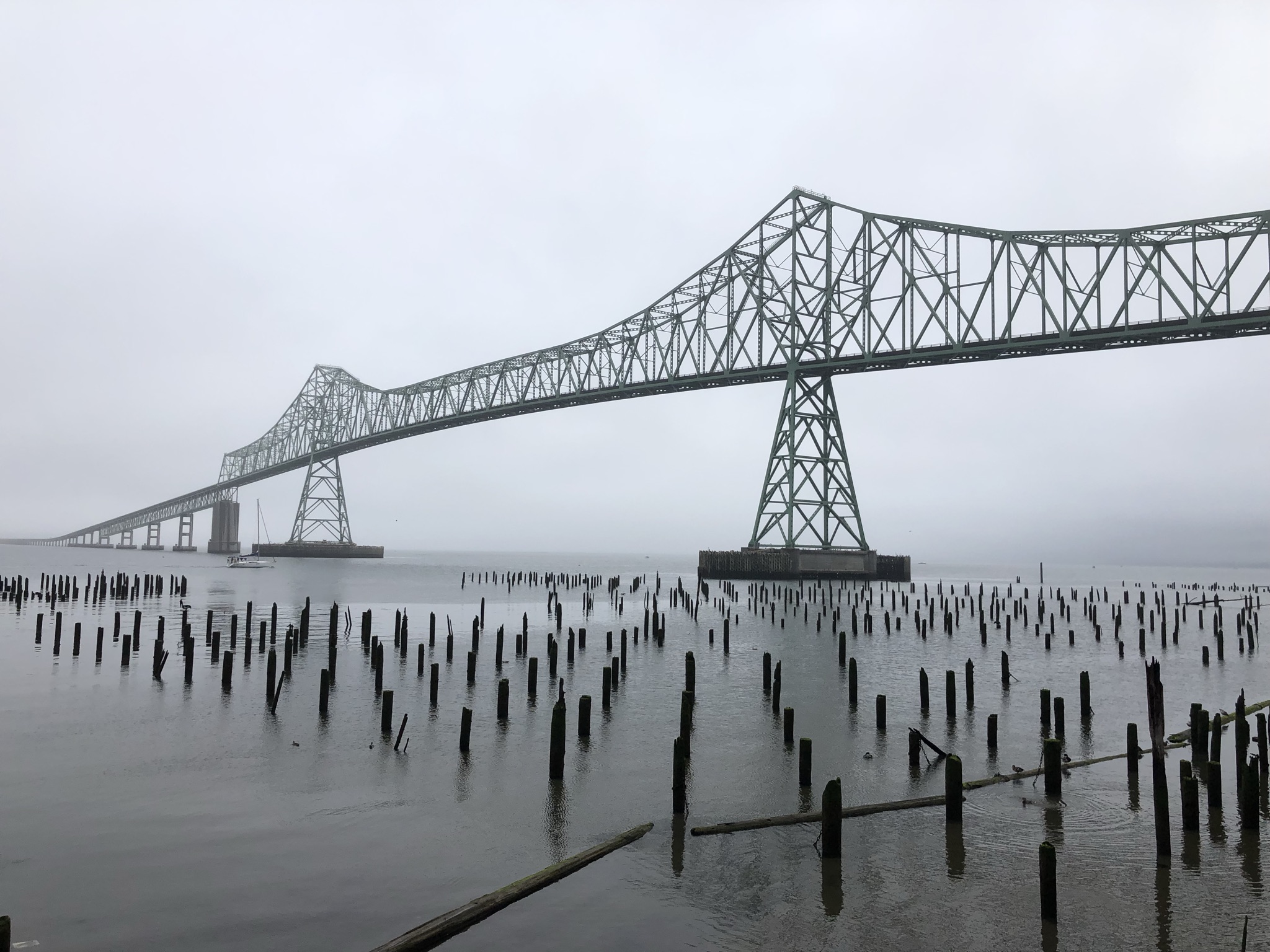
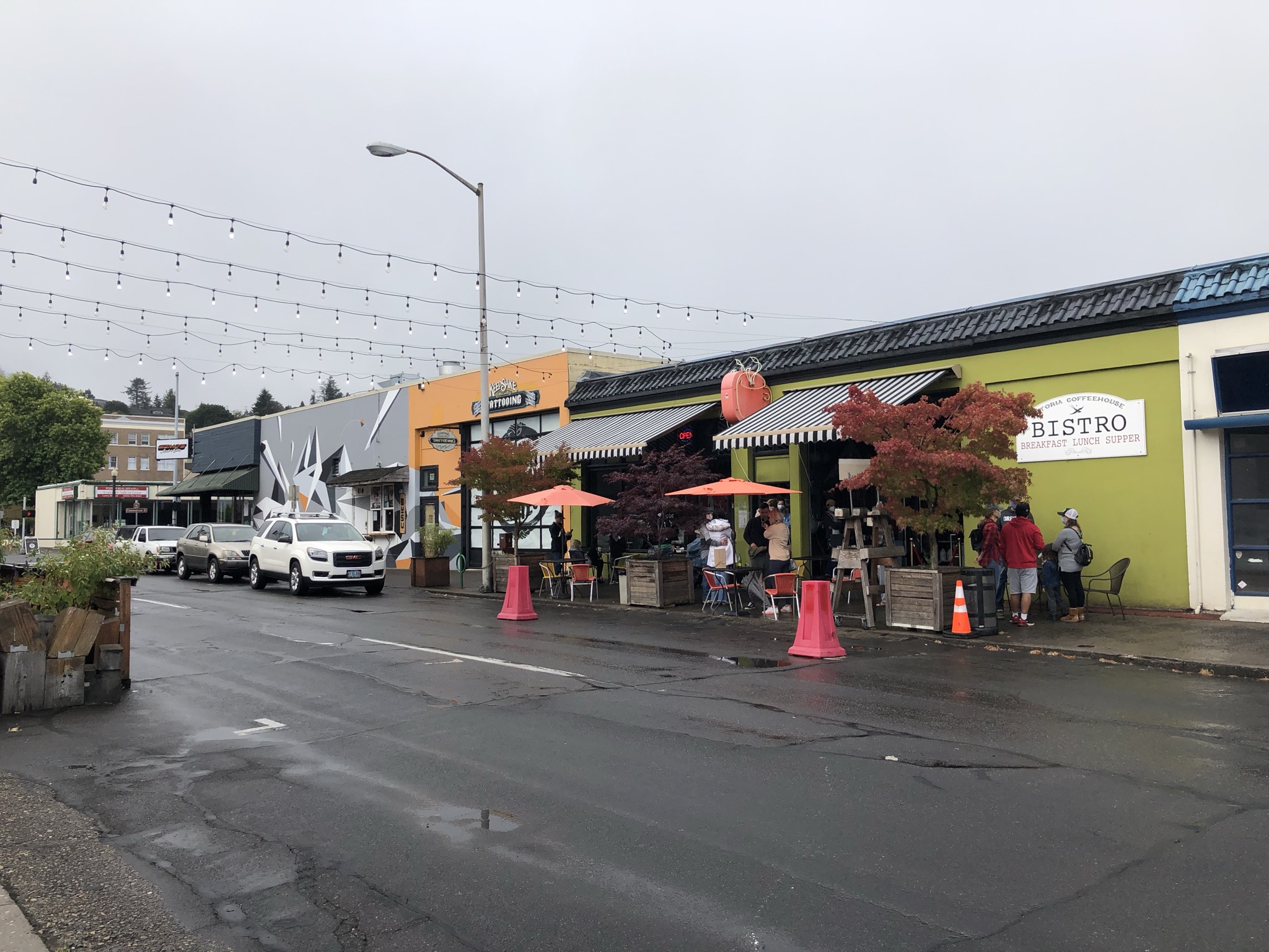
Sunday morning, and it’s my final day! I left the hostel at 7am, getting coffee there right as they were getting ready to open. I drove an hour and 45 minutes back toward the coast, this time passing through Washington State and looping back in to reach the northern-most coastal town in Oregon. Astoria, Oregon wasn’t high on my to-see list, but since I live in Astoria, Queens and it had gotten some good recommendations from friends I decided to go. I drove through a little drizzle on my way in, the first rain of the trip. As I approached the coast, the drizzle turned into a wet, dense forest. I couldn’t tell if it was raining (the phone app said it wasn’t) or if I was just inside a cloud (I guess so). I drove up some steep hills to sightsee the Astoria Column, which I couldn’t really see due to the weather, so I decided not to climb it for the non-existent scenic view. I parked in the downtown and visited a coffeeshop, then walked around a few blocks in the cute neighborhood and by the waterfront as a small farmers market was getting started.
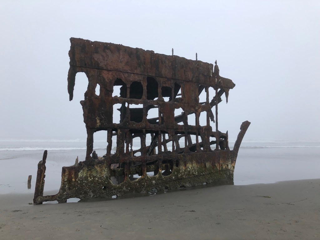
I continued to drive on to Fort Stevens State Park, another friend recommendation. It was a huge park you can drive through to different areas, filled with lots of historic cannons and stuff, including an iron shipwreck you could explore in the break of the waves on the beach. By now it wasn’t really rainy or wet anymore, but still very foggy, and by 10am there were a good number of people around.
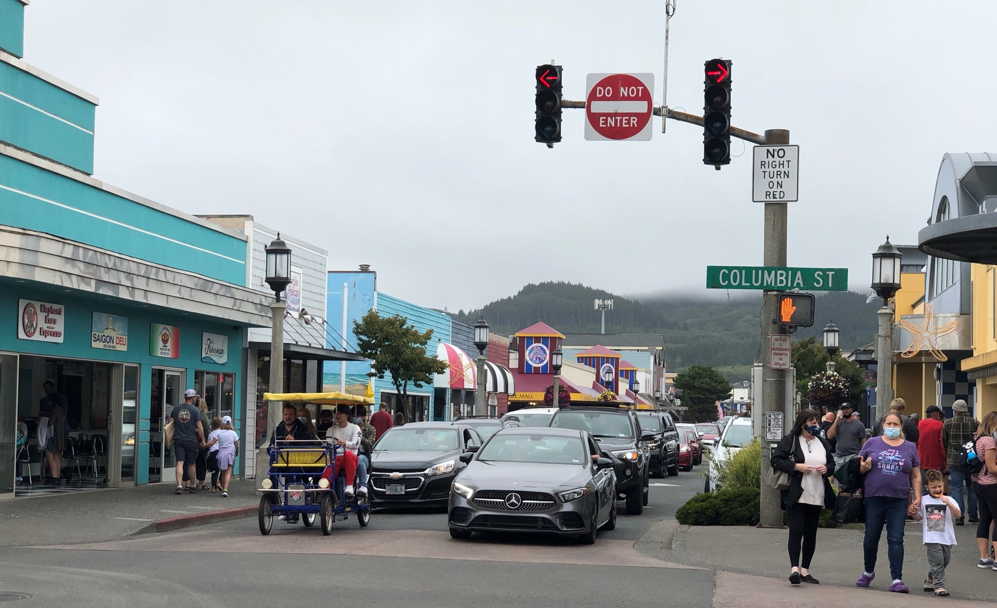
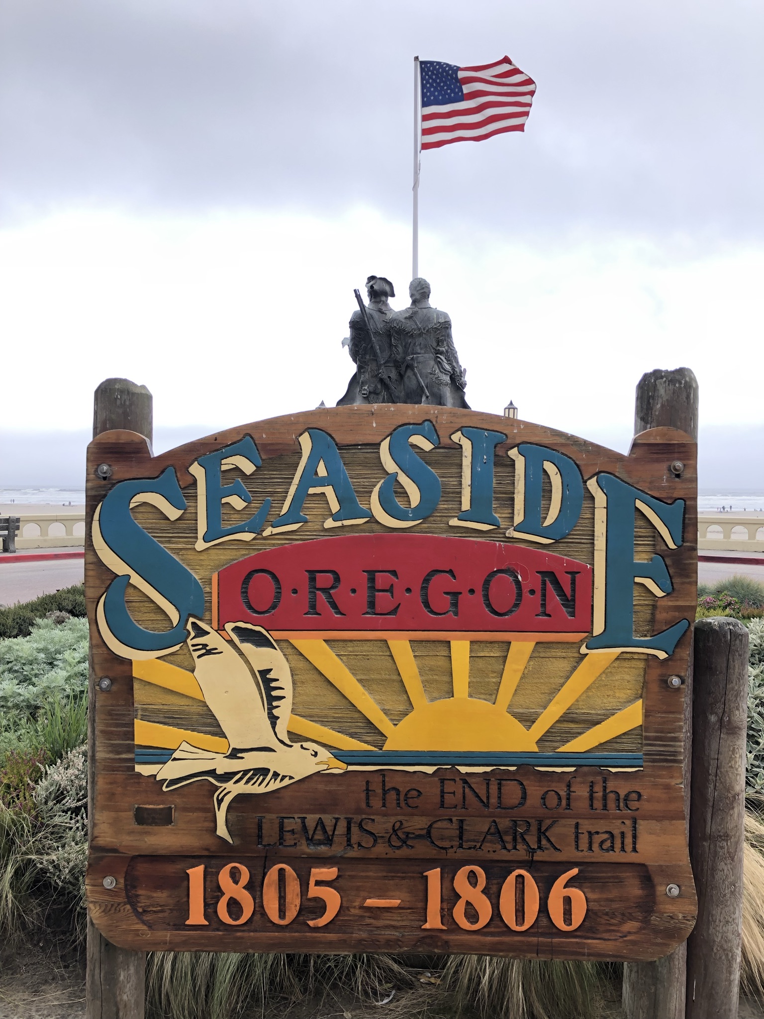
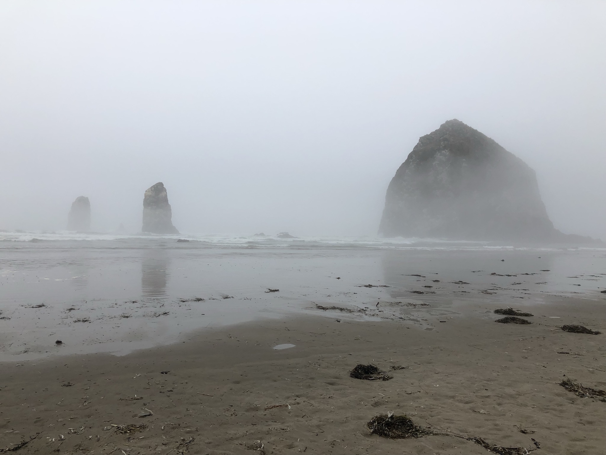
An hour later driving south I arrived at Seaside, a popular beachy vacation town. It was super busy on Labor Day weekend with lots of shops and a nice big beach, though still foggy there. I really enjoyed walking around here briefly, including inside one of the little malls and seeing a carousel. By the beach was a sign signifying the end of the Lewis and Clark trail. It was touristy but fun. Next up, a spot I was looking forward to but ended up being disappointing due to the fog – Ecola State Park. I drove up a narrow, windy, and foggy hill to get to a crowded parking lot, and as I walked to the cliffside I couldn’t see any of the scenic ocean view. I decided not to do the moderate hike I had planned to do, and instead left quickly and drove on. Next up, the other big popular coastal town of Cannon Beach. As I drove through it was cute but somehow even more crowded than Seaside, so I didn’t stop. The main attraction for me was the beach and some famous rock formations in the water. I managed to find a spot in a residential area with some fancy hillside houses, and walked downhill to a beach entrance right by the most photographed spot in the state, Haystack Rock. And naturally, I could barely see it. I still walked around a little and finally put my toes in the ice-cold Pacific Ocean. It was colder than Crater Lake but I was glad I did it! The beach was pretty to look out at, but looking down there were some dead birds and jellyfish washing up so it wasn’t totally pleasant. It was also crowded even with the fog. I lingered for a bit, then headed back out, failing to wipe all the sand off my feet and living with sandy socks for a few more hours. I skipped another planned viewpoint, feeling a little disappointed in my day so far and how weather and nature still managed to get in the way of my plans here on the last day of my trip.
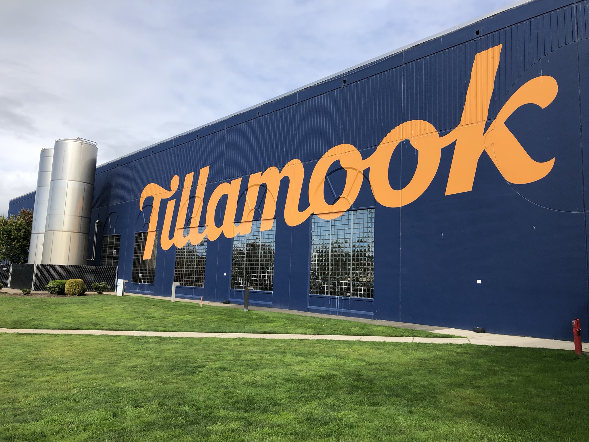
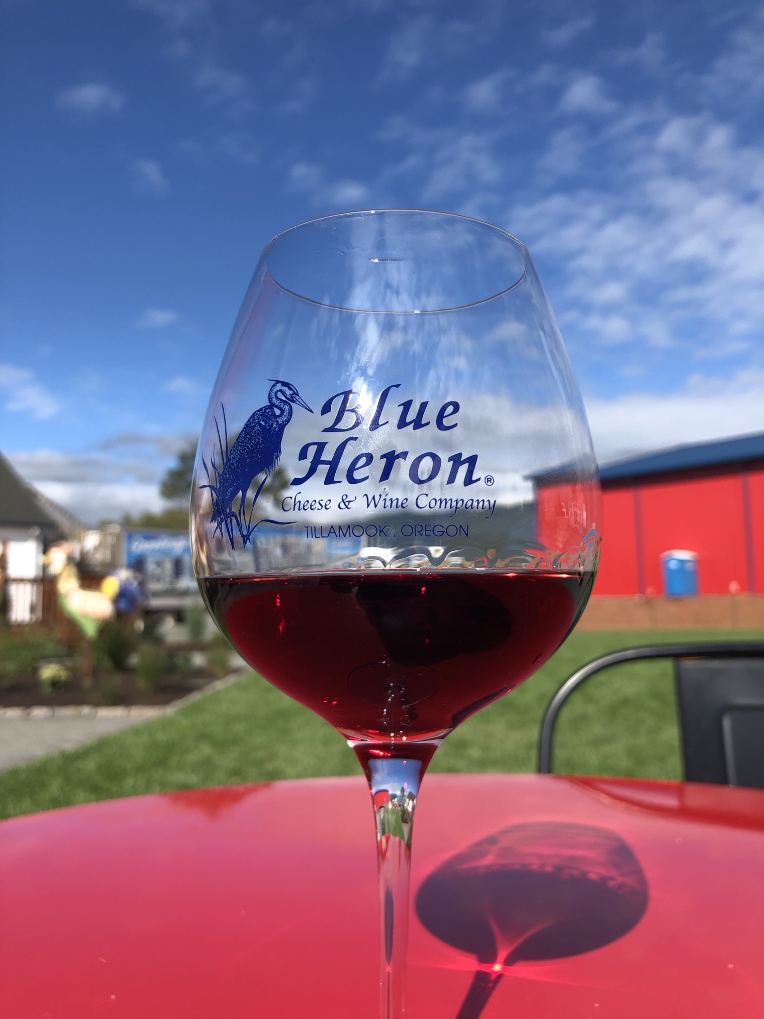
As the road turned inland past a bay, it finally cleared up and became sunny with blue skies. I stopped at the Tillamook Creamery, where they make a popular brand of dairy products. I did the free self-guided tour of the factory to see how they make cheese, and then ordered a grilled cheese and fries and enjoyed my free cheese sample, which ended up being my dinner in the late afternoon. It was so yummy and I started to feel better about things. I decided to skip the ice cream line which looked to be over a half hour wait, instead deciding to try Tillamook ice cream from the grocery store when I got home. A bit down the road I stopped at Blue Heron Cheese, a little farm stand/store area, and got a glass of pinot noir and drank at a lovely table outside, watching a peacock walk by the grassy landscape. I waited a bit to drive, and then decided it was time to head back to Portland.
Back in the city it was hot and sunny. I had two hours before I had to return the car, so I parked it near the hostel (for no reason other than it was somewhere I knew to go), cleaned out the car, got ice cream again at Salt and Straw, got gas, and dropped off the car before ordering a Lyft to the airport. I used the bathroom before security to change into pjs, wash my face, and somehow manage to fit everything in my suitcase before checking in. As much as I don’t love airports during covid, it wasn’t too crowded and I felt comfortable sitting in a bar and ordering a Deschutes Brewery local beer, sitting for a while without a mask. I was hopeful it would help me sleep through the red eye flight. I think I did manage to sleep more than usual, but still poorly. My parents graciously picked me up at JFK early the next morning and took me home, where I promptly fell asleep for several hours.
While slow travel might have been a deeper experience, as many travel experts like to recommend, I honestly wouldn’t have done things differently this time (except, truly, maybe going earlier in the summer or spring to avoid the smoke). I crammed so much beauty and adventure into this trip, which after sitting on my ass for the better part of a year and a half felt like the right thing to do. While I’m not quite back to where I want to be with international travel yet, I know that I’ll be there soon, and in the meantime I managed to build myself a unique adventure of new experiences right in my own country!
